Aquilla Topo Map Texas
To zoom in, hover over the map of Aquilla
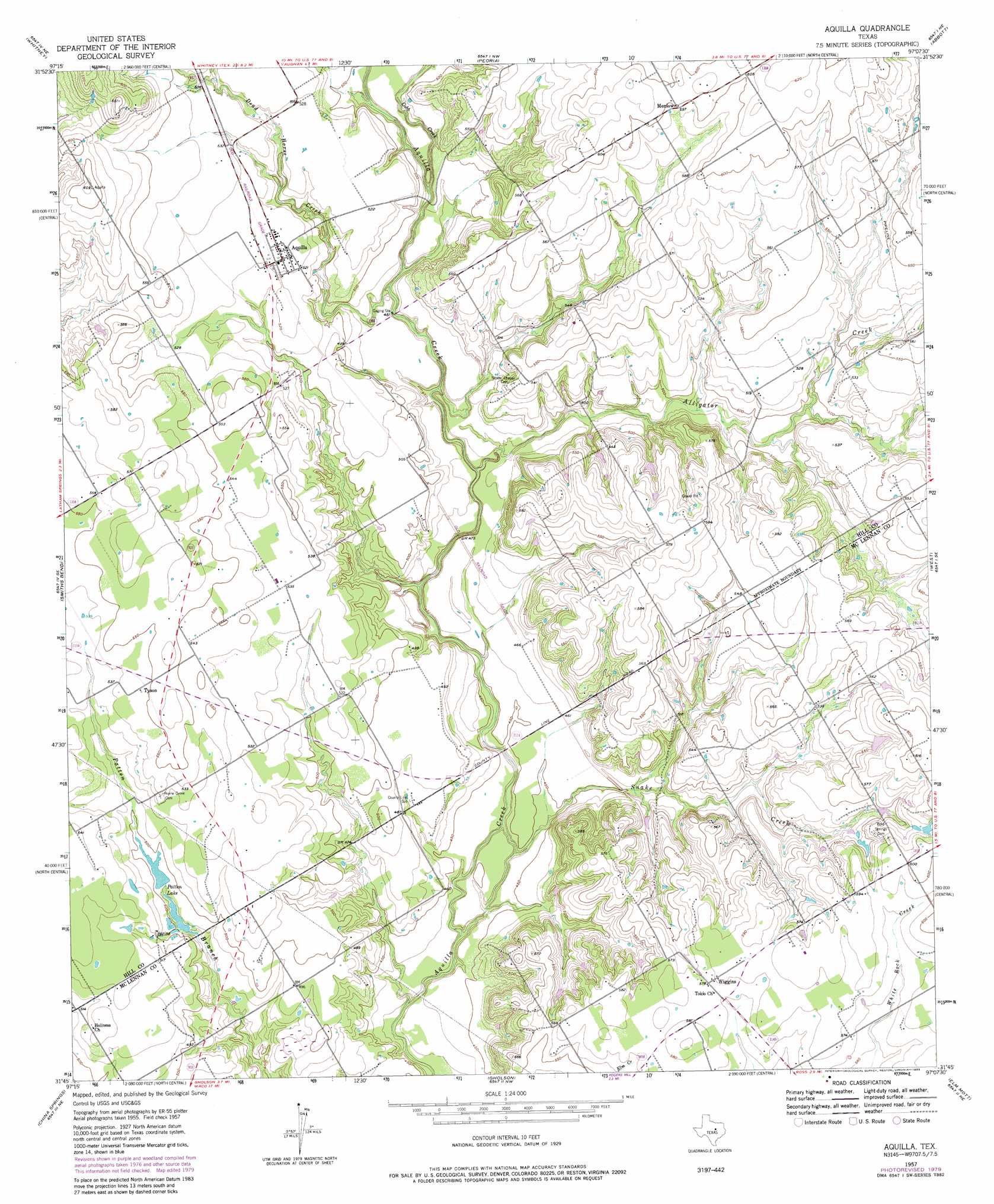
USGS Topo Quad 31097g2 - 1:24,000 scale
| Topo Map Name: | Aquilla |
| USGS Topo Quad ID: | 31097g2 |
| Print Size: | ca. 21 1/4" wide x 27" high |
| Southeast Coordinates: | 31.75° N latitude / 97.125° W longitude |
| Map Center Coordinates: | 31.8125° N latitude / 97.1875° W longitude |
| U.S. State: | TX |
| Filename: | o31097g2.jpg |
| Download Map JPG Image: | Aquilla topo map 1:24,000 scale |
| Map Type: | Topographic |
| Topo Series: | 7.5´ |
| Map Scale: | 1:24,000 |
| Source of Map Images: | United States Geological Survey (USGS) |
| Alternate Map Versions: |
Aquilla TX 1957, updated 1957 Download PDF Buy paper map Aquilla TX 1957, updated 1975 Download PDF Buy paper map Aquilla TX 1957, updated 1979 Download PDF Buy paper map Aquilla TX 2010 Download PDF Buy paper map Aquilla TX 2012 Download PDF Buy paper map Aquilla TX 2016 Download PDF Buy paper map |
1:24,000 Topo Quads surrounding Aquilla
Lakeside Village |
Blanton |
Hillsboro West |
Hillsboro East |
Mertens |
Allen Bend |
Whitney |
Peoria |
Abbott |
Malone |
Laguna Park |
Smiths Bend |
Aquilla |
West |
Penelope |
Valley Mills |
China Springs |
Gholson |
Elm Mott |
Axtell |
Crawford |
Speegleville |
Waco West |
Waco East |
Elk |
> Back to 31097e1 at 1:100,000 scale
> Back to 31096a1 at 1:250,000 scale
> Back to U.S. Topo Maps home
Aquilla topo map: Gazetteer
Aquilla: Airports
Hawkeye Hunting Club Airport elevation 177m 580′Aquilla: Dams
Coffelt Lake Number 1 Dam elevation 151m 495′Coffelt Lake Number 2 Dam elevation 146m 479′
Vrbas Lake Dam elevation 184m 603′
Aquilla: Populated Places
Aquilla elevation 159m 521′Menlow elevation 183m 600′
Tokio elevation 174m 570′
Tyson elevation 167m 547′
Wiggins elevation 176m 577′
Aquilla: Reservoirs
Coffelt Lake Number 1 elevation 151m 495′Coffelt Lake Number 2 elevation 146m 479′
Patten Lake elevation 151m 495′
Vrbas Lake elevation 184m 603′
Aquilla: Streams
Alligator Creek elevation 137m 449′Cobb Creek elevation 143m 469′
Dead Horse Creek elevation 141m 462′
Snake Creek elevation 128m 419′
Aquilla digital topo map on disk
Buy this Aquilla topo map showing relief, roads, GPS coordinates and other geographical features, as a high-resolution digital map file on DVD: