Fairy Topo Map Texas
To zoom in, hover over the map of Fairy
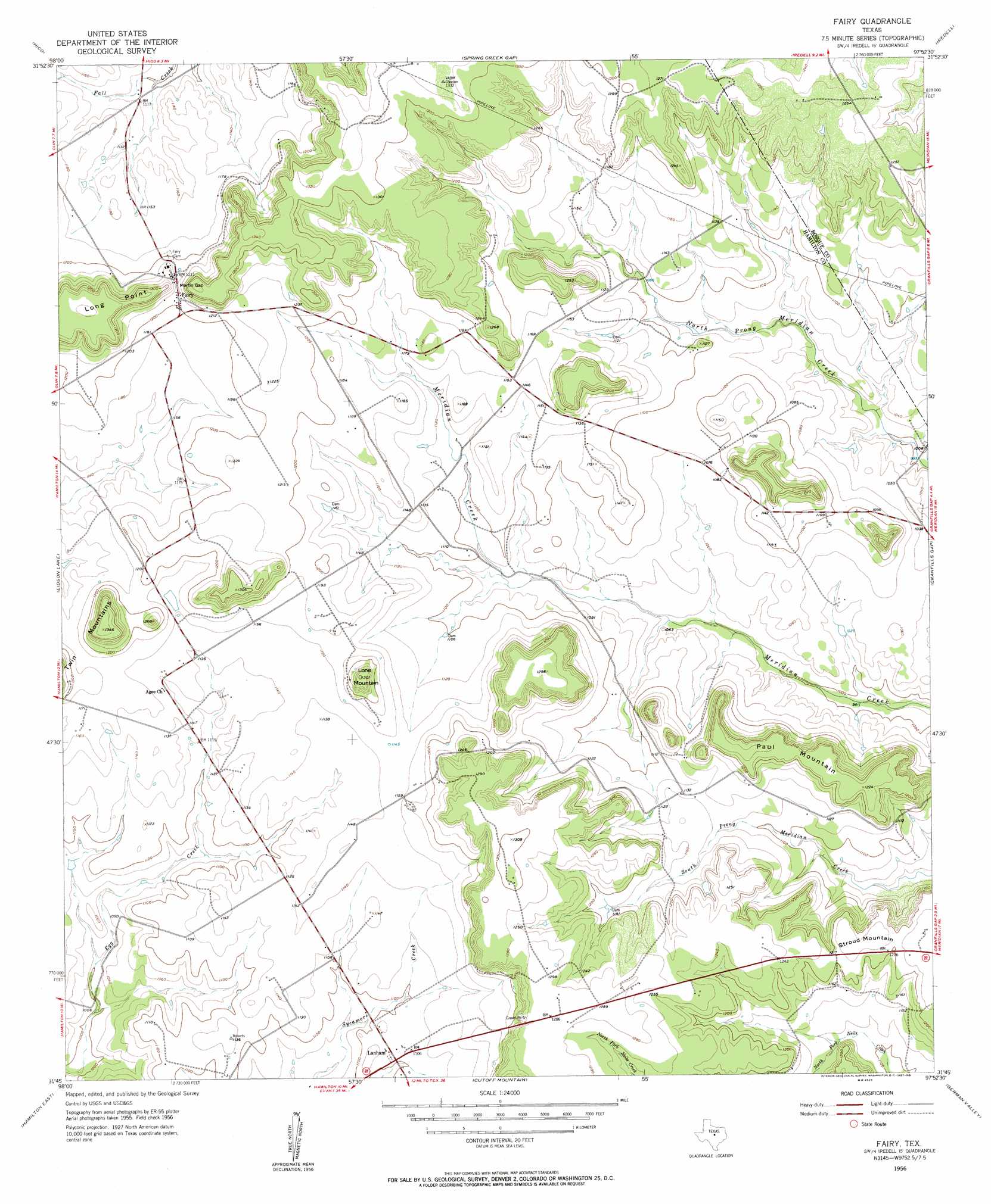
USGS Topo Quad 31097g8 - 1:24,000 scale
| Topo Map Name: | Fairy |
| USGS Topo Quad ID: | 31097g8 |
| Print Size: | ca. 21 1/4" wide x 27" high |
| Southeast Coordinates: | 31.75° N latitude / 97.875° W longitude |
| Map Center Coordinates: | 31.8125° N latitude / 97.9375° W longitude |
| U.S. State: | TX |
| Filename: | o31097g8.jpg |
| Download Map JPG Image: | Fairy topo map 1:24,000 scale |
| Map Type: | Topographic |
| Topo Series: | 7.5´ |
| Map Scale: | 1:24,000 |
| Source of Map Images: | United States Geological Survey (USGS) |
| Alternate Map Versions: |
Fairy TX 1956, updated 1957 Download PDF Buy paper map Fairy TX 1956, updated 1957 Download PDF Buy paper map Fairy TX 2010 Download PDF Buy paper map Fairy TX 2012 Download PDF Buy paper map Fairy TX 2016 Download PDF Buy paper map |
1:24,000 Topo Quads surrounding Fairy
Alexander |
Clairette |
Camp Branch |
Walnut Springs West |
Walnut Springs East |
Carlton |
Hico |
Spring Creek Gap |
Iredell |
Meridian |
Gentrys Mill |
Eidson Lake |
Fairy |
Cranfills Gap |
Sugarloaf Mountain |
Hamilton West |
Hamilton East |
Cutoff Mountain |
German Valley |
Hurst Spring |
Shive |
Ohio |
Jonesboro |
Ater |
Turnersville |
> Back to 31097e1 at 1:100,000 scale
> Back to 31096a1 at 1:250,000 scale
> Back to U.S. Topo Maps home
Fairy topo map: Gazetteer
Fairy: Gaps
Martin Gap elevation 375m 1230′Fairy: Populated Places
Fairy elevation 369m 1210′Lanham elevation 336m 1102′
Fairy: Summits
Lone Mountain elevation 396m 1299′Long Point elevation 415m 1361′
Paul Mountain elevation 373m 1223′
Stroud Mountain elevation 373m 1223′
Twin Mountains elevation 411m 1348′
Fairy digital topo map on disk
Buy this Fairy topo map showing relief, roads, GPS coordinates and other geographical features, as a high-resolution digital map file on DVD: