Meridian Topo Map Texas
To zoom in, hover over the map of Meridian
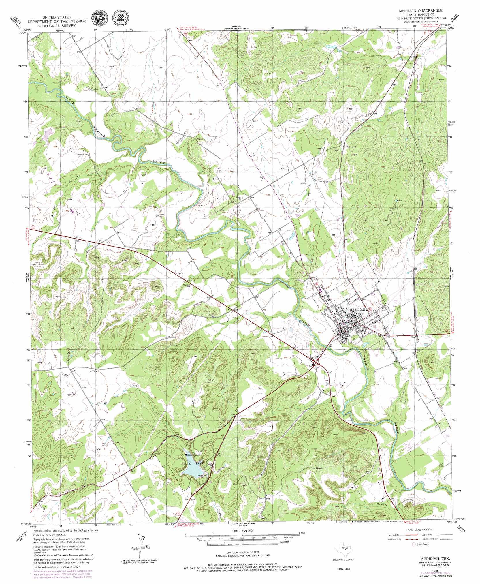
USGS Topo Quad 31097h6 - 1:24,000 scale
| Topo Map Name: | Meridian |
| USGS Topo Quad ID: | 31097h6 |
| Print Size: | ca. 21 1/4" wide x 27" high |
| Southeast Coordinates: | 31.875° N latitude / 97.625° W longitude |
| Map Center Coordinates: | 31.9375° N latitude / 97.6875° W longitude |
| U.S. State: | TX |
| Filename: | o31097h6.jpg |
| Download Map JPG Image: | Meridian topo map 1:24,000 scale |
| Map Type: | Topographic |
| Topo Series: | 7.5´ |
| Map Scale: | 1:24,000 |
| Source of Map Images: | United States Geological Survey (USGS) |
| Alternate Map Versions: |
Meridian TX 1955, updated 1956 Download PDF Buy paper map Meridian TX 1955, updated 1979 Download PDF Buy paper map Meridian TX 1955, updated 1979 Download PDF Buy paper map Meridian TX 2010 Download PDF Buy paper map Meridian TX 2012 Download PDF Buy paper map Meridian TX 2016 Download PDF Buy paper map |
1:24,000 Topo Quads surrounding Meridian
Chalk Mountain |
Glen Rose West |
Glen Rose East |
Brazos Point |
Blum |
Camp Branch |
Walnut Springs West |
Walnut Springs East |
Morgan |
Lakeside Village |
Spring Creek Gap |
Iredell |
Meridian |
Pilot Knob |
Allen Bend |
Fairy |
Cranfills Gap |
Sugarloaf Mountain |
Clifton |
Laguna Park |
Cutoff Mountain |
German Valley |
Hurst Spring |
Mosheim |
Valley Mills |
> Back to 31097e1 at 1:100,000 scale
> Back to 31096a1 at 1:250,000 scale
> Back to U.S. Topo Maps home
Meridian topo map: Gazetteer
Meridian: Dams
B E Farrell Lake Number 2 Dam elevation 250m 820′Meridian Lake Dam elevation 293m 961′
Meridian: Parks
Meridian State Park elevation 293m 961′Meridian: Populated Places
Meridian elevation 232m 761′Meridian: Reservoirs
B E Farrell Lake Number 2 elevation 250m 820′Meridian Lake elevation 293m 961′
Meridian: Streams
Dyes Branch elevation 209m 685′Gibson Branch elevation 229m 751′
Meridian: Trails
Bosque Trail elevation 313m 1026′Meridian State Park Trail elevation 300m 984′
Meridian digital topo map on disk
Buy this Meridian topo map showing relief, roads, GPS coordinates and other geographical features, as a high-resolution digital map file on DVD: