Buffalo Knob Topo Map Texas
To zoom in, hover over the map of Buffalo Knob
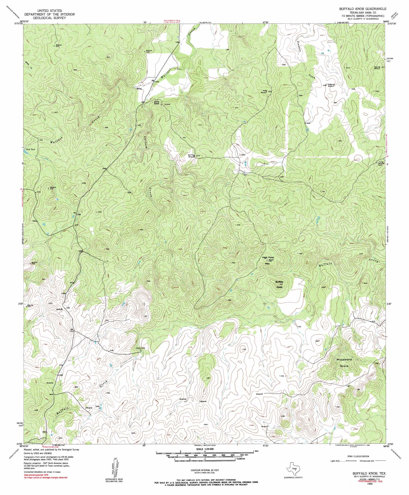
USGS Topo Quad 31098a7 - 1:24,000 scale
| Topo Map Name: | Buffalo Knob |
| USGS Topo Quad ID: | 31098a7 |
| Print Size: | ca. 21 1/4" wide x 27" high |
| Southeast Coordinates: | 31° N latitude / 98.75° W longitude |
| Map Center Coordinates: | 31.0625° N latitude / 98.8125° W longitude |
| U.S. State: | TX |
| Filename: | o31098a7.jpg |
| Download Map JPG Image: | Buffalo Knob topo map 1:24,000 scale |
| Map Type: | Topographic |
| Topo Series: | 7.5´ |
| Map Scale: | 1:24,000 |
| Source of Map Images: | United States Geological Survey (USGS) |
| Alternate Map Versions: |
Buffalo Knob TX 1955, updated 1956 Download PDF Buy paper map Buffalo Knob TX 1955, updated 1990 Download PDF Buy paper map Buffalo Knob TX 2010 Download PDF Buy paper map Buffalo Knob TX 2012 Download PDF Buy paper map Buffalo Knob TX 2016 Download PDF Buy paper map |
1:24,000 Topo Quads surrounding Buffalo Knob
Hall |
Richland Springs |
Blucher Mountain |
Big Valley South |
San Saba Peak |
Lost Creek |
Baker Spring |
Algerita |
San Saba |
Wolf Ridge |
Pecan Springs |
Brady Mountain |
Buffalo Knob |
Bear Hollow |
Bend |
Fredonia |
Pontotoc |
Magill Mountain |
Cherokee |
Indian Hills |
Fly Gap |
Smoothingiron Mountain |
Valley Spring |
Llano North |
Lone Grove |
> Back to 31098a1 at 1:100,000 scale
> Back to 31098a1 at 1:250,000 scale
> Back to U.S. Topo Maps home
Buffalo Knob topo map: Gazetteer
Buffalo Knob: Dams
Soil Conservation Service Site 13a Dam elevation 453m 1486′Soil Conservation Service Site 14a Dam elevation 459m 1505′
Buffalo Knob: Reservoirs
Click Tank elevation 465m 1525′Soil Conservation Service Site 13a Reservoir elevation 453m 1486′
Soil Conservation Service Site 14a Reservoir elevation 459m 1505′
Buffalo Knob: Springs
Wallace Springs elevation 472m 1548′Buffalo Knob: Streams
Latham Creek elevation 419m 1374′Buffalo Knob: Summits
Buffalo Knob elevation 538m 1765′High Pond Mountain elevation 537m 1761′
Buffalo Knob: Woods
Woodward Grove elevation 520m 1706′Buffalo Knob digital topo map on disk
Buy this Buffalo Knob topo map showing relief, roads, GPS coordinates and other geographical features, as a high-resolution digital map file on DVD: