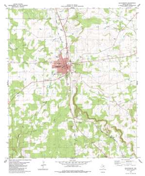
Goldthwaite Topo Map Texas
To zoom in, hover over the map of Goldthwaite
USGS Topo Quad 31098d5 - 1:24,000 scale
| Topo Map Name: | Goldthwaite |
| USGS Topo Quad ID: | 31098d5 |
| Print Size: | ca. 21 1/4" wide x 27" high |
| Southeast Coordinates: | 31.375° N latitude / 98.5° W longitude |
| Map Center Coordinates: | 31.4375° N latitude / 98.5625° W longitude |
| U.S. State: | TX |
| Filename: | o31098d5.jpg |
| Download Map JPG Image: | Goldthwaite topo map 1:24,000 scale |
| Map Type: | Topographic |
| Topo Series: | 7.5´ |
| Map Scale: | 1:24,000 |
| Source of Map Images: | United States Geological Survey (USGS) |
| Alternate Map Versions: |
Goldthwaite TX 1980, updated 1980 Download PDF Buy paper map Goldthwaite TX 2010 Download PDF Buy paper map Goldthwaite TX 2013 Download PDF Buy paper map Goldthwaite TX 2016 Download PDF Buy paper map |
1:24,000 Topo Quads surrounding Goldthwaite
> Back to 31098a1 at 1:100,000 scale
> Back to 31098a1 at 1:250,000 scale
> Back to U.S. Topo Maps home
Goldthwaite topo map: Gazetteer
Goldthwaite: Airports
Mills County Airport elevation 482m 1581′Goldthwaite: Parks
Eagle Field elevation 483m 1584′Goldthwaite Municipal Park elevation 466m 1528′
Goldthwaite: Populated Places
Durenville elevation 457m 1499′Goldthwaite elevation 479m 1571′
Goldthwaite: Streams
Cryers Branch elevation 421m 1381′East Fork Bull Creek elevation 407m 1335′
North Fork Bull Creek elevation 409m 1341′
Goldthwaite: Summits
Cedar Knob elevation 487m 1597′Goldthwaite digital topo map on disk
Buy this Goldthwaite topo map showing relief, roads, GPS coordinates and other geographical features, as a high-resolution digital map file on DVD:


