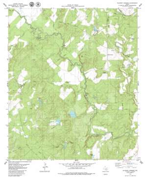
Blanket Springs Topo Map Texas
To zoom in, hover over the map of Blanket Springs
USGS Topo Quad 31098e7 - 1:24,000 scale
| Topo Map Name: | Blanket Springs |
| USGS Topo Quad ID: | 31098e7 |
| Print Size: | ca. 21 1/4" wide x 27" high |
| Southeast Coordinates: | 31.5° N latitude / 98.75° W longitude |
| Map Center Coordinates: | 31.5625° N latitude / 98.8125° W longitude |
| U.S. State: | TX |
| Filename: | o31098e7.jpg |
| Download Map JPG Image: | Blanket Springs topo map 1:24,000 scale |
| Map Type: | Topographic |
| Topo Series: | 7.5´ |
| Map Scale: | 1:24,000 |
| Source of Map Images: | United States Geological Survey (USGS) |
| Alternate Map Versions: |
Blanket Springs TX 1979, updated 1980 Download PDF Buy paper map Blanket Springs TX 2010 Download PDF Buy paper map Blanket Springs TX 2012 Download PDF Buy paper map Blanket Springs TX 2016 Download PDF Buy paper map |
1:24,000 Topo Quads surrounding Blanket Springs
> Back to 31098e1 at 1:100,000 scale
> Back to 31098a1 at 1:250,000 scale
> Back to U.S. Topo Maps home
Blanket Springs topo map: Gazetteer
Blanket Springs: Airports
Vaughan Ranch Airport elevation 399m 1309′Blanket Springs: Bends
Horseshoe Bend elevation 388m 1272′Blanket Springs: Dams
Childress Lake Dam elevation 380m 1246′Clayton Lake Number 1 South Dam elevation 400m 1312′
Clayton Lake Number 2 North Dam elevation 382m 1253′
John Graves Dam Number 2 elevation 387m 1269′
John Graves Dam Number 3 elevation 391m 1282′
John Graves Dam Number 4 elevation 406m 1332′
John Graves Dam Number 5 elevation 388m 1272′
Soil Conservation Service Site 23 Dam elevation 415m 1361′
Williams Lake Dam elevation 415m 1361′
Blanket Springs: Populated Places
Blanket Springs elevation 429m 1407′Duke Crossing elevation 372m 1220′
Fisk Crossing elevation 379m 1243′
Blanket Springs: Reservoirs
Childress Lake elevation 380m 1246′Clayton Lake Number 1 South elevation 400m 1312′
Clayton Lake Number 2 North elevation 382m 1253′
John Graves Lake Number 2 elevation 387m 1269′
John Graves Lake Number 3 elevation 391m 1282′
John Graves Lake Number 4 elevation 406m 1332′
John Graves Lake Number 5 elevation 388m 1272′
Soil Conservation Service Site 23 Reservoir elevation 415m 1361′
Williams Lake elevation 415m 1361′
Blanket Springs: Streams
Devils River elevation 382m 1253′Fisk Creek elevation 374m 1227′
Long Branch elevation 377m 1236′
Mackinally Creek elevation 382m 1253′
Mars Branch elevation 399m 1309′
Panther Creek elevation 373m 1223′
Pecan Creek elevation 381m 1250′
Rough Creek elevation 369m 1210′
Blanket Springs: Summits
Gobblers Knob elevation 399m 1309′Blanket Springs digital topo map on disk
Buy this Blanket Springs topo map showing relief, roads, GPS coordinates and other geographical features, as a high-resolution digital map file on DVD:


