Eidson Lake Topo Map Texas
To zoom in, hover over the map of Eidson Lake
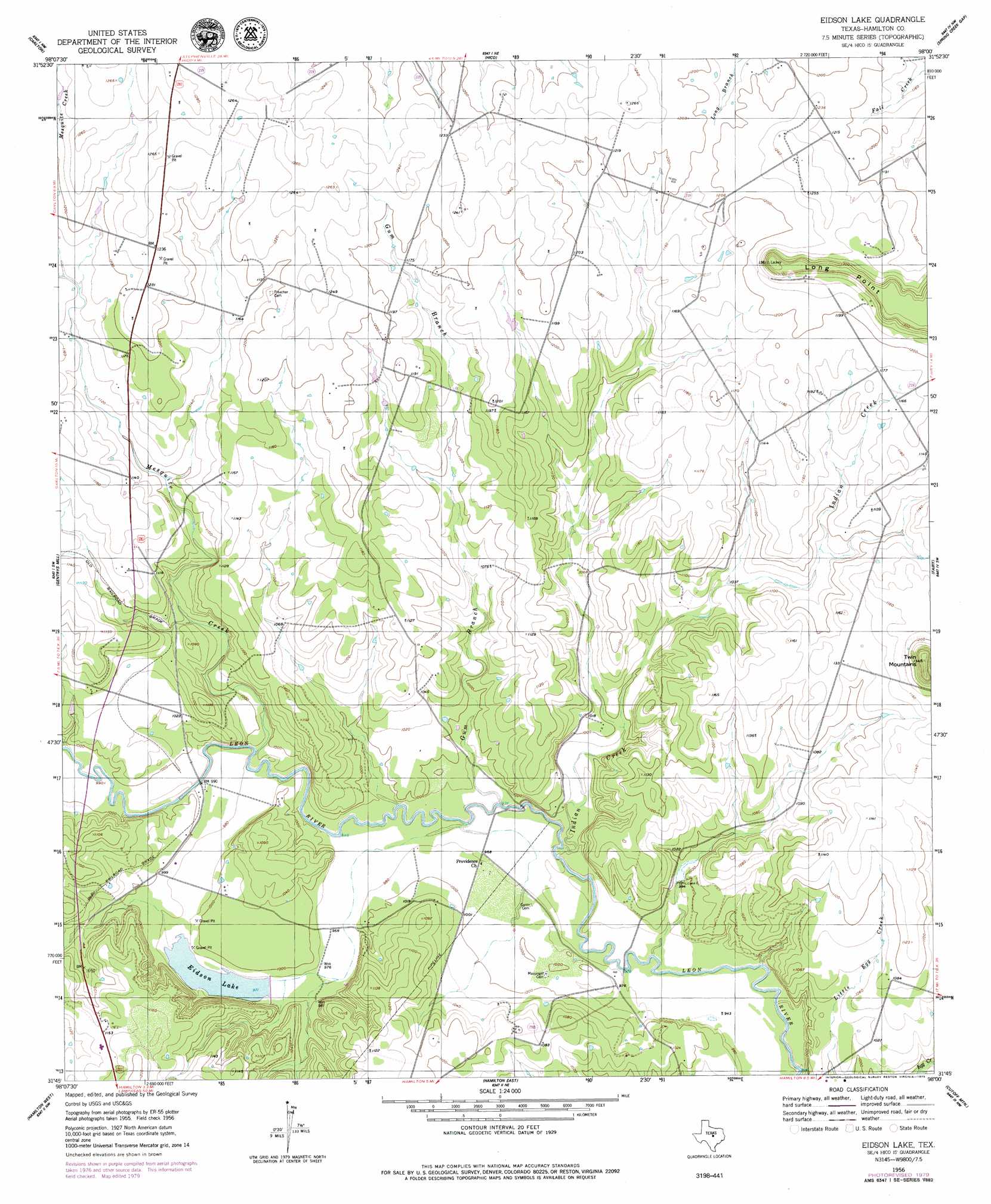
USGS Topo Quad 31098g1 - 1:24,000 scale
| Topo Map Name: | Eidson Lake |
| USGS Topo Quad ID: | 31098g1 |
| Print Size: | ca. 21 1/4" wide x 27" high |
| Southeast Coordinates: | 31.75° N latitude / 98° W longitude |
| Map Center Coordinates: | 31.8125° N latitude / 98.0625° W longitude |
| U.S. State: | TX |
| Filename: | o31098g1.jpg |
| Download Map JPG Image: | Eidson Lake topo map 1:24,000 scale |
| Map Type: | Topographic |
| Topo Series: | 7.5´ |
| Map Scale: | 1:24,000 |
| Source of Map Images: | United States Geological Survey (USGS) |
| Alternate Map Versions: |
Eidson Lake TX 1956, updated 1957 Download PDF Buy paper map Eidson Lake TX 1956, updated 1979 Download PDF Buy paper map Eidson Lake TX 2010 Download PDF Buy paper map Eidson Lake TX 2013 Download PDF Buy paper map Eidson Lake TX 2016 Download PDF Buy paper map |
1:24,000 Topo Quads surrounding Eidson Lake
Dublin |
Alexander |
Clairette |
Camp Branch |
Walnut Springs West |
Edna Hill |
Carlton |
Hico |
Spring Creek Gap |
Iredell |
Lamkin |
Gentrys Mill |
Eidson Lake |
Fairy |
Cranfills Gap |
Pottsville |
Hamilton West |
Hamilton East |
Cutoff Mountain |
German Valley |
Pecan Wells |
Shive |
Ohio |
Jonesboro |
Ater |
> Back to 31098e1 at 1:100,000 scale
> Back to 31098a1 at 1:250,000 scale
> Back to U.S. Topo Maps home
Eidson Lake topo map: Gazetteer
Eidson Lake: Dams
Harris Dam elevation 297m 974′Eidson Lake: Reservoirs
Edison Lake elevation 297m 974′Eidson Lake elevation 296m 971′
Eidson Lake: Streams
Gum Branch elevation 293m 961′Indian Creek elevation 282m 925′
Mesquite Creek elevation 293m 961′
Eidson Lake digital topo map on disk
Buy this Eidson Lake topo map showing relief, roads, GPS coordinates and other geographical features, as a high-resolution digital map file on DVD: