Gentrys Mill Topo Map Texas
To zoom in, hover over the map of Gentrys Mill
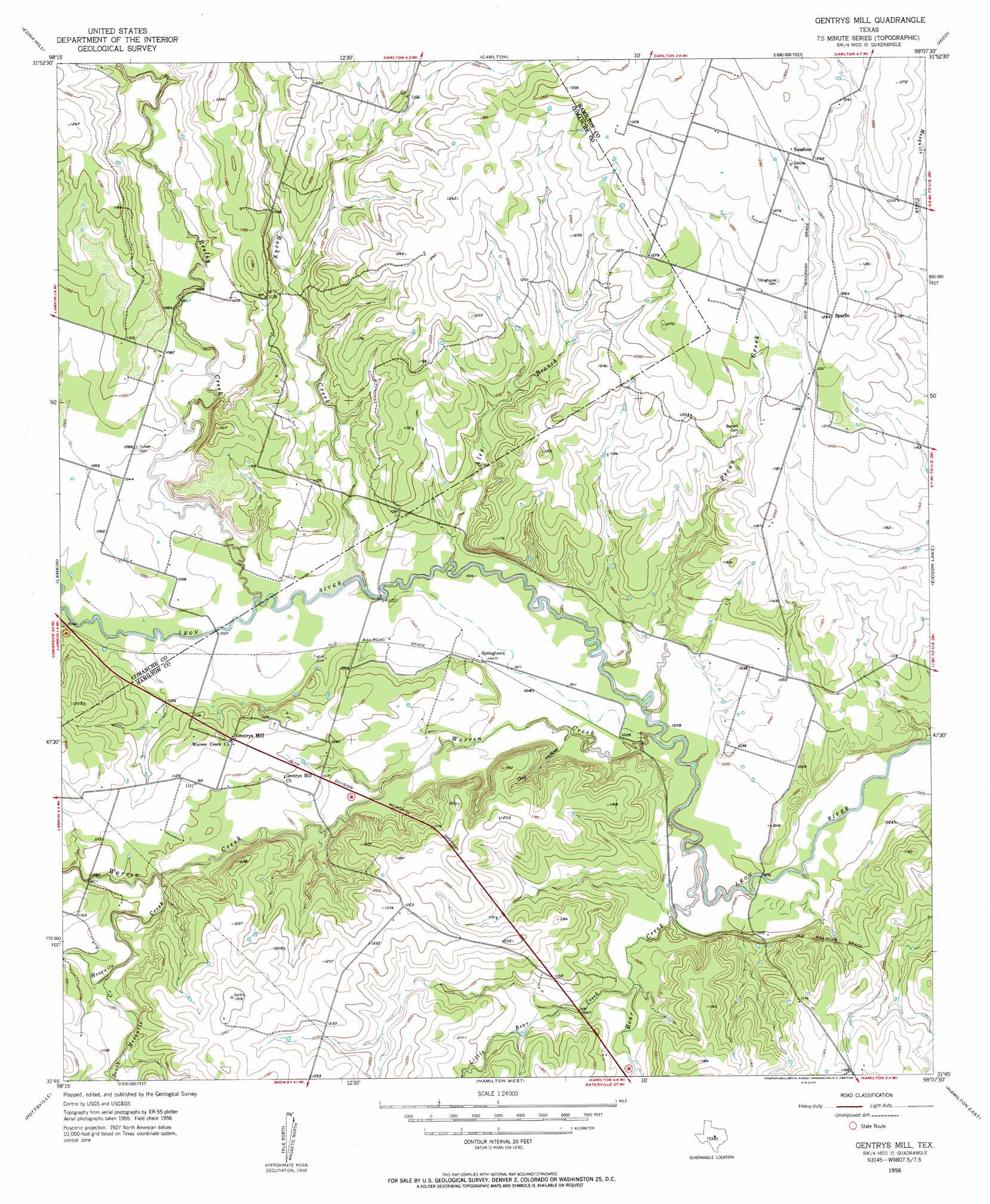
USGS Topo Quad 31098g2 - 1:24,000 scale
| Topo Map Name: | Gentrys Mill |
| USGS Topo Quad ID: | 31098g2 |
| Print Size: | ca. 21 1/4" wide x 27" high |
| Southeast Coordinates: | 31.75° N latitude / 98.125° W longitude |
| Map Center Coordinates: | 31.8125° N latitude / 98.1875° W longitude |
| U.S. State: | TX |
| Filename: | o31098g2.jpg |
| Download Map JPG Image: | Gentrys Mill topo map 1:24,000 scale |
| Map Type: | Topographic |
| Topo Series: | 7.5´ |
| Map Scale: | 1:24,000 |
| Source of Map Images: | United States Geological Survey (USGS) |
| Alternate Map Versions: |
Gentrys Mill TX 1956, updated 1957 Download PDF Buy paper map Gentrys Mill TX 1956, updated 1957 Download PDF Buy paper map Gentrys Mill TX 2010 Download PDF Buy paper map Gentrys Mill TX 2012 Download PDF Buy paper map Gentrys Mill TX 2016 Download PDF Buy paper map |
1:24,000 Topo Quads surrounding Gentrys Mill
Comyn |
Dublin |
Alexander |
Clairette |
Camp Branch |
Proctor |
Edna Hill |
Carlton |
Hico |
Spring Creek Gap |
Gustine |
Lamkin |
Gentrys Mill |
Eidson Lake |
Fairy |
Indian Gap |
Pottsville |
Hamilton West |
Hamilton East |
Cutoff Mountain |
Caradan |
Pecan Wells |
Shive |
Ohio |
Jonesboro |
> Back to 31098e1 at 1:100,000 scale
> Back to 31098a1 at 1:250,000 scale
> Back to U.S. Topo Maps home
Gentrys Mill topo map: Gazetteer
Gentrys Mill: Populated Places
Gentrys Mill elevation 345m 1131′Springtown elevation 311m 1020′
Spurlin elevation 385m 1263′
Sunshine elevation 391m 1282′
Gentrys Mill: Streams
Alex Branch elevation 305m 1000′Bear Creek elevation 299m 980′
Little Bear Creek elevation 309m 1013′
Mesquite Creek elevation 322m 1056′
Pecan Creek elevation 305m 1000′
Resley Creek elevation 311m 1020′
Rocky Creek elevation 305m 1000′
South Mesquite Creek elevation 335m 1099′
Warren Creek elevation 301m 987′
Gentrys Mill: Valleys
Owl Hollow elevation 305m 1000′Gentrys Mill digital topo map on disk
Buy this Gentrys Mill topo map showing relief, roads, GPS coordinates and other geographical features, as a high-resolution digital map file on DVD: