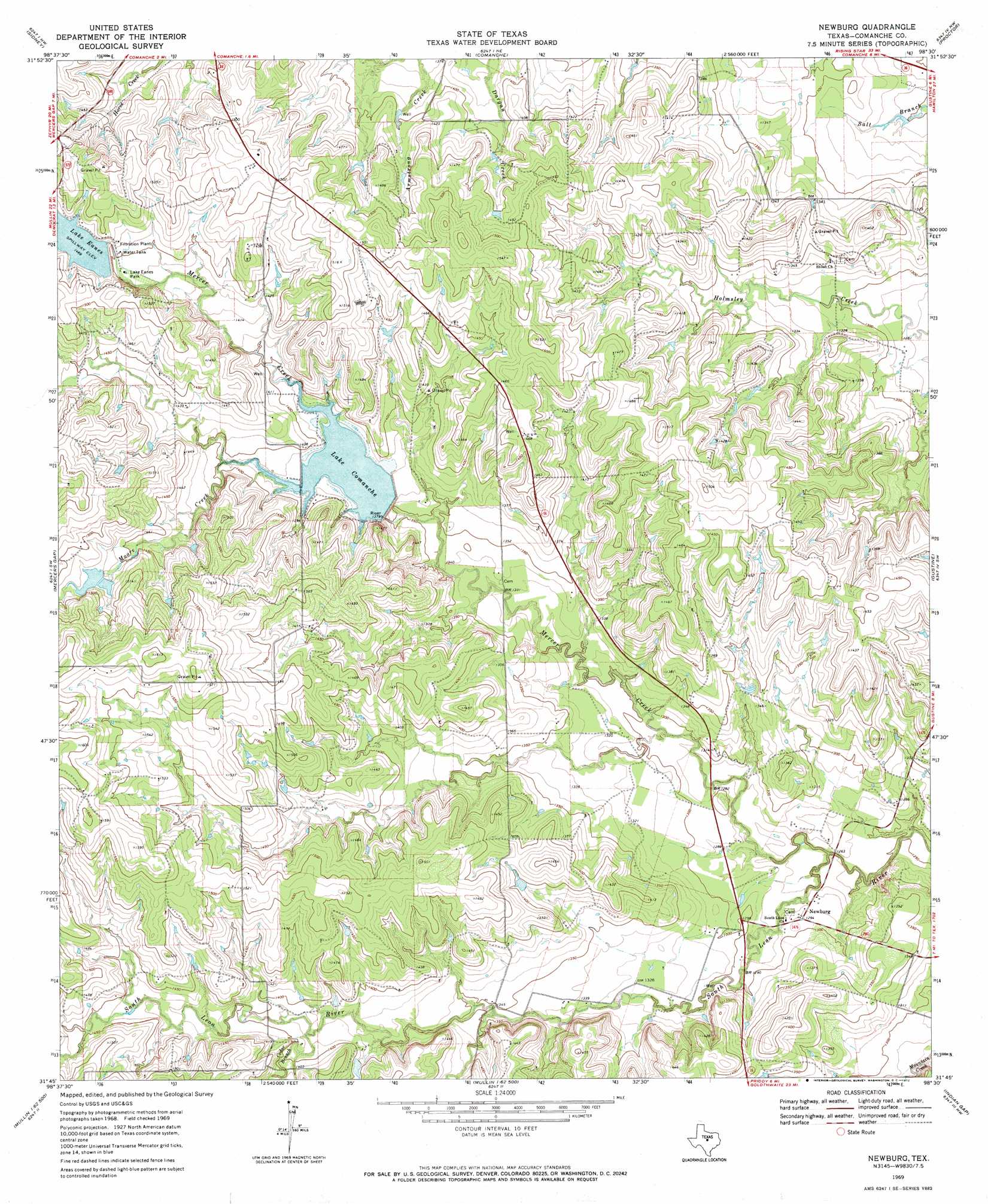
Newburg Topo Map Texas
To zoom in, hover over the map of Newburg
USGS Topo Quad 31098g5 - 1:24,000 scale
| Topo Map Name: | Newburg |
| USGS Topo Quad ID: | 31098g5 |
| Print Size: | ca. 21 1/4" wide x 27" high |
| Southeast Coordinates: | 31.75° N latitude / 98.5° W longitude |
| Map Center Coordinates: | 31.8125° N latitude / 98.5625° W longitude |
| U.S. State: | TX |
| Filename: | o31098g5.jpg |
| Download Map JPG Image: | Newburg topo map 1:24,000 scale |
| Map Type: | Topographic |
| Topo Series: | 7.5´ |
| Map Scale: | 1:24,000 |
| Source of Map Images: | United States Geological Survey (USGS) |
| Alternate Map Versions: |
Newburg TX 1969, updated 1972 Download PDF Buy paper map Newburg TX 2010 Download PDF Buy paper map Newburg TX 2013 Download PDF Buy paper map Newburg TX 2016 Download PDF Buy paper map |
1:24,000 Topo Quads surrounding Newburg
Sipe Springs |
Duster |
De Leon |
Comyn |
Dublin |
Star Mountain |
Sidney |
Comanche |
Proctor |
Edna Hill |
Blanket |
Mercers Gap |
Newburg |
Gustine |
Lamkin |
Zephyr |
Democrat |
Priddy |
Indian Gap |
Pottsville |
Blanket Springs |
Mullin |
Lake Merritt |
Caradan |
Pecan Wells |
> Back to 31098e1 at 1:100,000 scale
> Back to 31098a1 at 1:250,000 scale
> Back to U.S. Topo Maps home
Newburg topo map: Gazetteer
Newburg: Dams
Bean Dam elevation 448m 1469′Lake Comanche Dam elevation 424m 1391′
Lake Eanes Dam elevation 442m 1450′
Newburg: Parks
Lake Eanes Park elevation 440m 1443′Newburg: Populated Places
Newburg elevation 412m 1351′Newburg: Reservoirs
Bean Lake elevation 448m 1469′Lake Comanche elevation 423m 1387′
Lake Eanes elevation 448m 1469′
Newburg: Streams
Cedar Branch elevation 420m 1377′Mercer Creek elevation 378m 1240′
Moore Creek elevation 420m 1377′
Newburg digital topo map on disk
Buy this Newburg topo map showing relief, roads, GPS coordinates and other geographical features, as a high-resolution digital map file on DVD: