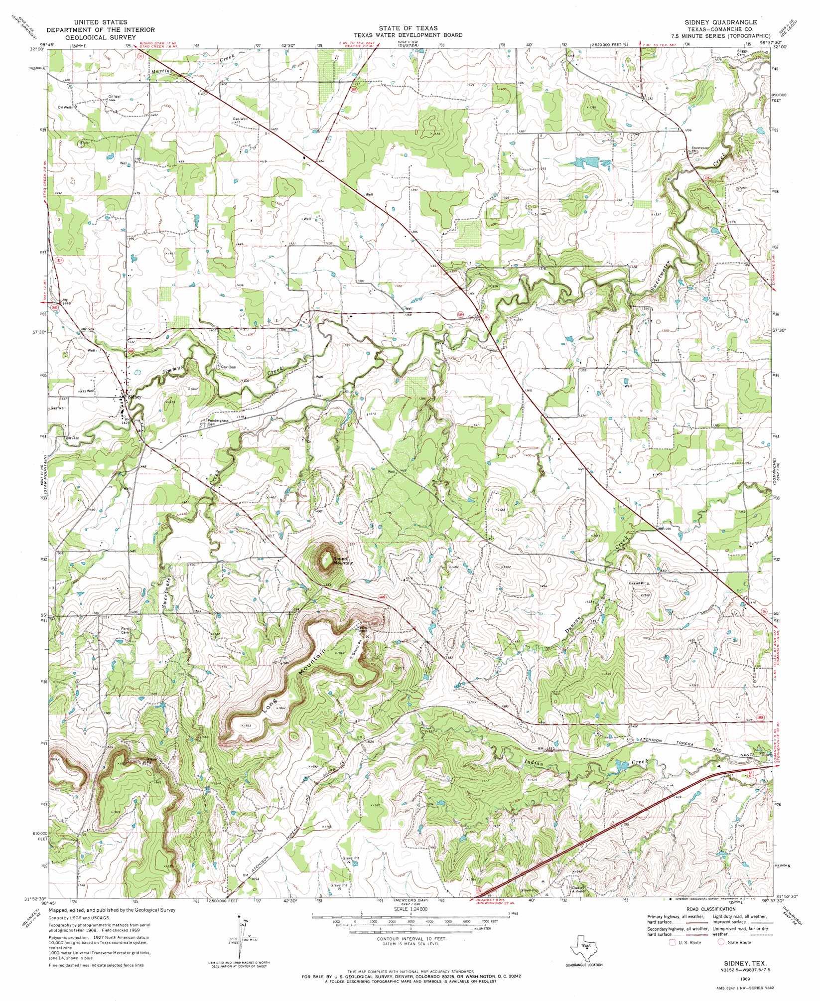
Sidney Topo Map Texas
To zoom in, hover over the map of Sidney
USGS Topo Quad 31098h6 - 1:24,000 scale
| Topo Map Name: | Sidney |
| USGS Topo Quad ID: | 31098h6 |
| Print Size: | ca. 21 1/4" wide x 27" high |
| Southeast Coordinates: | 31.875° N latitude / 98.625° W longitude |
| Map Center Coordinates: | 31.9375° N latitude / 98.6875° W longitude |
| U.S. State: | TX |
| Filename: | o31098h6.jpg |
| Download Map JPG Image: | Sidney topo map 1:24,000 scale |
| Map Type: | Topographic |
| Topo Series: | 7.5´ |
| Map Scale: | 1:24,000 |
| Source of Map Images: | United States Geological Survey (USGS) |
| Alternate Map Versions: |
Sidney TX 1969, updated 1972 Download PDF Buy paper map Sidney TX 2010 Download PDF Buy paper map Sidney TX 2012 Download PDF Buy paper map Sidney TX 2016 Download PDF Buy paper map |
1:24,000 Topo Quads surrounding Sidney
Union Center |
Hunting Shirt Creek |
Gorman |
Rucker |
Lingleville |
Rising Star |
Sipe Springs |
Duster |
De Leon |
Comyn |
May |
Star Mountain |
Sidney |
Comanche |
Proctor |
Owens |
Blanket |
Mercers Gap |
Newburg |
Gustine |
Brownwood |
Zephyr |
Democrat |
Priddy |
Indian Gap |
> Back to 31098e1 at 1:100,000 scale
> Back to 31098a1 at 1:250,000 scale
> Back to U.S. Topo Maps home
Sidney topo map: Gazetteer
Sidney: Dams
David M Pinson Dam elevation 438m 1437′Soil Conservation Service Site 12 Dam elevation 440m 1443′
Soil Conservation Service Site 13 Dam elevation 409m 1341′
Soil Conservation Service Site 14 Dam elevation 406m 1332′
Sidney: Populated Places
Sidney elevation 436m 1430′Sidney: Reservoirs
David M Pinson Lake elevation 438m 1437′Soil Conservation Service Site 13 Reservoir elevation 409m 1341′
Soil Conservation Service Site 14 Reservoir elevation 406m 1332′
Sidney: Streams
Jimmys Creek elevation 408m 1338′Sidney: Summits
Long Mountain elevation 562m 1843′Round Mountain elevation 554m 1817′
Sidney digital topo map on disk
Buy this Sidney topo map showing relief, roads, GPS coordinates and other geographical features, as a high-resolution digital map file on DVD: