Lost Creek Topo Map Texas
To zoom in, hover over the map of Lost Creek
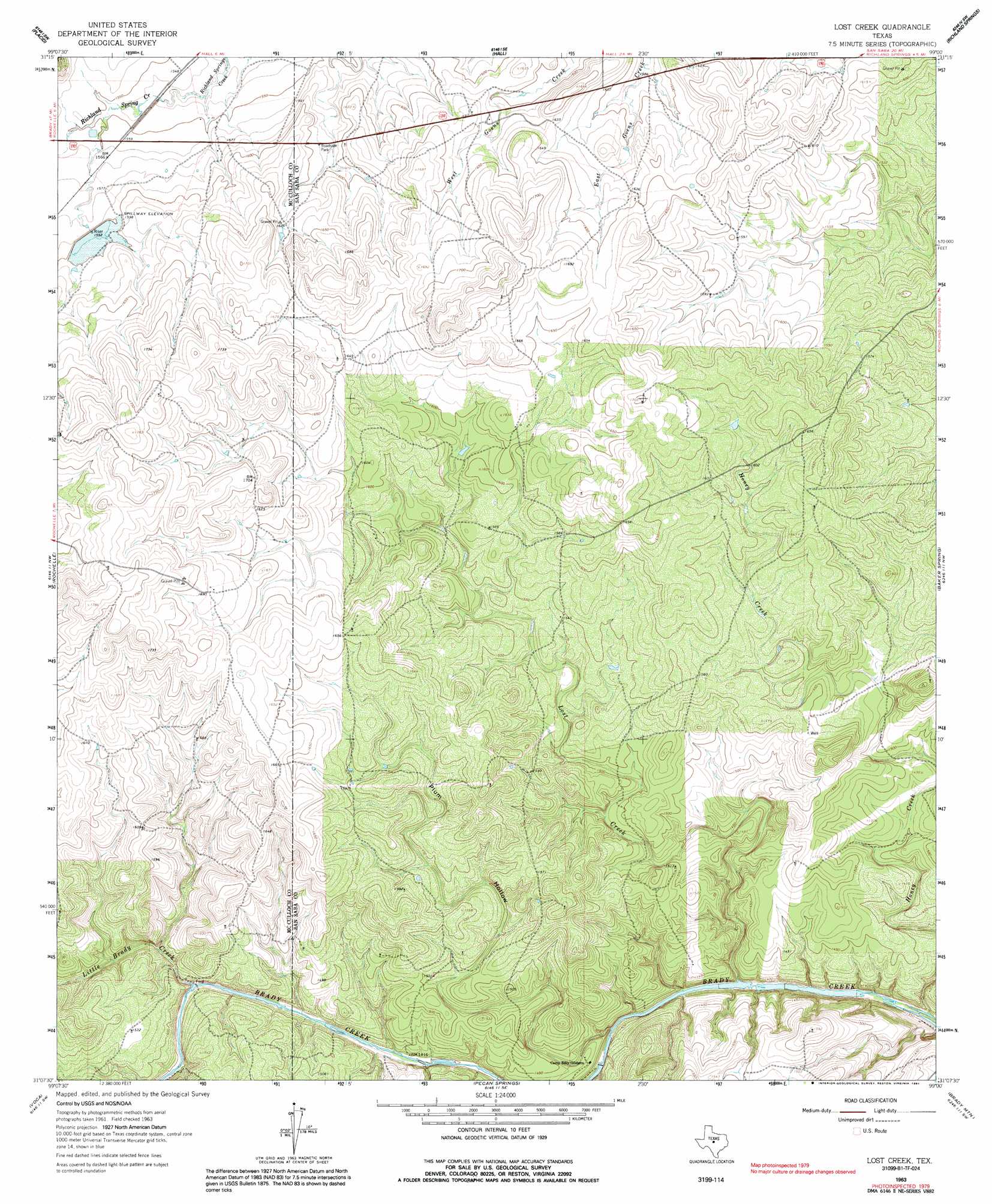
USGS Topo Quad 31099b1 - 1:24,000 scale
| Topo Map Name: | Lost Creek |
| USGS Topo Quad ID: | 31099b1 |
| Print Size: | ca. 21 1/4" wide x 27" high |
| Southeast Coordinates: | 31.125° N latitude / 99° W longitude |
| Map Center Coordinates: | 31.1875° N latitude / 99.0625° W longitude |
| U.S. State: | TX |
| Filename: | o31099b1.jpg |
| Download Map JPG Image: | Lost Creek topo map 1:24,000 scale |
| Map Type: | Topographic |
| Topo Series: | 7.5´ |
| Map Scale: | 1:24,000 |
| Source of Map Images: | United States Geological Survey (USGS) |
| Alternate Map Versions: |
Lost Creek TX 1963, updated 1964 Download PDF Buy paper map Lost Creek TX 1963, updated 1991 Download PDF Buy paper map Lost Creek TX 2010 Download PDF Buy paper map Lost Creek TX 2012 Download PDF Buy paper map Lost Creek TX 2016 Download PDF Buy paper map |
1:24,000 Topo Quads surrounding Lost Creek
Whon |
Mercury |
Elm Grove |
Bowser |
Regency |
Bluff Creek |
Placid |
Hall |
Richland Springs |
Blucher Mountain |
Brady North |
Rochelle |
Lost Creek |
Baker Spring |
Algerita |
Brady South |
Voca |
Pecan Springs |
Brady Mountain |
Buffalo Knob |
Katemcy |
Spy Rock |
Fredonia |
Pontotoc |
Magill Mountain |
> Back to 31099a1 at 1:100,000 scale
> Back to 31098a1 at 1:250,000 scale
> Back to U.S. Topo Maps home
Lost Creek topo map: Gazetteer
Lost Creek: Dams
Soil Conservation Service Site 1 Dam elevation 485m 1591′Lost Creek: Reservoirs
Soil Conservation Service Site 1 Reservoir elevation 485m 1591′Lost Creek: Streams
Honey Creek elevation 413m 1354′Little Brady Creek elevation 435m 1427′
Lost Creek elevation 413m 1354′
Lost Creek: Valleys
Plum Hollow elevation 415m 1361′Lost Creek digital topo map on disk
Buy this Lost Creek topo map showing relief, roads, GPS coordinates and other geographical features, as a high-resolution digital map file on DVD: