Melvin Topo Map Texas
To zoom in, hover over the map of Melvin
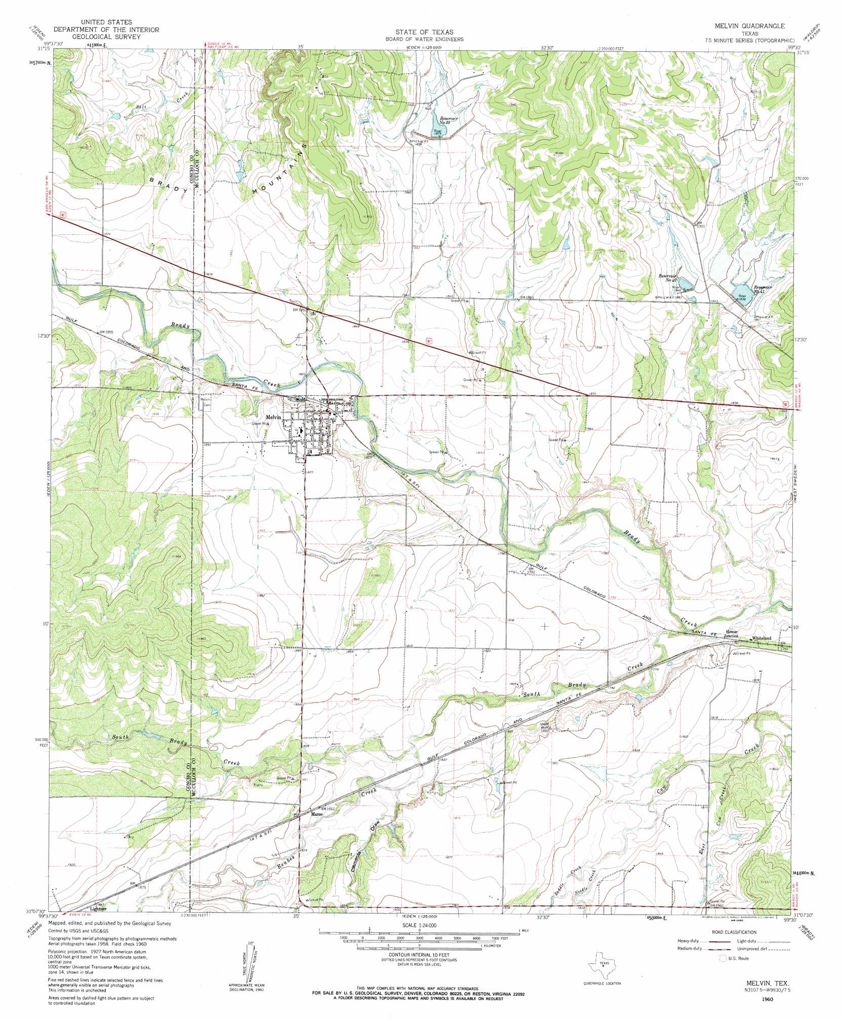
USGS Topo Quad 31099b5 - 1:24,000 scale
| Topo Map Name: | Melvin |
| USGS Topo Quad ID: | 31099b5 |
| Print Size: | ca. 21 1/4" wide x 27" high |
| Southeast Coordinates: | 31.125° N latitude / 99.5° W longitude |
| Map Center Coordinates: | 31.1875° N latitude / 99.5625° W longitude |
| U.S. State: | TX |
| Filename: | o31099b5.jpg |
| Download Map JPG Image: | Melvin topo map 1:24,000 scale |
| Map Type: | Topographic |
| Topo Series: | 7.5´ |
| Map Scale: | 1:24,000 |
| Source of Map Images: | United States Geological Survey (USGS) |
| Alternate Map Versions: |
Melvin TX 1960, updated 1961 Download PDF Buy paper map Melvin TX 1960, updated 1961 Download PDF Buy paper map Melvin TX 2010 Download PDF Buy paper map Melvin TX 2013 Download PDF Buy paper map Melvin TX 2016 Download PDF Buy paper map |
1:24,000 Topo Quads surrounding Melvin
Millersview |
Mustang Creek |
Doole |
Fife |
Whon |
Millersview Se |
Doole Sw |
Salt Gap |
Lohn |
Bluff Creek |
Eden |
Pasche |
Melvin |
West Sweden |
Brady North |
Eden Se |
Callan |
Needle Creek |
Brady Sw |
Brady South |
Menard |
Chapman Draw |
Robbers Roost |
Calf Creek |
Katemcy |
> Back to 31099a1 at 1:100,000 scale
> Back to 31098a1 at 1:250,000 scale
> Back to U.S. Topo Maps home
Melvin topo map: Gazetteer
Melvin: Dams
Soil Conservation Service Site 17 Dam elevation 562m 1843′Soil Conservation Service Site 39 Dam elevation 573m 1879′
Soil Conservation Service Site 40 Dam elevation 580m 1902′
Soil Conservation Service Site 41 Dam elevation 558m 1830′
Melvin: Populated Places
Homer Junction elevation 545m 1788′Lightner elevation 574m 1883′
Marco elevation 562m 1843′
Melvin elevation 566m 1856′
Whiteland elevation 548m 1797′
Melvin: Reservoirs
Reservoir Number Forty elevation 563m 1847′Reservoir Number Fortyone elevation 558m 1830′
Reservoir Number Thirtynine elevation 579m 1899′
Soil Conservation Service Site 17 Reservoir elevation 562m 1843′
Soil Conservation Service Site 39 Reservoir elevation 573m 1879′
Soil Conservation Service Site 40 Reservoir elevation 580m 1902′
Soil Conservation Service Site 41 Reservoir elevation 558m 1830′
Melvin: Streams
East Cow Creek elevation 546m 1791′Needle Creek elevation 556m 1824′
Reubes Creek elevation 550m 1804′
Saddle Creek elevation 556m 1824′
South Brady Creek elevation 540m 1771′
Melvin: Valleys
Clements Draw elevation 555m 1820′Melvin digital topo map on disk
Buy this Melvin topo map showing relief, roads, GPS coordinates and other geographical features, as a high-resolution digital map file on DVD: