Bluff Creek Topo Map Texas
To zoom in, hover over the map of Bluff Creek
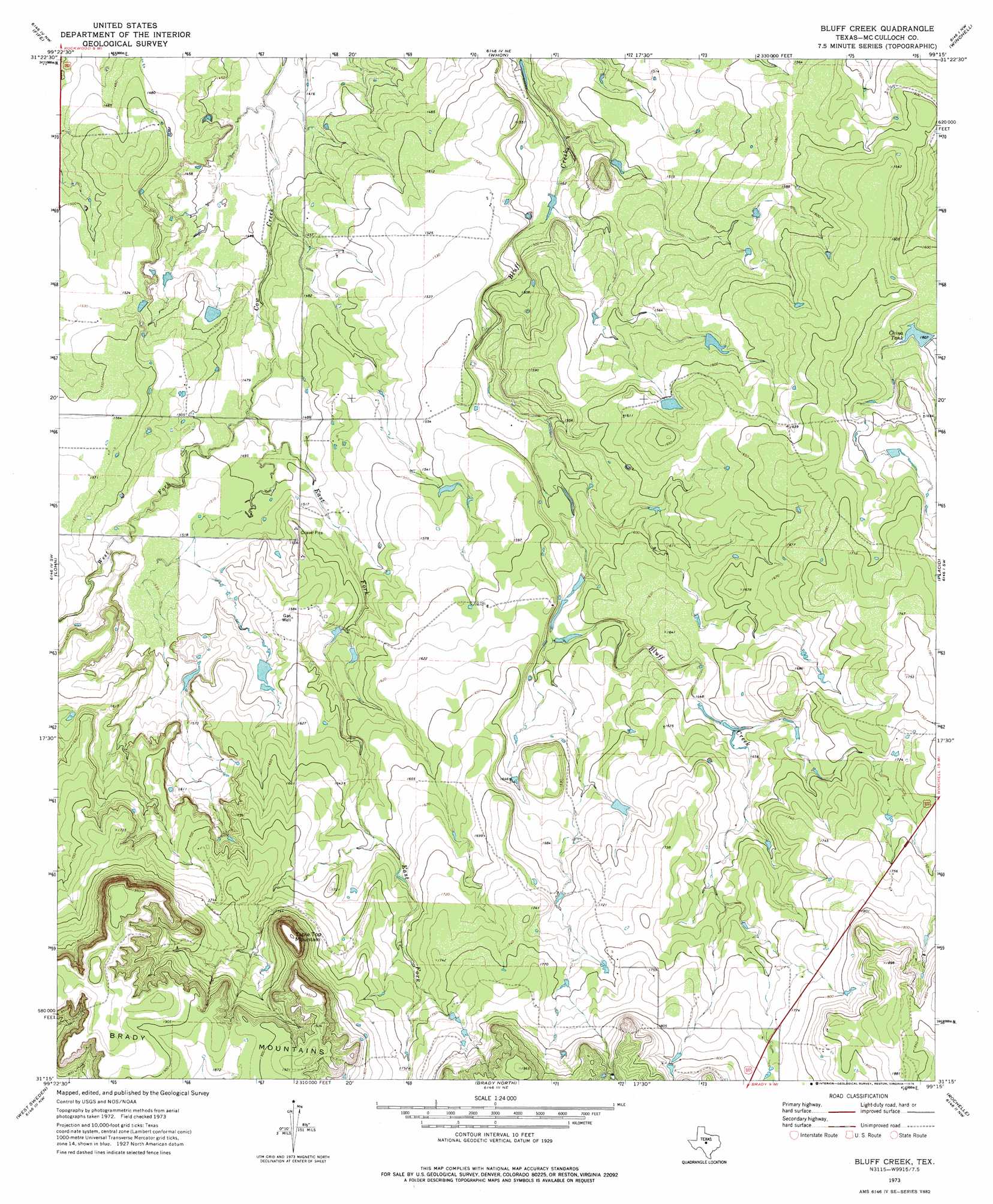
USGS Topo Quad 31099c3 - 1:24,000 scale
| Topo Map Name: | Bluff Creek |
| USGS Topo Quad ID: | 31099c3 |
| Print Size: | ca. 21 1/4" wide x 27" high |
| Southeast Coordinates: | 31.25° N latitude / 99.25° W longitude |
| Map Center Coordinates: | 31.3125° N latitude / 99.3125° W longitude |
| U.S. State: | TX |
| Filename: | o31099c3.jpg |
| Download Map JPG Image: | Bluff Creek topo map 1:24,000 scale |
| Map Type: | Topographic |
| Topo Series: | 7.5´ |
| Map Scale: | 1:24,000 |
| Source of Map Images: | United States Geological Survey (USGS) |
| Alternate Map Versions: |
Bluff Creek TX 1973, updated 1976 Download PDF Buy paper map Bluff Creek TX 2010 Download PDF Buy paper map Bluff Creek TX 2012 Download PDF Buy paper map Bluff Creek TX 2016 Download PDF Buy paper map |
1:24,000 Topo Quads surrounding Bluff Creek
Voss |
Gouldbusk |
Speck Mountain |
Trickham |
Brookesmith |
Doole |
Fife |
Whon |
Mercury |
Elm Grove |
Salt Gap |
Lohn |
Bluff Creek |
Placid |
Hall |
Melvin |
West Sweden |
Brady North |
Rochelle |
Lost Creek |
Needle Creek |
Brady Sw |
Brady South |
Voca |
Pecan Springs |
> Back to 31099a1 at 1:100,000 scale
> Back to 31098a1 at 1:250,000 scale
> Back to U.S. Topo Maps home
Bluff Creek topo map: Gazetteer
Bluff Creek: Reservoirs
China Tank elevation 490m 1607′Bluff Creek: Streams
East Fork Cow Creek elevation 449m 1473′West Fork Cow Creek elevation 448m 1469′
Bluff Creek: Summits
Table Top Mountain elevation 592m 1942′Bluff Creek digital topo map on disk
Buy this Bluff Creek topo map showing relief, roads, GPS coordinates and other geographical features, as a high-resolution digital map file on DVD: