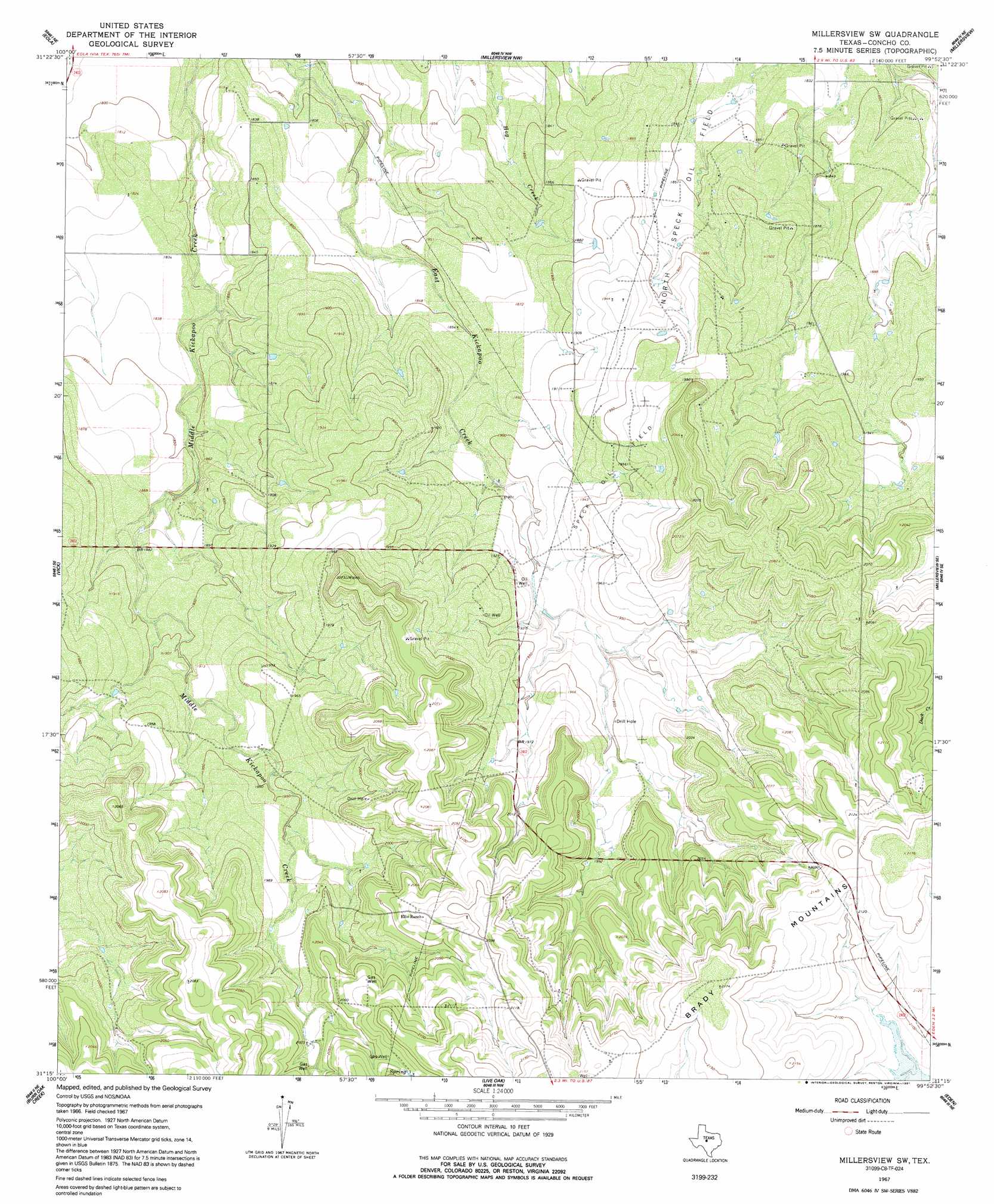
Millersview Sw Topo Map Texas
To zoom in, hover over the map of Millersview Sw
USGS Topo Quad 31099c8 - 1:24,000 scale
| Topo Map Name: | Millersview Sw |
| USGS Topo Quad ID: | 31099c8 |
| Print Size: | ca. 21 1/4" wide x 27" high |
| Southeast Coordinates: | 31.25° N latitude / 99.875° W longitude |
| Map Center Coordinates: | 31.3125° N latitude / 99.9375° W longitude |
| U.S. State: | TX |
| Filename: | o31099c8.jpg |
| Download Map JPG Image: | Millersview Sw topo map 1:24,000 scale |
| Map Type: | Topographic |
| Topo Series: | 7.5´ |
| Map Scale: | 1:24,000 |
| Source of Map Images: | United States Geological Survey (USGS) |
| Alternate Map Versions: |
Millersview SW TX 1967, updated 1991 Download PDF Buy paper map Millersview SW TX 2010 Download PDF Buy paper map Millersview SW TX 2012 Download PDF Buy paper map Millersview SW TX 2016 Download PDF Buy paper map |
1:24,000 Topo Quads surrounding Millersview Sw
Miles |
Lowake |
Paint Rock |
Concho |
Leaday |
Mereta |
Eola |
Millersview Nw |
Millersview |
Mustang Creek |
Vancourt |
Vick |
Millersview Sw |
Millersview Se |
Doole Sw |
Kickapoo Spring |
Burr Oak Creek |
Live Oak |
Eden |
Pasche |
Rocking Chair Ranch |
Del Venado Ranch |
Eden Sw |
Eden Se |
Callan |
> Back to 31099a1 at 1:100,000 scale
> Back to 31098a1 at 1:250,000 scale
> Back to U.S. Topo Maps home
Millersview Sw topo map: Gazetteer
Millersview Sw: Oilfields
North Speck Oil Field elevation 567m 1860′Speck Oil Field elevation 592m 1942′
Millersview Sw digital topo map on disk
Buy this Millersview Sw topo map showing relief, roads, GPS coordinates and other geographical features, as a high-resolution digital map file on DVD: