Bead Mountain Topo Map Texas
To zoom in, hover over the map of Bead Mountain
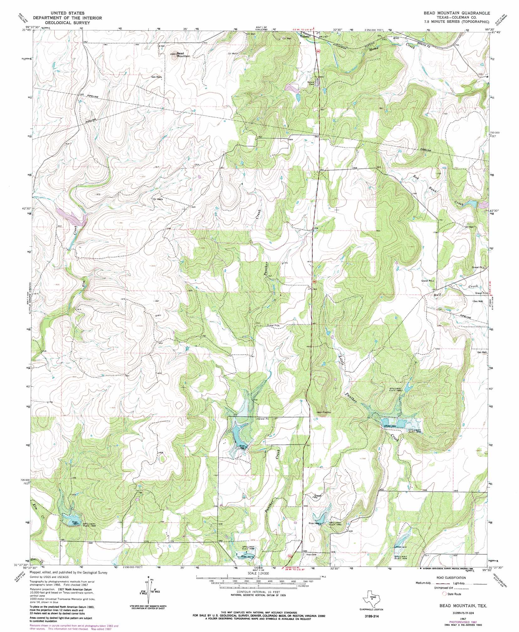
USGS Topo Quad 31099f5 - 1:24,000 scale
| Topo Map Name: | Bead Mountain |
| USGS Topo Quad ID: | 31099f5 |
| Print Size: | ca. 21 1/4" wide x 27" high |
| Southeast Coordinates: | 31.625° N latitude / 99.5° W longitude |
| Map Center Coordinates: | 31.6875° N latitude / 99.5625° W longitude |
| U.S. State: | TX |
| Filename: | o31099f5.jpg |
| Download Map JPG Image: | Bead Mountain topo map 1:24,000 scale |
| Map Type: | Topographic |
| Topo Series: | 7.5´ |
| Map Scale: | 1:24,000 |
| Source of Map Images: | United States Geological Survey (USGS) |
| Alternate Map Versions: |
Bead Mountian TX 1967, updated 1970 Download PDF Buy paper map Bead Mountain TX 1967, updated 1988 Download PDF Buy paper map Bead Mountain TX 2010 Download PDF Buy paper map Bead Mountain TX 2013 Download PDF Buy paper map Bead Mountain TX 2016 Download PDF Buy paper map |
1:24,000 Topo Quads surrounding Bead Mountain
Crews |
Novice West |
Novice East |
Lake Scarborough |
Coleman Ne |
Benoit |
Talpa |
Valera |
Coleman |
Lake San Tana |
Buffalo Bluff |
Little Grape Creek |
Bead Mountain |
Fisk |
Santa Anna |
Concho |
Leaday |
Voss |
Gouldbusk |
Speck Mountain |
Millersview |
Mustang Creek |
Doole |
Fife |
Whon |
> Back to 31099e1 at 1:100,000 scale
> Back to 31098a1 at 1:250,000 scale
> Back to U.S. Topo Maps home
Bead Mountain topo map: Gazetteer
Bead Mountain: Dams
Soil Conservation Service Site 10 Dam elevation 506m 1660′Soil Conservation Service Site 11 Dam elevation 554m 1817′
Soil Conservation Service Site 11 Dam elevation 518m 1699′
Soil Conservation Service Site 11 Dam elevation 503m 1650′
Soil Conservation Service Site 5a Dam elevation 544m 1784′
Soil Conservation Service Site 6 Dam elevation 514m 1686′
Soil Conservation Service Site 7 Dam elevation 518m 1699′
Soil Conservation Service Site 8 Dam elevation 505m 1656′
Soil Conservation Service Site 9 Dam elevation 494m 1620′
Bead Mountain: Reservoirs
Soil Conservation Service Site 10 Reservoir elevation 506m 1660′Soil Conservation Service Site 11 Reservoir elevation 503m 1650′
Soil Conservation Service Site 11 Reservoir elevation 554m 1817′
Soil Conservation Service Site 5a Reservoir elevation 544m 1784′
Soil Conservation Service Site 6 Reservoir elevation 514m 1686′
Soil Conservation Service Site 7 Reservoir elevation 518m 1699′
Soil Conservation Service Site 8 Reservoir elevation 505m 1656′
Soil Conservation Service Site 9 Reservoir elevation 494m 1620′
Bead Mountain: Summits
Bead Mountain elevation 603m 1978′Bead Mountain digital topo map on disk
Buy this Bead Mountain topo map showing relief, roads, GPS coordinates and other geographical features, as a high-resolution digital map file on DVD: