Ballinger Topo Map Texas
To zoom in, hover over the map of Ballinger
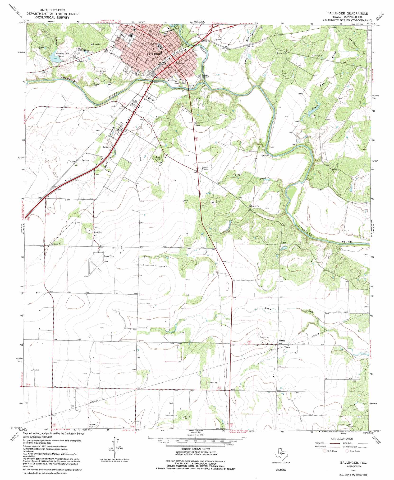
USGS Topo Quad 31099f8 - 1:24,000 scale
| Topo Map Name: | Ballinger |
| USGS Topo Quad ID: | 31099f8 |
| Print Size: | ca. 21 1/4" wide x 27" high |
| Southeast Coordinates: | 31.625° N latitude / 99.875° W longitude |
| Map Center Coordinates: | 31.6875° N latitude / 99.9375° W longitude |
| U.S. State: | TX |
| Filename: | o31099f8.jpg |
| Download Map JPG Image: | Ballinger topo map 1:24,000 scale |
| Map Type: | Topographic |
| Topo Series: | 7.5´ |
| Map Scale: | 1:24,000 |
| Source of Map Images: | United States Geological Survey (USGS) |
| Alternate Map Versions: |
Ballinger TX 1967, updated 1970 Download PDF Buy paper map Ballinger TX 1967, updated 1992 Download PDF Buy paper map Ballinger TX 2010 Download PDF Buy paper map Ballinger TX 2012 Download PDF Buy paper map Ballinger TX 2016 Download PDF Buy paper map |
1:24,000 Topo Quads surrounding Ballinger
Hog Mountain |
Wilmeth |
Winters |
Crews |
Novice West |
Maverick |
Herring Ranch |
Hatchel |
Benoit |
Talpa |
Miles Nw |
Rowena |
Ballinger |
Buffalo Bluff |
Little Grape Creek |
Miles |
Lowake |
Paint Rock |
Concho |
Leaday |
Mereta |
Eola |
Millersview Nw |
Millersview |
Mustang Creek |
> Back to 31099e1 at 1:100,000 scale
> Back to 31098a1 at 1:250,000 scale
> Back to U.S. Topo Maps home
Ballinger topo map: Gazetteer
Ballinger: Airports
Bruce Field elevation 529m 1735′Ballinger: Dams
Country Club Lake Dam elevation 512m 1679′Elm Creek Lake Dam elevation 496m 1627′
Lee Lake Dam elevation 491m 1610′
Texas No Name Number 13 Dam elevation 499m 1637′
Ballinger: Lakes
Country Club Lake elevation 501m 1643′Ballinger: Parks
Bearcat Stadium elevation 508m 1666′Ballinger: Populated Places
Ballinger elevation 496m 1627′Bethel elevation 511m 1676′
Ballinger: Reservoirs
Country Club Lake elevation 512m 1679′Elm Creek Lake elevation 496m 1627′
Lee Lake elevation 491m 1610′
Texas Noname Number 13 elevation 499m 1637′
Ballinger: Streams
Bears Foot Creek elevation 484m 1587′Elm Creek elevation 487m 1597′
Long Branch elevation 482m 1581′
Sand Branch elevation 493m 1617′
Spur Creek elevation 480m 1574′
Stag Branch elevation 479m 1571′
Ballinger: Valleys
Los Arroyos elevation 491m 1610′Ballinger digital topo map on disk
Buy this Ballinger topo map showing relief, roads, GPS coordinates and other geographical features, as a high-resolution digital map file on DVD: