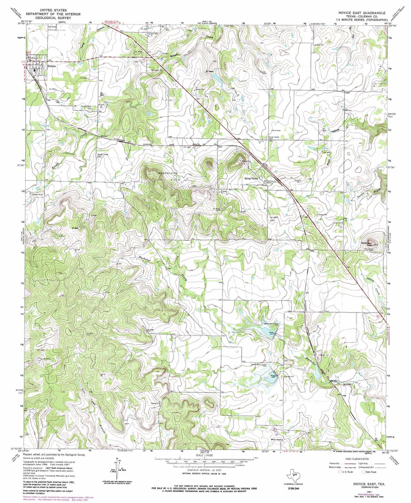
Novice East Topo Map Texas
To zoom in, hover over the map of Novice East
USGS Topo Quad 31099h5 - 1:24,000 scale
| Topo Map Name: | Novice East |
| USGS Topo Quad ID: | 31099h5 |
| Print Size: | ca. 21 1/4" wide x 27" high |
| Southeast Coordinates: | 31.875° N latitude / 99.5° W longitude |
| Map Center Coordinates: | 31.9375° N latitude / 99.5625° W longitude |
| U.S. State: | TX |
| Filename: | o31099h5.jpg |
| Download Map JPG Image: | Novice East topo map 1:24,000 scale |
| Map Type: | Topographic |
| Topo Series: | 7.5´ |
| Map Scale: | 1:24,000 |
| Source of Map Images: | United States Geological Survey (USGS) |
| Alternate Map Versions: |
Novice East TX 1967, updated 1969 Download PDF Buy paper map Novice East TX 1967, updated 1987 Download PDF Buy paper map Novice East TX 2010 Download PDF Buy paper map Novice East TX 2013 Download PDF Buy paper map Novice East TX 2016 Download PDF Buy paper map |
1:24,000 Topo Quads surrounding Novice East
Tuscola |
Lawn |
Oplin |
Rowden Nw |
Rowden |
Bald Knob |
Goldsboro |
Mcewen Draw |
Crooked Creek |
Webbville |
Crews |
Novice West |
Novice East |
Lake Scarborough |
Coleman Ne |
Benoit |
Talpa |
Valera |
Coleman |
Lake San Tana |
Buffalo Bluff |
Little Grape Creek |
Bead Mountain |
Fisk |
Santa Anna |
> Back to 31099e1 at 1:100,000 scale
> Back to 31098a1 at 1:250,000 scale
> Back to U.S. Topo Maps home
Novice East topo map: Gazetteer
Novice East: Dams
Hughes Dam elevation 591m 1938′Santa Fe Railroad Dam elevation 572m 1876′
Soil Conservation Service Site 33 Dam elevation 582m 1909′
Soil Conservation Service Site 34a Dam elevation 581m 1906′
Soil Conservation Service Site 35 Dam elevation 578m 1896′
Novice East: Oilfields
Burroughs Oil Field elevation 619m 2030′Novice East: Populated Places
Novice elevation 606m 1988′Silver Valley elevation 615m 2017′
Novice East: Reservoirs
Hughes Lake elevation 591m 1938′Santa Fe Lake elevation 572m 1876′
Soil Conservation Service Site 33 Reservoir elevation 582m 1909′
Soil Conservation Service Site 34a Reservoir elevation 581m 1906′
Soil Conservation Service Site 35 Reservoir elevation 578m 1896′
Novice East: Summits
Robinson Peak elevation 632m 2073′Novice East digital topo map on disk
Buy this Novice East topo map showing relief, roads, GPS coordinates and other geographical features, as a high-resolution digital map file on DVD: