Kickapoo Spring Topo Map Texas
To zoom in, hover over the map of Kickapoo Spring
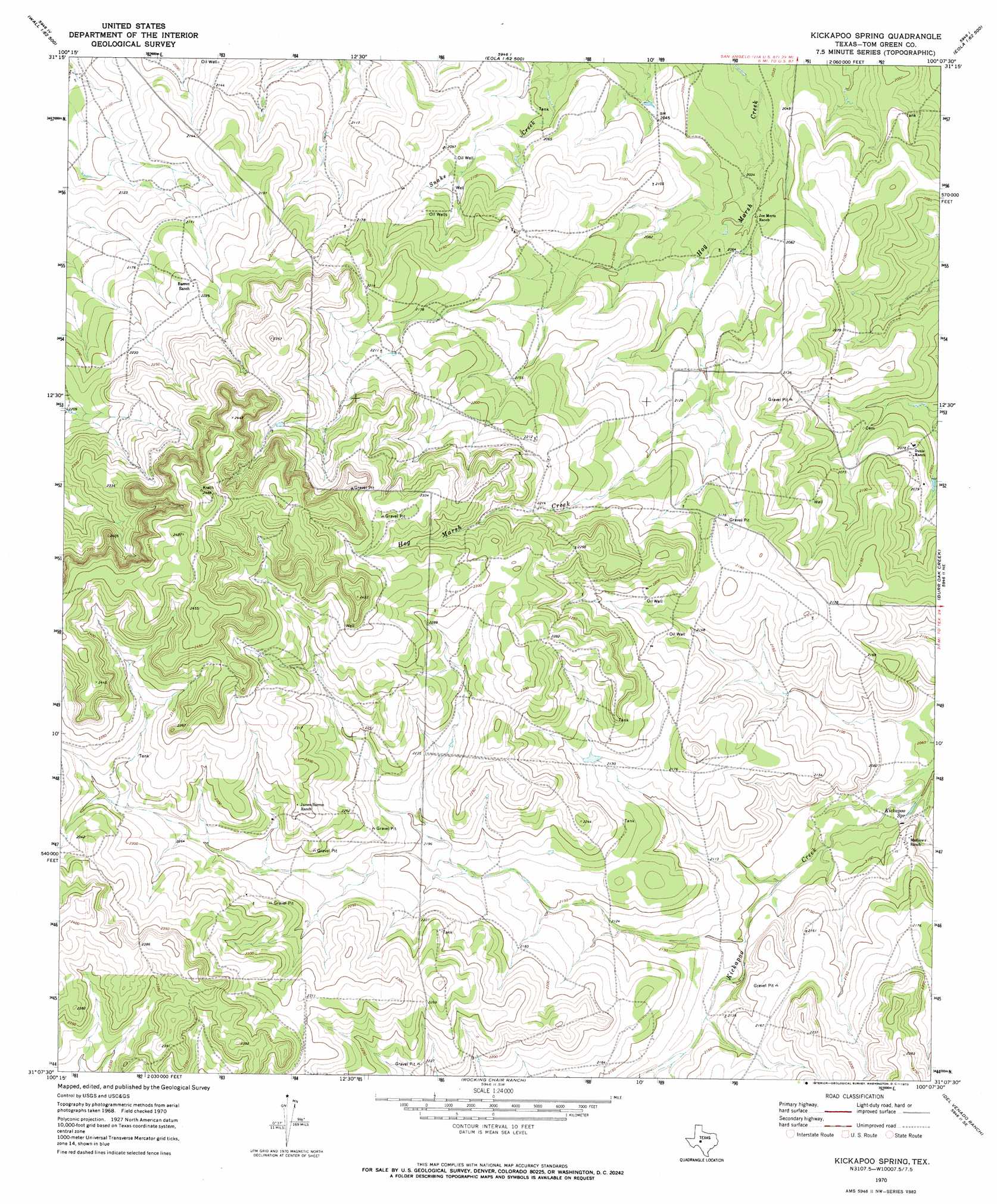
USGS Topo Quad 31100b2 - 1:24,000 scale
| Topo Map Name: | Kickapoo Spring |
| USGS Topo Quad ID: | 31100b2 |
| Print Size: | ca. 21 1/4" wide x 27" high |
| Southeast Coordinates: | 31.125° N latitude / 100.125° W longitude |
| Map Center Coordinates: | 31.1875° N latitude / 100.1875° W longitude |
| U.S. State: | TX |
| Filename: | o31100b2.jpg |
| Download Map JPG Image: | Kickapoo Spring topo map 1:24,000 scale |
| Map Type: | Topographic |
| Topo Series: | 7.5´ |
| Map Scale: | 1:24,000 |
| Source of Map Images: | United States Geological Survey (USGS) |
| Alternate Map Versions: |
Kickapoo Spring TX 1970, updated 1973 Download PDF Buy paper map Kickapoo Spring TX 2010 Download PDF Buy paper map Kickapoo Spring TX 2012 Download PDF Buy paper map Kickapoo Spring TX 2016 Download PDF Buy paper map |
1:24,000 Topo Quads surrounding Kickapoo Spring
San Angelo South |
Veribest |
Mereta |
Eola |
Millersview Nw |
Pecan Station |
Wall |
Vancourt |
Vick |
Millersview Sw |
Christoval |
Susan Peak |
Kickapoo Spring |
Burr Oak Creek |
Live Oak |
Cave Spring |
Christoval Se |
Rocking Chair Ranch |
Del Venado Ranch |
Eden Sw |
Adams Nw |
Adams |
Fort Mckavett Nw |
Fort Mckavett Ne |
Clear Creek Lake |
> Back to 31100a1 at 1:100,000 scale
> Back to 31100a1 at 1:250,000 scale
> Back to U.S. Topo Maps home
Kickapoo Spring topo map: Gazetteer
Kickapoo Spring: Springs
Kickapoo Spring elevation 630m 2066′Rust Spring elevation 625m 2050′
Kickapoo Spring digital topo map on disk
Buy this Kickapoo Spring topo map showing relief, roads, GPS coordinates and other geographical features, as a high-resolution digital map file on DVD: