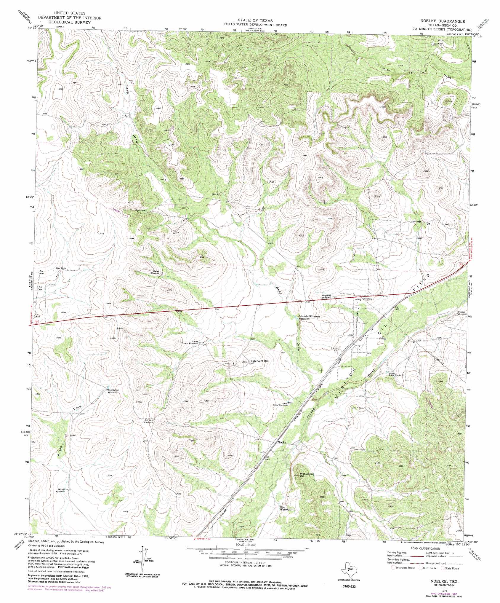
Noelke Topo Map Texas
To zoom in, hover over the map of Noelke
USGS Topo Quad 31100b8 - 1:24,000 scale
| Topo Map Name: | Noelke |
| USGS Topo Quad ID: | 31100b8 |
| Print Size: | ca. 21 1/4" wide x 27" high |
| Southeast Coordinates: | 31.125° N latitude / 100.875° W longitude |
| Map Center Coordinates: | 31.1875° N latitude / 100.9375° W longitude |
| U.S. State: | TX |
| Filename: | o31100b8.jpg |
| Download Map JPG Image: | Noelke topo map 1:24,000 scale |
| Map Type: | Topographic |
| Topo Series: | 7.5´ |
| Map Scale: | 1:24,000 |
| Source of Map Images: | United States Geological Survey (USGS) |
| Alternate Map Versions: |
Noelke TX 1971, updated 1974 Download PDF Buy paper map Noelke TX 1971, updated 1988 Download PDF Buy paper map Noelke TX 2010 Download PDF Buy paper map Noelke TX 2012 Download PDF Buy paper map Noelke TX 2016 Download PDF Buy paper map |
1:24,000 Topo Quads surrounding Noelke
Causey Draw |
Bradford Draw |
Wallace Draw |
Arden |
Knickerbocker Nw |
Rocker B Ranch |
Ketchum Mountain |
Mertzon Sw |
Mertzon |
Tankersley |
Barnhart |
Barnhart Ne |
Noelke |
Noelke Ne |
Hulldale Nw |
Barnhart Sw |
Suggs |
Noelke Sw |
Noelke Se |
Hulldale Sw |
Double Mill Draw Nw |
Double Mill Draw Ne |
Oglesby Ranch |
Moore Ranch |
Eldorado Nw |
> Back to 31100a1 at 1:100,000 scale
> Back to 31100a1 at 1:250,000 scale
> Back to U.S. Topo Maps home
Noelke topo map: Gazetteer
Noelke: Lakes
Clay Waterhole elevation 713m 2339′Jehovahs Witnesses Waterhole elevation 720m 2362′
Noelke: Oilfields
Mertzon Oil Field elevation 700m 2296′Noelke: Populated Places
Noelke elevation 712m 2335′Noelke: Summits
High Point Hill elevation 739m 2424′Monument Hill elevation 750m 2460′
Noelke: Valleys
Seep Draw elevation 701m 2299′Noelke digital topo map on disk
Buy this Noelke topo map showing relief, roads, GPS coordinates and other geographical features, as a high-resolution digital map file on DVD: