Mertzon Topo Map Texas
To zoom in, hover over the map of Mertzon
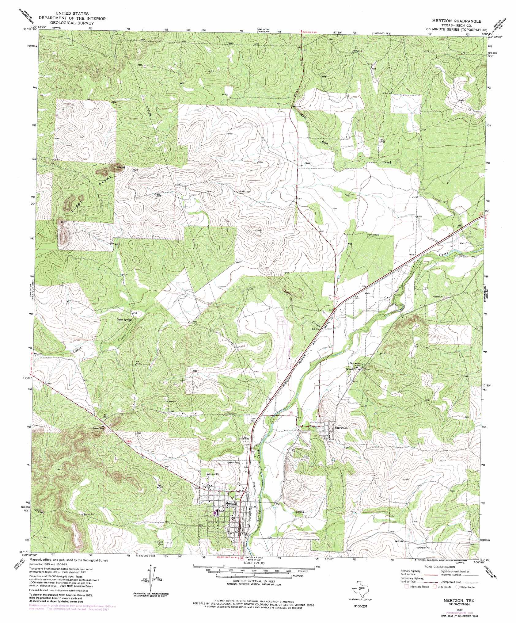
USGS Topo Quad 31100c7 - 1:24,000 scale
| Topo Map Name: | Mertzon |
| USGS Topo Quad ID: | 31100c7 |
| Print Size: | ca. 21 1/4" wide x 27" high |
| Southeast Coordinates: | 31.25° N latitude / 100.75° W longitude |
| Map Center Coordinates: | 31.3125° N latitude / 100.8125° W longitude |
| U.S. State: | TX |
| Filename: | o31100c7.jpg |
| Download Map JPG Image: | Mertzon topo map 1:24,000 scale |
| Map Type: | Topographic |
| Topo Series: | 7.5´ |
| Map Scale: | 1:24,000 |
| Source of Map Images: | United States Geological Survey (USGS) |
| Alternate Map Versions: |
Mertzon TX 1972, updated 1974 Download PDF Buy paper map Mertzon TX 1972, updated 1988 Download PDF Buy paper map Mertzon TX 2010 Download PDF Buy paper map Mertzon TX 2013 Download PDF Buy paper map Mertzon TX 2016 Download PDF Buy paper map |
1:24,000 Topo Quads surrounding Mertzon
Coon Dive Draw |
Dog Creek Sw |
Dog Creek |
Carlsbad |
Mount Nebo |
Bradford Draw |
Wallace Draw |
Arden |
Knickerbocker Nw |
Twin Buttes |
Ketchum Mountain |
Mertzon Sw |
Mertzon |
Tankersley |
Knickerbocker |
Barnhart Ne |
Noelke |
Noelke Ne |
Hulldale Nw |
Cold Creek Spring |
Suggs |
Noelke Sw |
Noelke Se |
Hulldale Sw |
Hulldale |
> Back to 31100a1 at 1:100,000 scale
> Back to 31100a1 at 1:250,000 scale
> Back to U.S. Topo Maps home
Mertzon topo map: Gazetteer
Mertzon: Populated Places
Mertzon elevation 671m 2201′Sherwood elevation 662m 2171′
Mertzon: Springs
Lopez Spring elevation 683m 2240′Mertzon: Streams
Lopez Creek elevation 639m 2096′Mertzon: Summits
Lopez Peaks elevation 781m 2562′Mertzon digital topo map on disk
Buy this Mertzon topo map showing relief, roads, GPS coordinates and other geographical features, as a high-resolution digital map file on DVD: