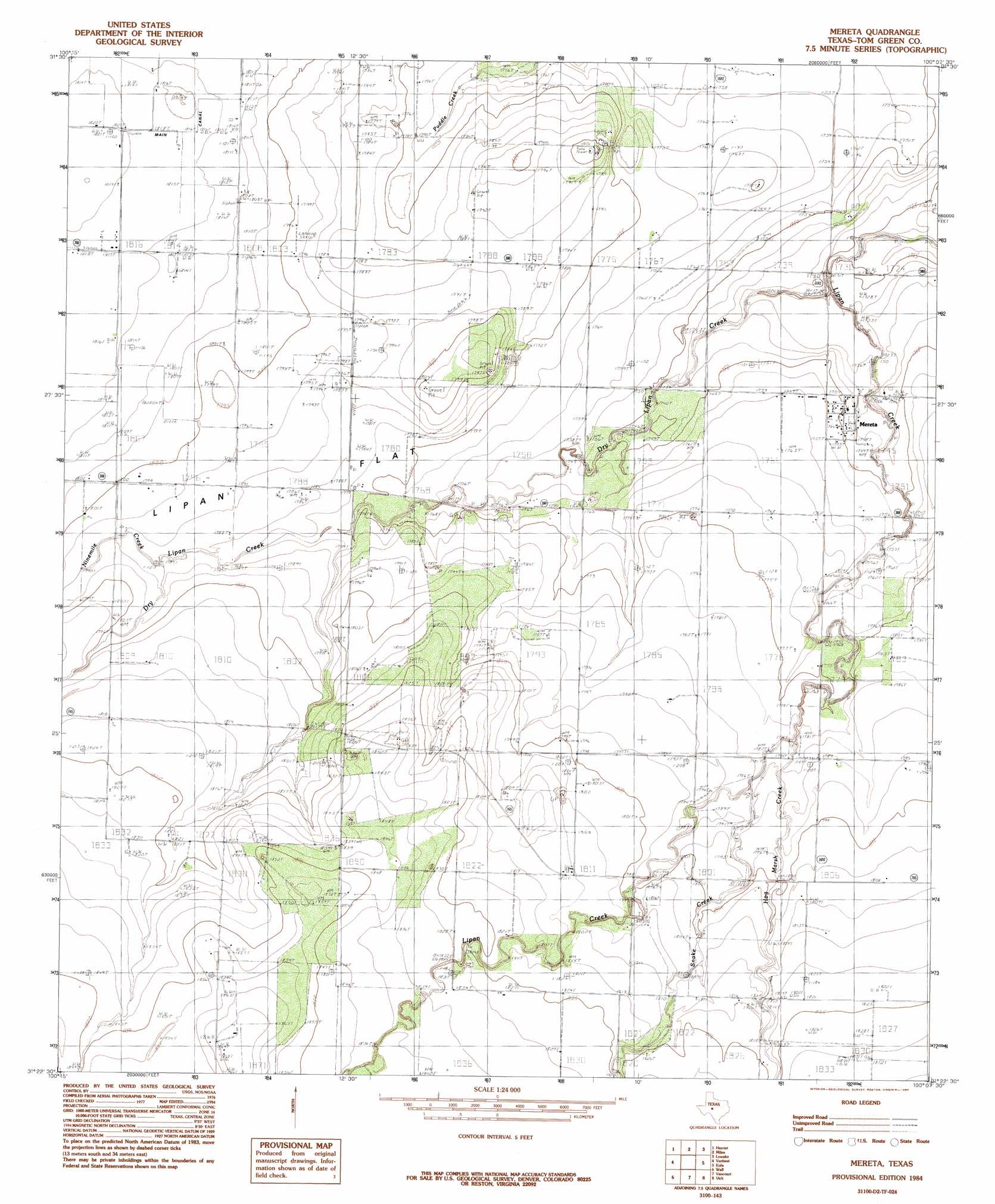
Mereta Topo Map Texas
To zoom in, hover over the map of Mereta
USGS Topo Quad 31100d2 - 1:24,000 scale
| Topo Map Name: | Mereta |
| USGS Topo Quad ID: | 31100d2 |
| Print Size: | ca. 21 1/4" wide x 27" high |
| Southeast Coordinates: | 31.375° N latitude / 100.125° W longitude |
| Map Center Coordinates: | 31.4375° N latitude / 100.1875° W longitude |
| U.S. State: | TX |
| Filename: | o31100d2.jpg |
| Download Map JPG Image: | Mereta topo map 1:24,000 scale |
| Map Type: | Topographic |
| Topo Series: | 7.5´ |
| Map Scale: | 1:24,000 |
| Source of Map Images: | United States Geological Survey (USGS) |
| Alternate Map Versions: |
Mereta TX 1984, updated 1984 Download PDF Buy paper map Mereta TX 2010 Download PDF Buy paper map Mereta TX 2012 Download PDF Buy paper map Mereta TX 2016 Download PDF Buy paper map |
1:24,000 Topo Quads surrounding Mereta
Pecan Mott |
Tennyson |
Miles Nw |
Rowena |
Ballinger |
San Angelo North |
Harriet |
Miles |
Lowake |
Paint Rock |
San Angelo South |
Veribest |
Mereta |
Eola |
Millersview Nw |
Pecan Station |
Wall |
Vancourt |
Vick |
Millersview Sw |
Christoval |
Susan Peak |
Kickapoo Spring |
Burr Oak Creek |
Live Oak |
> Back to 31100a1 at 1:100,000 scale
> Back to 31100a1 at 1:250,000 scale
> Back to U.S. Topo Maps home
Mereta topo map: Gazetteer
Mereta: Populated Places
Mereta elevation 535m 1755′Mereta: Streams
Dry Lipan Creek elevation 525m 1722′Hog Marsh Creek elevation 543m 1781′
Ninemile Creek elevation 544m 1784′
Snake Creek elevation 543m 1781′
Mereta digital topo map on disk
Buy this Mereta topo map showing relief, roads, GPS coordinates and other geographical features, as a high-resolution digital map file on DVD: