Mount Nebo Topo Map Texas
To zoom in, hover over the map of Mount Nebo
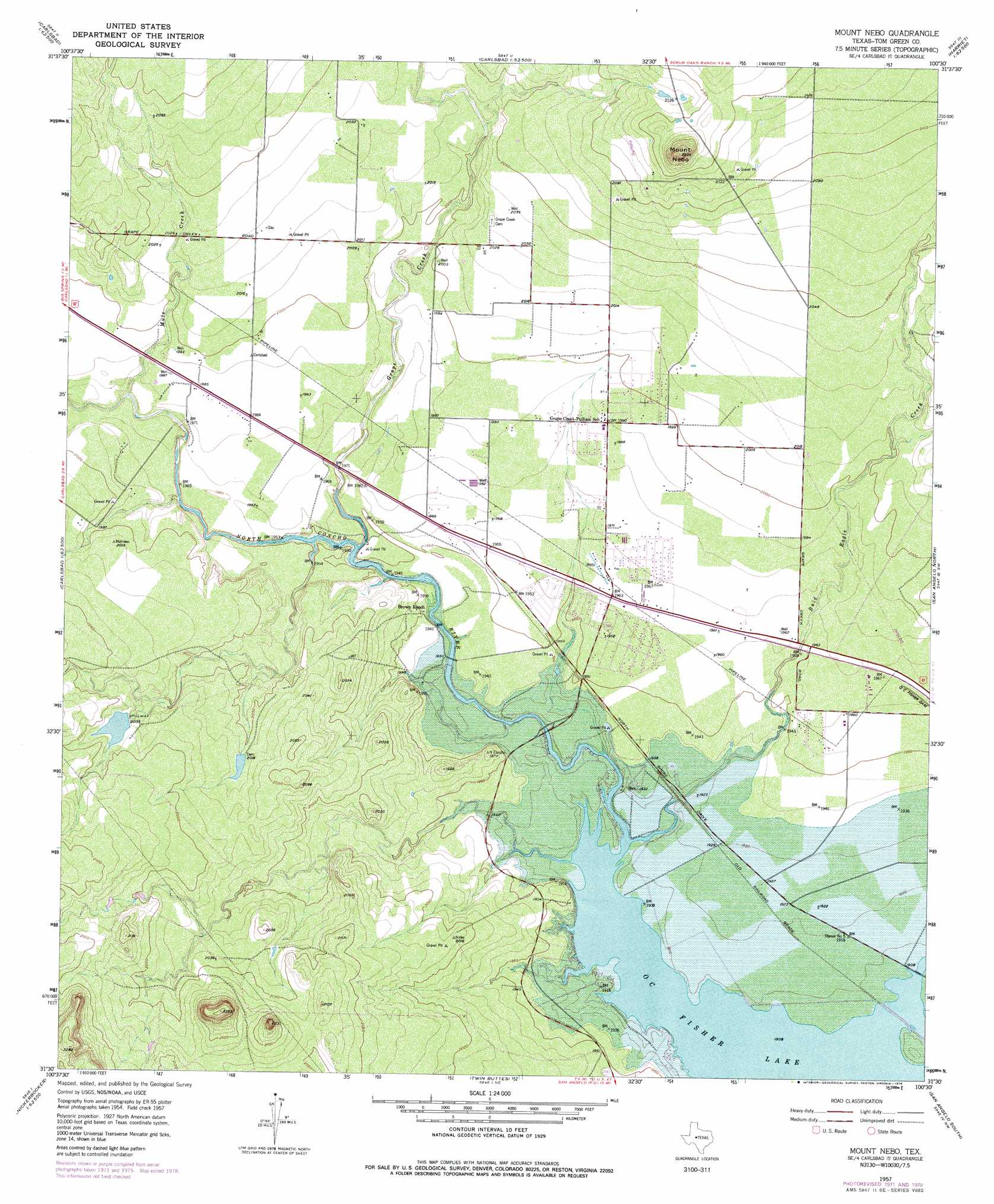
USGS Topo Quad 31100e5 - 1:24,000 scale
| Topo Map Name: | Mount Nebo |
| USGS Topo Quad ID: | 31100e5 |
| Print Size: | ca. 21 1/4" wide x 27" high |
| Southeast Coordinates: | 31.5° N latitude / 100.5° W longitude |
| Map Center Coordinates: | 31.5625° N latitude / 100.5625° W longitude |
| U.S. State: | TX |
| Filename: | o31100e5.jpg |
| Download Map JPG Image: | Mount Nebo topo map 1:24,000 scale |
| Map Type: | Topographic |
| Topo Series: | 7.5´ |
| Map Scale: | 1:24,000 |
| Source of Map Images: | United States Geological Survey (USGS) |
| Alternate Map Versions: |
Mount Nebo TX 1957, updated 1958 Download PDF Buy paper map Mount Nebo TX 1957, updated 1973 Download PDF Buy paper map Mount Nebo TX 1957, updated 1978 Download PDF Buy paper map Mount Nebo TX 2010 Download PDF Buy paper map Mount Nebo TX 2012 Download PDF Buy paper map Mount Nebo TX 2016 Download PDF Buy paper map |
1:24,000 Topo Quads surrounding Mount Nebo
Broome |
Divide |
Millican Mountains |
Cement Mountain |
Shawville |
Dog Creek Ne |
Water Valley |
Murph Draw |
Pecan Mott |
Tennyson |
Dog Creek |
Carlsbad |
Mount Nebo |
San Angelo North |
Harriet |
Arden |
Knickerbocker Nw |
Twin Buttes |
San Angelo South |
Veribest |
Mertzon |
Tankersley |
Knickerbocker |
Pecan Station |
Wall |
> Back to 31100e1 at 1:100,000 scale
> Back to 31100a1 at 1:250,000 scale
> Back to U.S. Topo Maps home
Mount Nebo topo map: Gazetteer
Mount Nebo: Dams
Kenneth Brown Reservoir Dam elevation 616m 2020′Mount Nebo: Parks
San Angelo State Park - North Shore elevation 585m 1919′Mount Nebo: Populated Places
Grape Creek elevation 606m 1988′Mount Nebo: Reservoirs
Kenneth Brown Reservoir elevation 616m 2020′Mount Nebo: Streams
Bald Eagle Creek elevation 582m 1909′Grape Creek elevation 589m 1932′
Mule Creek elevation 597m 1958′
Mount Nebo: Summits
Mount Nebo elevation 710m 2329′Mount Nebo digital topo map on disk
Buy this Mount Nebo topo map showing relief, roads, GPS coordinates and other geographical features, as a high-resolution digital map file on DVD: