Carlsbad Topo Map Texas
To zoom in, hover over the map of Carlsbad
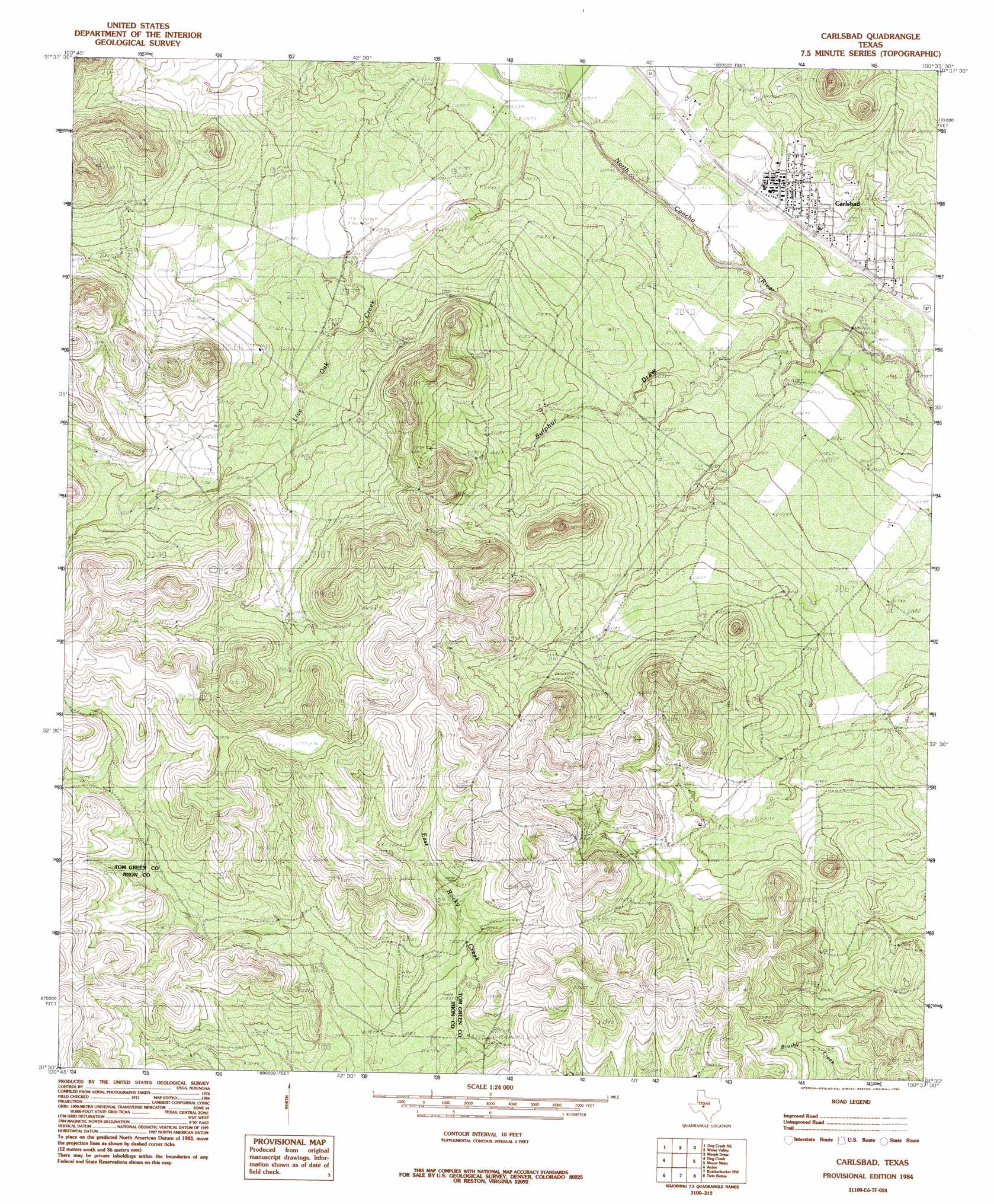
USGS Topo Quad 31100e6 - 1:24,000 scale
| Topo Map Name: | Carlsbad |
| USGS Topo Quad ID: | 31100e6 |
| Print Size: | ca. 21 1/4" wide x 27" high |
| Southeast Coordinates: | 31.5° N latitude / 100.625° W longitude |
| Map Center Coordinates: | 31.5625° N latitude / 100.6875° W longitude |
| U.S. State: | TX |
| Filename: | o31100e6.jpg |
| Download Map JPG Image: | Carlsbad topo map 1:24,000 scale |
| Map Type: | Topographic |
| Topo Series: | 7.5´ |
| Map Scale: | 1:24,000 |
| Source of Map Images: | United States Geological Survey (USGS) |
| Alternate Map Versions: |
Carlsbad TX 1984, updated 1984 Download PDF Buy paper map Carlsbad TX 2010 Download PDF Buy paper map Carlsbad TX 2012 Download PDF Buy paper map Carlsbad TX 2016 Download PDF Buy paper map |
1:24,000 Topo Quads surrounding Carlsbad
Sterling City |
Broome |
Divide |
Millican Mountains |
Cement Mountain |
Dog Creek Nw |
Dog Creek Ne |
Water Valley |
Murph Draw |
Pecan Mott |
Dog Creek Sw |
Dog Creek |
Carlsbad |
Mount Nebo |
San Angelo North |
Wallace Draw |
Arden |
Knickerbocker Nw |
Twin Buttes |
San Angelo South |
Mertzon Sw |
Mertzon |
Tankersley |
Knickerbocker |
Pecan Station |
> Back to 31100e1 at 1:100,000 scale
> Back to 31100a1 at 1:250,000 scale
> Back to U.S. Topo Maps home
Carlsbad topo map: Gazetteer
Carlsbad: Populated Places
Carlsbad elevation 617m 2024′Carlsbad: Streams
Live Oak Creek elevation 613m 2011′Sulpher Draw elevation 602m 1975′
Carlsbad digital topo map on disk
Buy this Carlsbad topo map showing relief, roads, GPS coordinates and other geographical features, as a high-resolution digital map file on DVD: