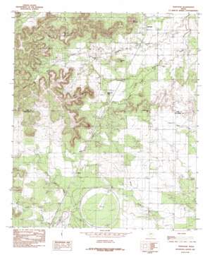
Tennyson Topo Map Texas
To zoom in, hover over the map of Tennyson
USGS Topo Quad 31100f3 - 1:24,000 scale
| Topo Map Name: | Tennyson |
| USGS Topo Quad ID: | 31100f3 |
| Print Size: | ca. 21 1/4" wide x 27" high |
| Southeast Coordinates: | 31.625° N latitude / 100.25° W longitude |
| Map Center Coordinates: | 31.6875° N latitude / 100.3125° W longitude |
| U.S. State: | TX |
| Filename: | o31100f3.jpg |
| Download Map JPG Image: | Tennyson topo map 1:24,000 scale |
| Map Type: | Topographic |
| Topo Series: | 7.5´ |
| Map Scale: | 1:24,000 |
| Source of Map Images: | United States Geological Survey (USGS) |
| Alternate Map Versions: |
Tennyson TX 1984, updated 1984 Download PDF Buy paper map Tennyson TX 2010 Download PDF Buy paper map Tennyson TX 2012 Download PDF Buy paper map Tennyson TX 2016 Download PDF Buy paper map |
1:24,000 Topo Quads surrounding Tennyson
> Back to 31100e1 at 1:100,000 scale
> Back to 31100a1 at 1:250,000 scale
> Back to U.S. Topo Maps home
Tennyson topo map: Gazetteer
Tennyson: Populated Places
Orient elevation 619m 2030′Tennyson elevation 574m 1883′
Tennyson: Springs
Hidden Spring elevation 623m 2043′Tennyson: Streams
Cedar Creek elevation 564m 1850′Tennyson: Summits
Brooks Hill elevation 610m 2001′Buttermilk Hill elevation 602m 1975′
Deadman Hill elevation 614m 2014′
Gobbler Hill elevation 616m 2020′
Kiser Mountain elevation 713m 2339′
Mount Margaret elevation 660m 2165′
Tennyson digital topo map on disk
Buy this Tennyson topo map showing relief, roads, GPS coordinates and other geographical features, as a high-resolution digital map file on DVD:


