Pecan Mott Topo Map Texas
To zoom in, hover over the map of Pecan Mott
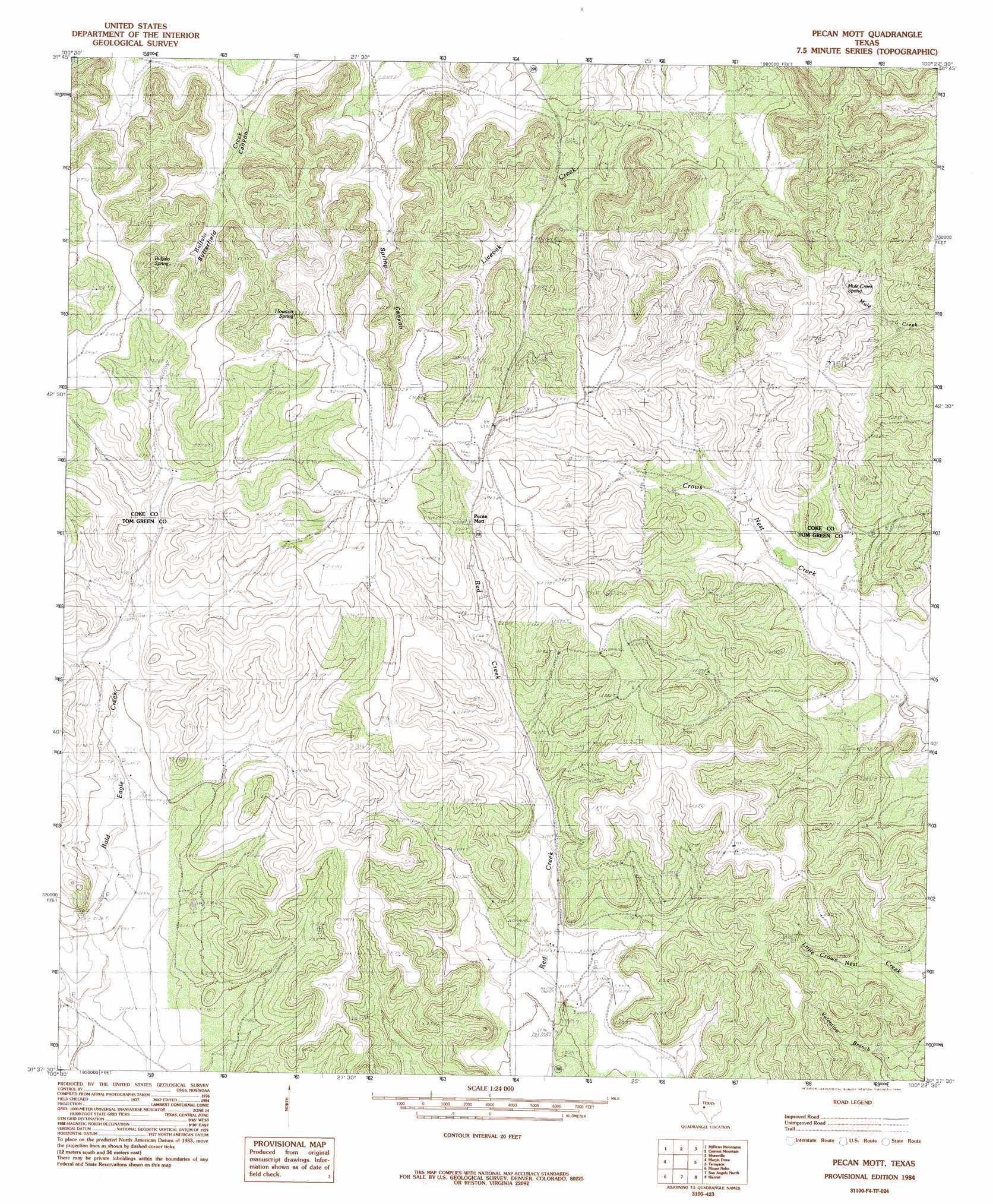
USGS Topo Quad 31100f4 - 1:24,000 scale
| Topo Map Name: | Pecan Mott |
| USGS Topo Quad ID: | 31100f4 |
| Print Size: | ca. 21 1/4" wide x 27" high |
| Southeast Coordinates: | 31.625° N latitude / 100.375° W longitude |
| Map Center Coordinates: | 31.6875° N latitude / 100.4375° W longitude |
| U.S. State: | TX |
| Filename: | o31100f4.jpg |
| Download Map JPG Image: | Pecan Mott topo map 1:24,000 scale |
| Map Type: | Topographic |
| Topo Series: | 7.5´ |
| Map Scale: | 1:24,000 |
| Source of Map Images: | United States Geological Survey (USGS) |
| Alternate Map Versions: |
Pecan Mott TX 1984, updated 1984 Download PDF Buy paper map Pecan Mott TX 2010 Download PDF Buy paper map Pecan Mott TX 2012 Download PDF Buy paper map Pecan Mott TX 2016 Download PDF Buy paper map |
1:24,000 Topo Quads surrounding Pecan Mott
Green Mountain |
Edith |
Robert Lee |
Bronte |
Hog Mountain |
Divide |
Millican Mountains |
Cement Mountain |
Shawville |
Maverick |
Water Valley |
Murph Draw |
Pecan Mott |
Tennyson |
Miles Nw |
Carlsbad |
Mount Nebo |
San Angelo North |
Harriet |
Miles |
Knickerbocker Nw |
Twin Buttes |
San Angelo South |
Veribest |
Mereta |
> Back to 31100e1 at 1:100,000 scale
> Back to 31100a1 at 1:250,000 scale
> Back to U.S. Topo Maps home
Pecan Mott topo map: Gazetteer
Pecan Mott: Populated Places
Pecan Mott elevation 713m 2339′Pecan Mott: Springs
Buffalo Spring elevation 708m 2322′Houston Springs elevation 695m 2280′
Mule Creek Spring elevation 697m 2286′
Pecan Mott: Valleys
Butterfield Canyon elevation 635m 2083′Spring Canyon elevation 626m 2053′
Pecan Mott digital topo map on disk
Buy this Pecan Mott topo map showing relief, roads, GPS coordinates and other geographical features, as a high-resolution digital map file on DVD: