Dog Creek Nw Topo Map Texas
To zoom in, hover over the map of Dog Creek Nw
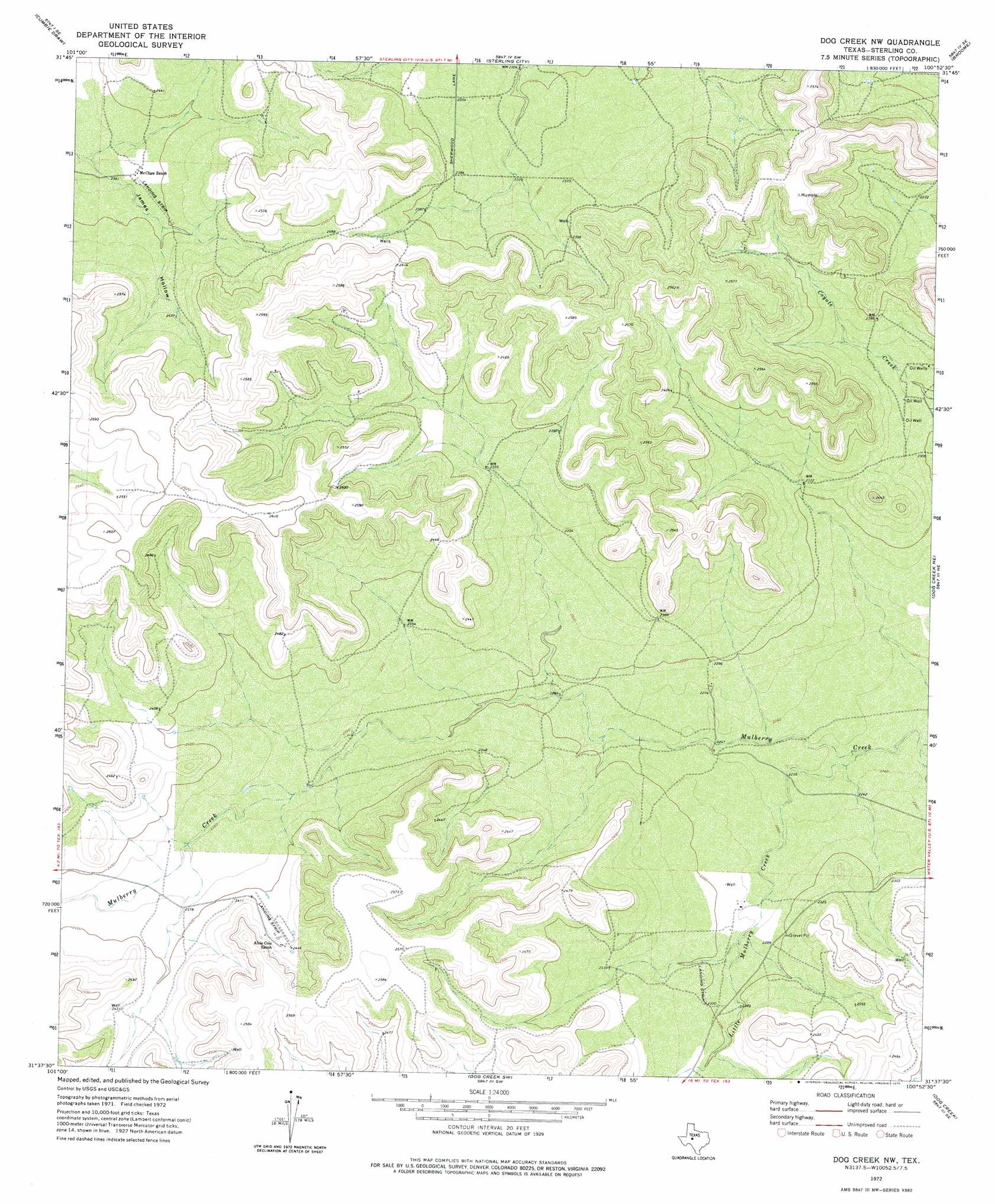
USGS Topo Quad 31100f8 - 1:24,000 scale
| Topo Map Name: | Dog Creek Nw |
| USGS Topo Quad ID: | 31100f8 |
| Print Size: | ca. 21 1/4" wide x 27" high |
| Southeast Coordinates: | 31.625° N latitude / 100.875° W longitude |
| Map Center Coordinates: | 31.6875° N latitude / 100.9375° W longitude |
| U.S. State: | TX |
| Filename: | o31100f8.jpg |
| Download Map JPG Image: | Dog Creek Nw topo map 1:24,000 scale |
| Map Type: | Topographic |
| Topo Series: | 7.5´ |
| Map Scale: | 1:24,000 |
| Source of Map Images: | United States Geological Survey (USGS) |
| Alternate Map Versions: |
Dog Creek NW TX 1972, updated 1975 Download PDF Buy paper map Dog Creek NW TX 2010 Download PDF Buy paper map Dog Creek NW TX 2012 Download PDF Buy paper map Dog Creek NW TX 2016 Download PDF Buy paper map |
1:24,000 Topo Quads surrounding Dog Creek Nw
Sand Bluff Draw |
Cumbie Draw Ne |
Sterling City Nw |
Crawford Slide |
Green Mountain |
Glass Ranch |
Cumbie Draw |
Sterling City |
Broome |
Divide |
Coon Dive Draw Nw |
Dripping Springs Draw |
Dog Creek Nw |
Dog Creek Ne |
Water Valley |
Hay Hollow |
Coon Dive Draw |
Dog Creek Sw |
Dog Creek |
Carlsbad |
Causey Draw |
Bradford Draw |
Wallace Draw |
Arden |
Knickerbocker Nw |
> Back to 31100e1 at 1:100,000 scale
> Back to 31100a1 at 1:250,000 scale
> Back to U.S. Topo Maps home
Dog Creek Nw topo map: Gazetteer
Dog Creek Nw: Airports
Alvie Cole Ranch Airport elevation 737m 2417′Dog Creek Nw: Streams
Little Mulberry Creek elevation 677m 2221′Dog Creek Nw digital topo map on disk
Buy this Dog Creek Nw topo map showing relief, roads, GPS coordinates and other geographical features, as a high-resolution digital map file on DVD: