Cement Mountain Topo Map Texas
To zoom in, hover over the map of Cement Mountain
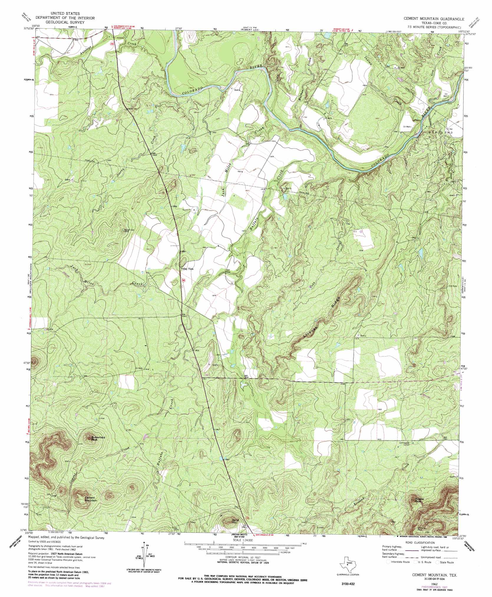
USGS Topo Quad 31100g4 - 1:24,000 scale
| Topo Map Name: | Cement Mountain |
| USGS Topo Quad ID: | 31100g4 |
| Print Size: | ca. 21 1/4" wide x 27" high |
| Southeast Coordinates: | 31.75° N latitude / 100.375° W longitude |
| Map Center Coordinates: | 31.8125° N latitude / 100.4375° W longitude |
| U.S. State: | TX |
| Filename: | o31100g4.jpg |
| Download Map JPG Image: | Cement Mountain topo map 1:24,000 scale |
| Map Type: | Topographic |
| Topo Series: | 7.5´ |
| Map Scale: | 1:24,000 |
| Source of Map Images: | United States Geological Survey (USGS) |
| Alternate Map Versions: |
Cement Mountain TX 1962, updated 1964 Download PDF Buy paper map Cement Mountain TX 1962, updated 1981 Download PDF Buy paper map Cement Mountain TX 1962, updated 1988 Download PDF Buy paper map Cement Mountain TX 2010 Download PDF Buy paper map Cement Mountain TX 2012 Download PDF Buy paper map Cement Mountain TX 2016 Download PDF Buy paper map |
1:24,000 Topo Quads surrounding Cement Mountain
Silver |
Sanco |
Blackwell Sw |
Blackwell |
Church Peak |
Green Mountain |
Edith |
Robert Lee |
Bronte |
Hog Mountain |
Divide |
Millican Mountains |
Cement Mountain |
Shawville |
Maverick |
Water Valley |
Murph Draw |
Pecan Mott |
Tennyson |
Miles Nw |
Carlsbad |
Mount Nebo |
San Angelo North |
Harriet |
Miles |
> Back to 31100e1 at 1:100,000 scale
> Back to 31100a1 at 1:250,000 scale
> Back to U.S. Topo Maps home
Cement Mountain topo map: Gazetteer
Cement Mountain: Oilfields
Wendland Oil Field elevation 557m 1827′Cement Mountain: Ridges
Liveoak Ridge elevation 611m 2004′Cement Mountain: Streams
Antelope Creek elevation 540m 1771′Buffalo Creek elevation 533m 1748′
Cement Creek elevation 595m 1952′
Cobb Creek elevation 536m 1758′
Cow Creek elevation 530m 1738′
Indian Creek elevation 533m 1748′
Jack Miles Creek elevation 534m 1751′
Machae Creek elevation 531m 1742′
Storey Creek elevation 539m 1768′
Cement Mountain: Summits
Butterfield Peak elevation 690m 2263′Cement Mountain elevation 709m 2326′
Little Round Mountain elevation 703m 2306′
Nipple Peak elevation 673m 2208′
Sand Hill elevation 690m 2263′
Cement Mountain digital topo map on disk
Buy this Cement Mountain topo map showing relief, roads, GPS coordinates and other geographical features, as a high-resolution digital map file on DVD: