Green Mountain Topo Map Texas
To zoom in, hover over the map of Green Mountain
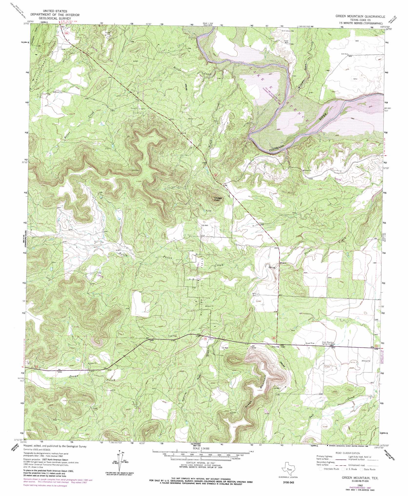
USGS Topo Quad 31100h6 - 1:24,000 scale
| Topo Map Name: | Green Mountain |
| USGS Topo Quad ID: | 31100h6 |
| Print Size: | ca. 21 1/4" wide x 27" high |
| Southeast Coordinates: | 31.875° N latitude / 100.625° W longitude |
| Map Center Coordinates: | 31.9375° N latitude / 100.6875° W longitude |
| U.S. State: | TX |
| Filename: | o31100h6.jpg |
| Download Map JPG Image: | Green Mountain topo map 1:24,000 scale |
| Map Type: | Topographic |
| Topo Series: | 7.5´ |
| Map Scale: | 1:24,000 |
| Source of Map Images: | United States Geological Survey (USGS) |
| Alternate Map Versions: |
Green Mountain TX 1962, updated 1964 Download PDF Buy paper map Green Mountain TX 1962, updated 1968 Download PDF Buy paper map Green Mountain TX 1962, updated 1988 Download PDF Buy paper map Green Mountain TX 2010 Download PDF Buy paper map Green Mountain TX 2013 Download PDF Buy paper map Green Mountain TX 2016 Download PDF Buy paper map |
1:24,000 Topo Quads surrounding Green Mountain
Spade Ranch |
Pecan Crossing |
Dam Draw |
Dew Drop Creek |
Maryneal |
Mcwhorter Mountain |
Dead Indian Mountain |
Silver |
Sanco |
Blackwell Sw |
Sterling City Nw |
Crawford Slide |
Green Mountain |
Edith |
Robert Lee |
Sterling City |
Broome |
Divide |
Millican Mountains |
Cement Mountain |
Dog Creek Nw |
Dog Creek Ne |
Water Valley |
Murph Draw |
Pecan Mott |
> Back to 31100e1 at 1:100,000 scale
> Back to 31100a1 at 1:250,000 scale
> Back to U.S. Topo Maps home
Green Mountain topo map: Gazetteer
Green Mountain: Oilfields
Lygay Oil Field elevation 596m 1955′Millican Oil Field elevation 650m 2132′
South Lygay Oil Field elevation 632m 2073′
Green Mountain: Streams
Bitter Creek elevation 579m 1899′North Pecan Creek elevation 610m 2001′
Pecan Creek elevation 581m 1906′
Rough Creek elevation 579m 1899′
Willmo Sand Creek elevation 579m 1899′
Green Mountain: Summits
Green Mountain elevation 778m 2552′Shaggy Peak elevation 747m 2450′
Green Mountain: Valleys
Natural Well Draw elevation 627m 2057′Green Mountain digital topo map on disk
Buy this Green Mountain topo map showing relief, roads, GPS coordinates and other geographical features, as a high-resolution digital map file on DVD: