Big Lake Se Topo Map Texas
To zoom in, hover over the map of Big Lake Se
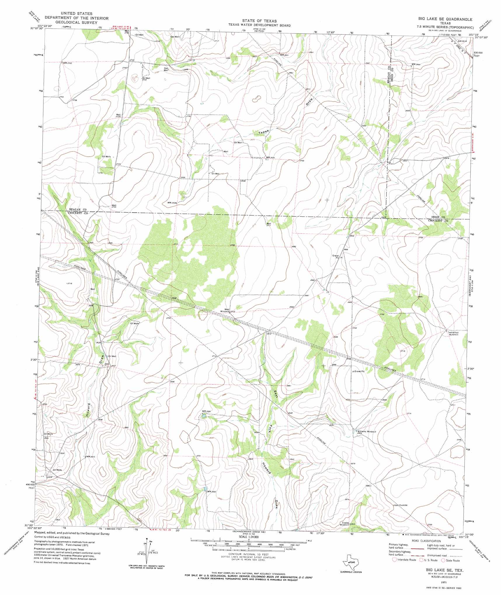
USGS Topo Quad 31101a3 - 1:24,000 scale
| Topo Map Name: | Big Lake Se |
| USGS Topo Quad ID: | 31101a3 |
| Print Size: | ca. 21 1/4" wide x 27" high |
| Southeast Coordinates: | 31° N latitude / 101.25° W longitude |
| Map Center Coordinates: | 31.0625° N latitude / 101.3125° W longitude |
| U.S. State: | TX |
| Filename: | o31101a3.jpg |
| Download Map JPG Image: | Big Lake Se topo map 1:24,000 scale |
| Map Type: | Topographic |
| Topo Series: | 7.5´ |
| Map Scale: | 1:24,000 |
| Source of Map Images: | United States Geological Survey (USGS) |
| Alternate Map Versions: |
Big Lake SE TX 1971, updated 1974 Download PDF Buy paper map Big Lake SE TX 2010 Download PDF Buy paper map Big Lake SE TX 2012 Download PDF Buy paper map Big Lake SE TX 2016 Download PDF Buy paper map |
1:24,000 Topo Quads surrounding Big Lake Se
Gardener Draw |
Divide Draw |
South Mustang Draw Se |
Rocker B Ranch |
Ketchum Mountain |
Best |
Big Lake |
Witco |
Barnhart |
Barnhart Ne |
Texon Se |
Big Lake Sw |
Big Lake Se |
Barnhart Sw |
Suggs |
Owens Creek Ne |
Schneeman Draw Nw |
Schneeman Draw Ne |
Double Mill Draw Nw |
Double Mill Draw Ne |
Owens Creek Se |
Schneeman Draw Sw |
Schneeman Draw Se |
Indio Hill |
Double Mill Draw Se |
> Back to 31101a1 at 1:100,000 scale
> Back to 31100a1 at 1:250,000 scale
> Back to U.S. Topo Maps home
No gazetteer data is available for the Big Lake Se topo map sheet.
Big Lake Se digital topo map on disk
Buy this Big Lake Se topo map showing relief, roads, GPS coordinates and other geographical features, as a high-resolution digital map file on DVD: