Cedar Canyon Topo Map Texas
To zoom in, hover over the map of Cedar Canyon
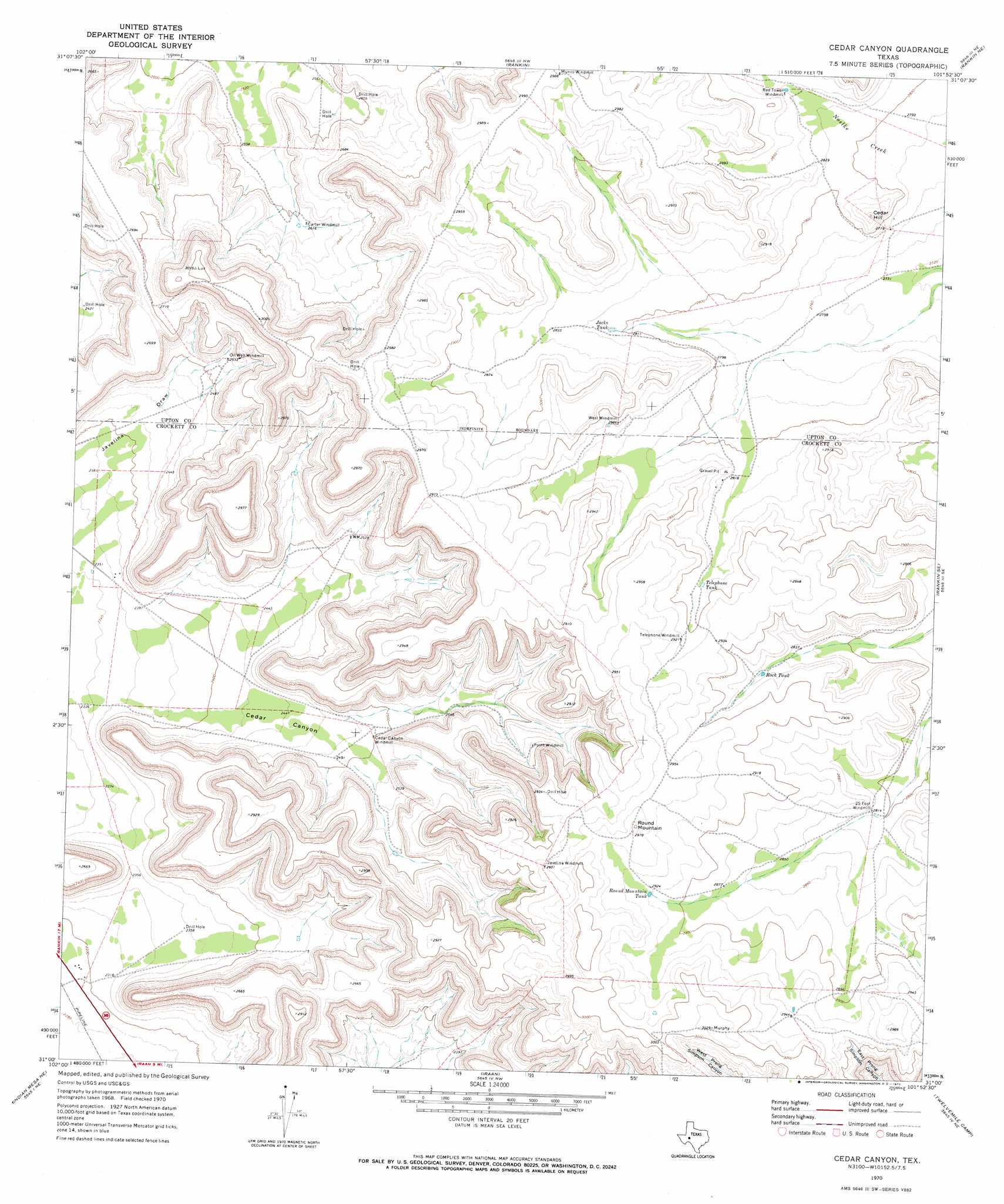
USGS Topo Quad 31101a8 - 1:24,000 scale
| Topo Map Name: | Cedar Canyon |
| USGS Topo Quad ID: | 31101a8 |
| Print Size: | ca. 21 1/4" wide x 27" high |
| Southeast Coordinates: | 31° N latitude / 101.875° W longitude |
| Map Center Coordinates: | 31.0625° N latitude / 101.9375° W longitude |
| U.S. State: | TX |
| Filename: | o31101a8.jpg |
| Download Map JPG Image: | Cedar Canyon topo map 1:24,000 scale |
| Map Type: | Topographic |
| Topo Series: | 7.5´ |
| Map Scale: | 1:24,000 |
| Source of Map Images: | United States Geological Survey (USGS) |
| Alternate Map Versions: |
Cedar Canyon TX 1970, updated 1973 Download PDF Buy paper map Cedar Canyon TX 2010 Download PDF Buy paper map Cedar Canyon TX 2012 Download PDF Buy paper map Cedar Canyon TX 2016 Download PDF Buy paper map |
1:24,000 Topo Quads surrounding Cedar Canyon
Marlboro Canyon |
Marlboro Canyon Se |
Sevenmile Corner |
Sevenmile Corner Se |
Garrison Draw |
Mccamey North |
Square Top Mountain |
Rankin |
Rankin Ne |
Texon |
Mccamey South |
Table Top Mountain |
Cedar Canyon |
Rankin Se |
Lone Mountain |
Indian Mesa |
Indian Mesa Ne |
Iraan |
Twelvemile Camp |
Owens Creek Nw |
Sherbino Ranch |
Indian Mesa Se |
Divide Country |
Deer Canyon |
Owens Creek Sw |
> Back to 31101a1 at 1:100,000 scale
> Back to 31100a1 at 1:250,000 scale
> Back to U.S. Topo Maps home
Cedar Canyon topo map: Gazetteer
Cedar Canyon: Reservoirs
Jacks Tank elevation 857m 2811′Rock Tank elevation 871m 2857′
Round Mountain Tank elevation 891m 2923′
Telephone Tank elevation 878m 2880′
Cedar Canyon: Summits
Cedar Hill elevation 884m 2900′Round Mountain elevation 908m 2979′
Cedar Canyon: Valleys
Cedar Canyon elevation 713m 2339′Cedar Canyon digital topo map on disk
Buy this Cedar Canyon topo map showing relief, roads, GPS coordinates and other geographical features, as a high-resolution digital map file on DVD: