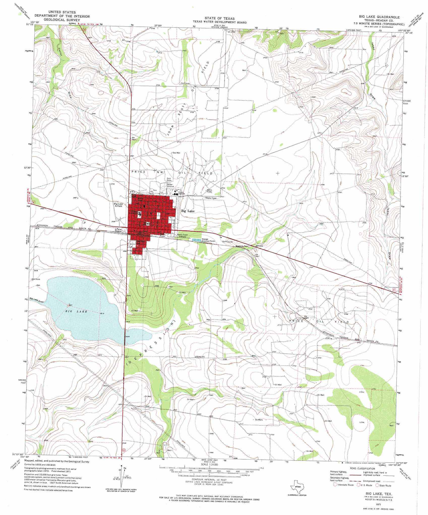
Big Lake Topo Map Texas
To zoom in, hover over the map of Big Lake
USGS Topo Quad 31101b4 - 1:24,000 scale
| Topo Map Name: | Big Lake |
| USGS Topo Quad ID: | 31101b4 |
| Print Size: | ca. 21 1/4" wide x 27" high |
| Southeast Coordinates: | 31.125° N latitude / 101.375° W longitude |
| Map Center Coordinates: | 31.1875° N latitude / 101.4375° W longitude |
| U.S. State: | TX |
| Filename: | o31101b4.jpg |
| Download Map JPG Image: | Big Lake topo map 1:24,000 scale |
| Map Type: | Topographic |
| Topo Series: | 7.5´ |
| Map Scale: | 1:24,000 |
| Source of Map Images: | United States Geological Survey (USGS) |
| Alternate Map Versions: |
Big Lake TX 1971, updated 1974 Download PDF Buy paper map Big Lake TX 2010 Download PDF Buy paper map Big Lake TX 2013 Download PDF Buy paper map Big Lake TX 2016 Download PDF Buy paper map |
1:24,000 Topo Quads surrounding Big Lake
Stiles Nw |
Stiles |
Moore Hill |
South Mustang Draw Ne |
Causey Draw |
Garrison Draw |
Gardener Draw |
Divide Draw |
South Mustang Draw Se |
Rocker B Ranch |
Texon |
Best |
Big Lake |
Witco |
Barnhart |
Lone Mountain |
Texon Se |
Big Lake Sw |
Big Lake Se |
Barnhart Sw |
Owens Creek Nw |
Owens Creek Ne |
Schneeman Draw Nw |
Schneeman Draw Ne |
Double Mill Draw Nw |
> Back to 31101a1 at 1:100,000 scale
> Back to 31100a1 at 1:250,000 scale
> Back to U.S. Topo Maps home
Big Lake topo map: Gazetteer
Big Lake: Airports
Reagan County Airport elevation 822m 2696′Big Lake: Lakes
Big Lake elevation 798m 2618′Big Lake: Oilfields
John Scott Oil Field elevation 833m 2732′Price Northwest Oil Field elevation 822m 2696′
Price Oil Field elevation 830m 2723′
Big Lake: Populated Places
Big Lake elevation 820m 2690′Big Lake: Valleys
Big Lake Draw elevation 798m 2618′Big Lake digital topo map on disk
Buy this Big Lake topo map showing relief, roads, GPS coordinates and other geographical features, as a high-resolution digital map file on DVD: