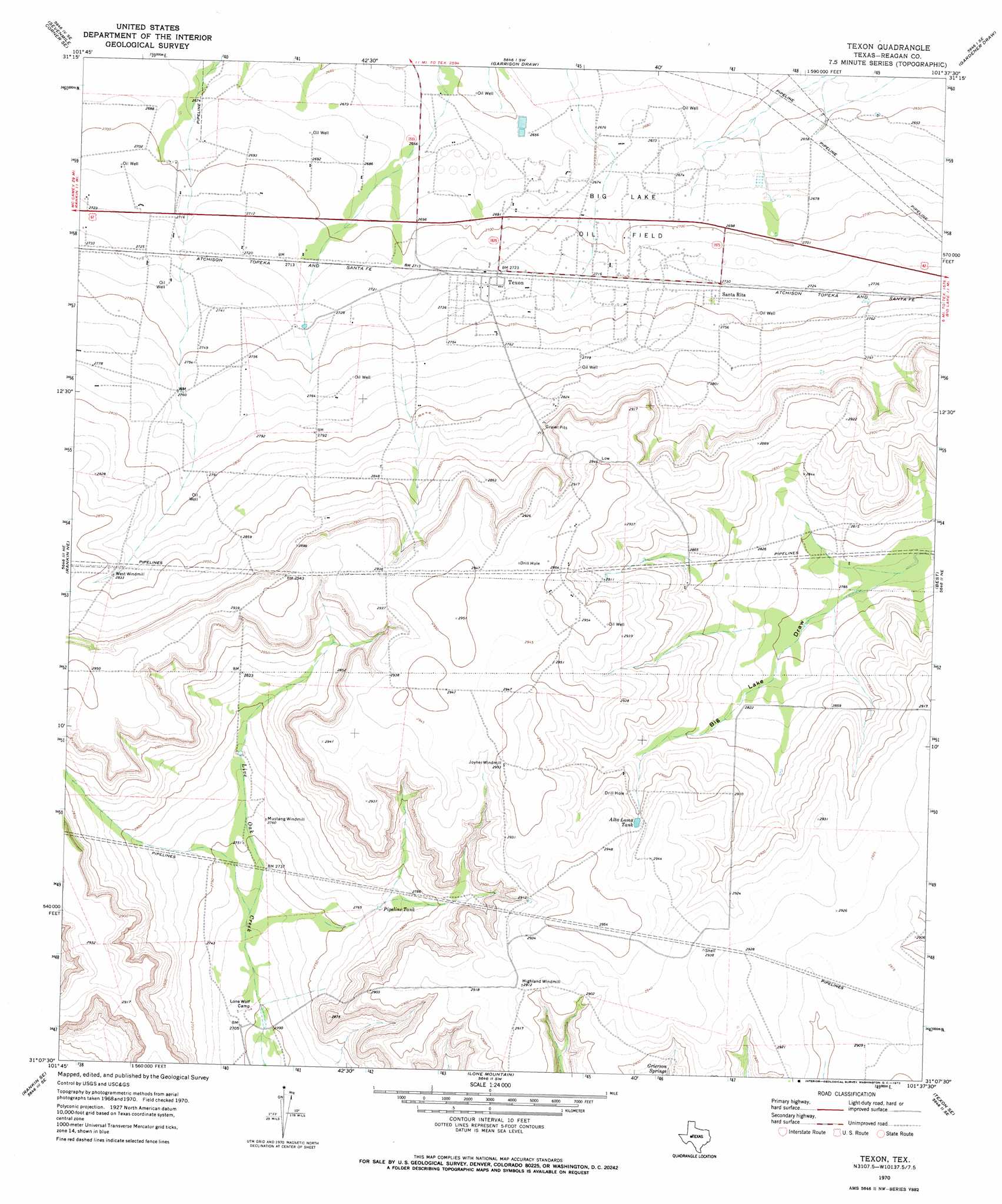
Texon Topo Map Texas
To zoom in, hover over the map of Texon
USGS Topo Quad 31101b6 - 1:24,000 scale
| Topo Map Name: | Texon |
| USGS Topo Quad ID: | 31101b6 |
| Print Size: | ca. 21 1/4" wide x 27" high |
| Southeast Coordinates: | 31.125° N latitude / 101.625° W longitude |
| Map Center Coordinates: | 31.1875° N latitude / 101.6875° W longitude |
| U.S. State: | TX |
| Filename: | o31101b6.jpg |
| Download Map JPG Image: | Texon topo map 1:24,000 scale |
| Map Type: | Topographic |
| Topo Series: | 7.5´ |
| Map Scale: | 1:24,000 |
| Source of Map Images: | United States Geological Survey (USGS) |
| Alternate Map Versions: |
Texon TX 1970, updated 1973 Download PDF Buy paper map Texon TX 2010 Download PDF Buy paper map Texon TX 2012 Download PDF Buy paper map Texon TX 2016 Download PDF Buy paper map |
1:24,000 Topo Quads surrounding Texon
Lindsey Ranch |
Sevenmile Corner Ne |
Stiles Nw |
Stiles |
Moore Hill |
Sevenmile Corner |
Sevenmile Corner Se |
Garrison Draw |
Gardener Draw |
Divide Draw |
Rankin |
Rankin Ne |
Texon |
Best |
Big Lake |
Cedar Canyon |
Rankin Se |
Lone Mountain |
Texon Se |
Big Lake Sw |
Iraan |
Twelvemile Camp |
Owens Creek Nw |
Owens Creek Ne |
Schneeman Draw Nw |
> Back to 31101a1 at 1:100,000 scale
> Back to 31100a1 at 1:250,000 scale
> Back to U.S. Topo Maps home
Texon topo map: Gazetteer
Texon: Oilfields
Big Lake Oil Field elevation 820m 2690′Texon: Populated Places
Santa Rita elevation 833m 2732′Texon elevation 830m 2723′
Texon: Reservoirs
Alta Loma Tank elevation 888m 2913′Pipeline Tank elevation 843m 2765′
Texon: Springs
Grierson Springs elevation 868m 2847′Texon digital topo map on disk
Buy this Texon topo map showing relief, roads, GPS coordinates and other geographical features, as a high-resolution digital map file on DVD: