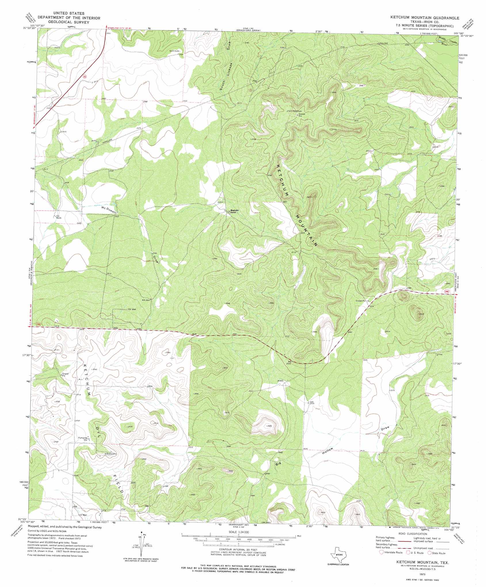
Ketchum Mountain Topo Map Texas
To zoom in, hover over the map of Ketchum Mountain
USGS Topo Quad 31101c1 - 1:24,000 scale
| Topo Map Name: | Ketchum Mountain |
| USGS Topo Quad ID: | 31101c1 |
| Print Size: | ca. 21 1/4" wide x 27" high |
| Southeast Coordinates: | 31.25° N latitude / 101° W longitude |
| Map Center Coordinates: | 31.3125° N latitude / 101.0625° W longitude |
| U.S. State: | TX |
| Filename: | o31101c1.jpg |
| Download Map JPG Image: | Ketchum Mountain topo map 1:24,000 scale |
| Map Type: | Topographic |
| Topo Series: | 7.5´ |
| Map Scale: | 1:24,000 |
| Source of Map Images: | United States Geological Survey (USGS) |
| Alternate Map Versions: |
Ketchum Mountain TX 1973, updated 1976 Download PDF Buy paper map Ketchum Mountain TX 2010 Download PDF Buy paper map Ketchum Mountain TX 2012 Download PDF Buy paper map Ketchum Mountain TX 2016 Download PDF Buy paper map |
1:24,000 Topo Quads surrounding Ketchum Mountain
Three Bluff Draw |
Hay Hollow |
Coon Dive Draw |
Dog Creek Sw |
Dog Creek |
South Mustang Draw Ne |
Causey Draw |
Bradford Draw |
Wallace Draw |
Arden |
South Mustang Draw Se |
Rocker B Ranch |
Ketchum Mountain |
Mertzon Sw |
Mertzon |
Witco |
Barnhart |
Barnhart Ne |
Noelke |
Noelke Ne |
Big Lake Se |
Barnhart Sw |
Suggs |
Noelke Sw |
Noelke Se |
> Back to 31101a1 at 1:100,000 scale
> Back to 31100a1 at 1:250,000 scale
> Back to U.S. Topo Maps home
Ketchum Mountain topo map: Gazetteer
Ketchum Mountain: Oilfields
Ketchum Oil Field elevation 835m 2739′Ketchum Mountain: Summits
Ketchum Mountain elevation 830m 2723′Ketchum Mountain digital topo map on disk
Buy this Ketchum Mountain topo map showing relief, roads, GPS coordinates and other geographical features, as a high-resolution digital map file on DVD: