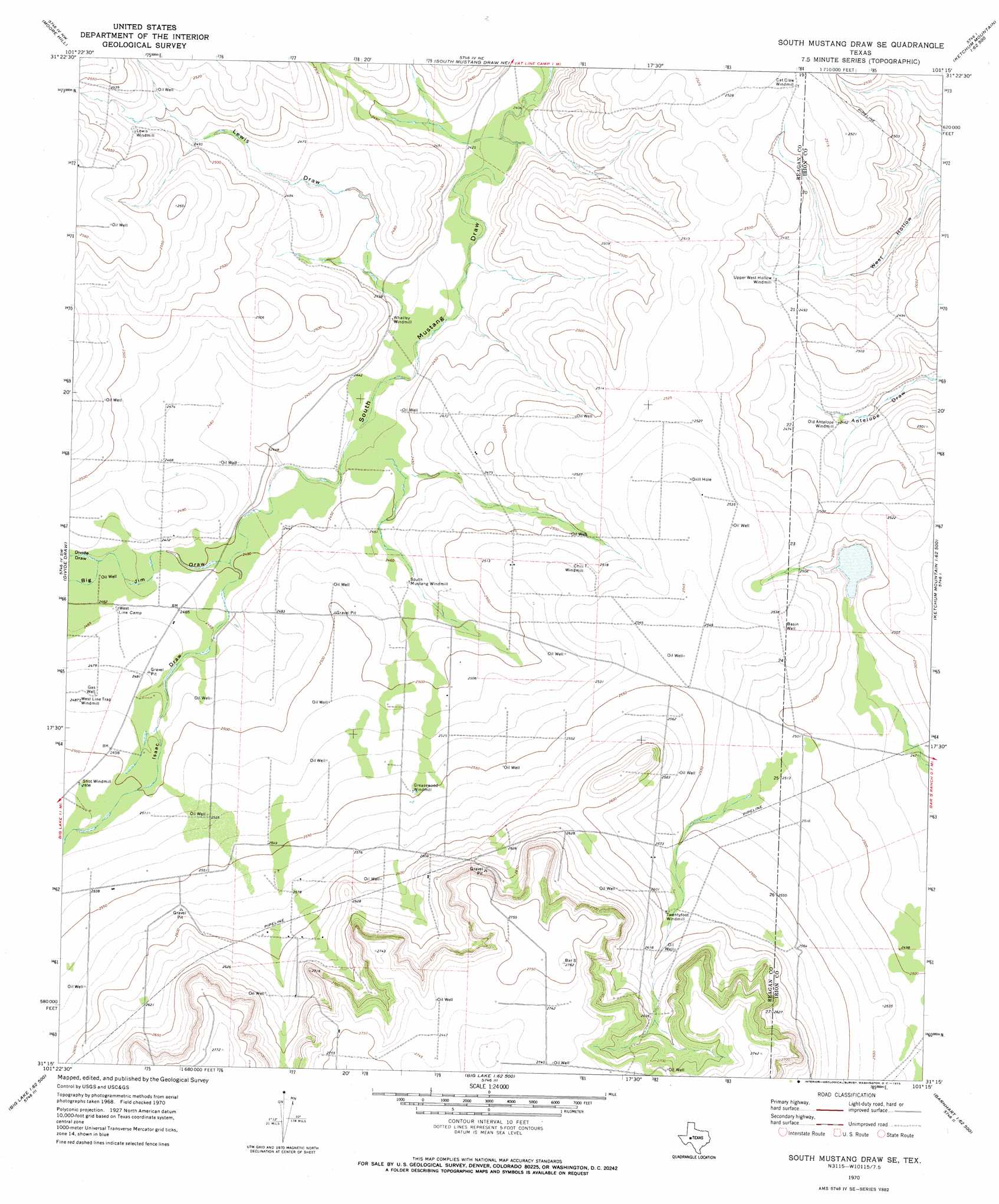
South Mustang Draw Se Topo Map Texas
To zoom in, hover over the map of South Mustang Draw Se
USGS Topo Quad 31101c3 - 1:24,000 scale
| Topo Map Name: | South Mustang Draw Se |
| USGS Topo Quad ID: | 31101c3 |
| Print Size: | ca. 21 1/4" wide x 27" high |
| Southeast Coordinates: | 31.25° N latitude / 101.25° W longitude |
| Map Center Coordinates: | 31.3125° N latitude / 101.3125° W longitude |
| U.S. State: | TX |
| Filename: | o31101c3.jpg |
| Download Map JPG Image: | South Mustang Draw Se topo map 1:24,000 scale |
| Map Type: | Topographic |
| Topo Series: | 7.5´ |
| Map Scale: | 1:24,000 |
| Source of Map Images: | United States Geological Survey (USGS) |
| Alternate Map Versions: |
South Mustang Draw SE TX 1970, updated 1973 Download PDF Buy paper map South Mustang Draw SE TX 2010 Download PDF Buy paper map South Mustang Draw SE TX 2012 Download PDF Buy paper map South Mustang Draw SE TX 2016 Download PDF Buy paper map |
1:24,000 Topo Quads surrounding South Mustang Draw Se
Saint Lawrence Se |
Three Bluff Draw Sw |
Three Bluff Draw |
Hay Hollow |
Coon Dive Draw |
Stiles |
Moore Hill |
South Mustang Draw Ne |
Causey Draw |
Bradford Draw |
Gardener Draw |
Divide Draw |
South Mustang Draw Se |
Rocker B Ranch |
Ketchum Mountain |
Best |
Big Lake |
Witco |
Barnhart |
Barnhart Ne |
Texon Se |
Big Lake Sw |
Big Lake Se |
Barnhart Sw |
Suggs |
> Back to 31101a1 at 1:100,000 scale
> Back to 31100a1 at 1:250,000 scale
> Back to U.S. Topo Maps home
South Mustang Draw Se topo map: Gazetteer
South Mustang Draw Se: Valleys
Big Jim Draw elevation 746m 2447′Divide Draw elevation 751m 2463′
Isaac Draw elevation 746m 2447′
Lewis Draw elevation 743m 2437′
South Mustang Draw Se: Wells
Basin Well elevation 774m 2539′South Mustang Draw Se digital topo map on disk
Buy this South Mustang Draw Se topo map showing relief, roads, GPS coordinates and other geographical features, as a high-resolution digital map file on DVD: