Causey Draw Topo Map Texas
To zoom in, hover over the map of Causey Draw
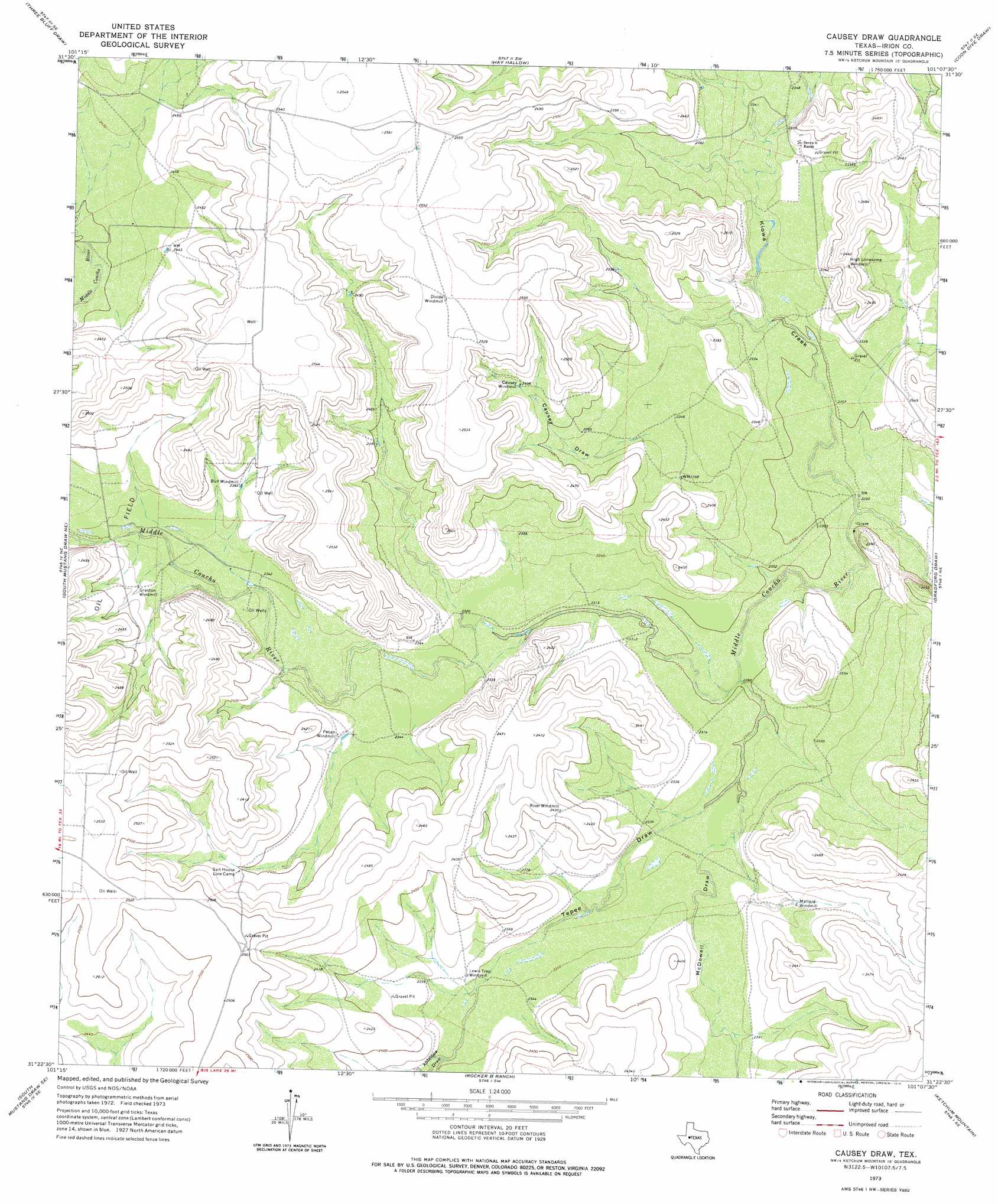
USGS Topo Quad 31101d2 - 1:24,000 scale
| Topo Map Name: | Causey Draw |
| USGS Topo Quad ID: | 31101d2 |
| Print Size: | ca. 21 1/4" wide x 27" high |
| Southeast Coordinates: | 31.375° N latitude / 101.125° W longitude |
| Map Center Coordinates: | 31.4375° N latitude / 101.1875° W longitude |
| U.S. State: | TX |
| Filename: | o31101d2.jpg |
| Download Map JPG Image: | Causey Draw topo map 1:24,000 scale |
| Map Type: | Topographic |
| Topo Series: | 7.5´ |
| Map Scale: | 1:24,000 |
| Source of Map Images: | United States Geological Survey (USGS) |
| Alternate Map Versions: |
Causey Draw TX 1973, updated 1976 Download PDF Buy paper map Causey Draw TX 2010 Download PDF Buy paper map Causey Draw TX 2012 Download PDF Buy paper map Causey Draw TX 2016 Download PDF Buy paper map |
1:24,000 Topo Quads surrounding Causey Draw
Three Bluff Draw Nw |
Three Bluff Draw Ne |
Coon Dive Draw Nw |
Dripping Springs Draw |
Dog Creek Nw |
Three Bluff Draw Sw |
Three Bluff Draw |
Hay Hollow |
Coon Dive Draw |
Dog Creek Sw |
Moore Hill |
South Mustang Draw Ne |
Causey Draw |
Bradford Draw |
Wallace Draw |
Divide Draw |
South Mustang Draw Se |
Rocker B Ranch |
Ketchum Mountain |
Mertzon Sw |
Big Lake |
Witco |
Barnhart |
Barnhart Ne |
Noelke |
> Back to 31101a1 at 1:100,000 scale
> Back to 31100a1 at 1:250,000 scale
> Back to U.S. Topo Maps home
Causey Draw topo map: Gazetteer
Causey Draw: Streams
Kiowa Creek elevation 695m 2280′Causey Draw: Valleys
Antelope Draw elevation 713m 2339′Causey Draw elevation 718m 2355′
McDowell Draw elevation 705m 2312′
Tepee Draw elevation 698m 2290′
Causey Draw digital topo map on disk
Buy this Causey Draw topo map showing relief, roads, GPS coordinates and other geographical features, as a high-resolution digital map file on DVD: