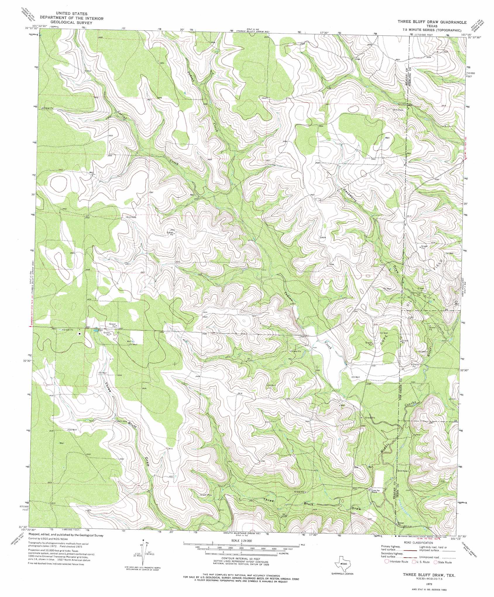
Three Bluff Draw Topo Map Texas
To zoom in, hover over the map of Three Bluff Draw
USGS Topo Quad 31101e3 - 1:24,000 scale
| Topo Map Name: | Three Bluff Draw |
| USGS Topo Quad ID: | 31101e3 |
| Print Size: | ca. 21 1/4" wide x 27" high |
| Southeast Coordinates: | 31.5° N latitude / 101.25° W longitude |
| Map Center Coordinates: | 31.5625° N latitude / 101.3125° W longitude |
| U.S. State: | TX |
| Filename: | o31101e3.jpg |
| Download Map JPG Image: | Three Bluff Draw topo map 1:24,000 scale |
| Map Type: | Topographic |
| Topo Series: | 7.5´ |
| Map Scale: | 1:24,000 |
| Source of Map Images: | United States Geological Survey (USGS) |
| Alternate Map Versions: |
Three Bluff Draw TX 1973, updated 1976 Download PDF Buy paper map Three Bluff Draw TX 2010 Download PDF Buy paper map Three Bluff Draw TX 2012 Download PDF Buy paper map Three Bluff Draw TX 2016 Download PDF Buy paper map |
1:24,000 Topo Quads surrounding Three Bluff Draw
Dewey Lake Se |
Garden City |
Currie Reservoir |
Glass Ranch |
Cumbie Draw |
Saint Lawrence |
Three Bluff Draw Nw |
Three Bluff Draw Ne |
Coon Dive Draw Nw |
Dripping Springs Draw |
Saint Lawrence Se |
Three Bluff Draw Sw |
Three Bluff Draw |
Hay Hollow |
Coon Dive Draw |
Stiles |
Moore Hill |
South Mustang Draw Ne |
Causey Draw |
Bradford Draw |
Gardener Draw |
Divide Draw |
South Mustang Draw Se |
Rocker B Ranch |
Ketchum Mountain |
> Back to 31101e1 at 1:100,000 scale
> Back to 31100a1 at 1:250,000 scale
> Back to U.S. Topo Maps home
Three Bluff Draw topo map: Gazetteer
Three Bluff Draw: Oilfields
Cope Oil Field elevation 768m 2519′Three Bluff Draw: Streams
Corral Creek elevation 768m 2519′Indian Creek elevation 743m 2437′
Three Bluff Draw: Valleys
Hackberry Draw elevation 753m 2470′Three Bluff Draw elevation 739m 2424′
Three Bluff Draw digital topo map on disk
Buy this Three Bluff Draw topo map showing relief, roads, GPS coordinates and other geographical features, as a high-resolution digital map file on DVD: