Cumbie Draw Topo Map Texas
To zoom in, hover over the map of Cumbie Draw
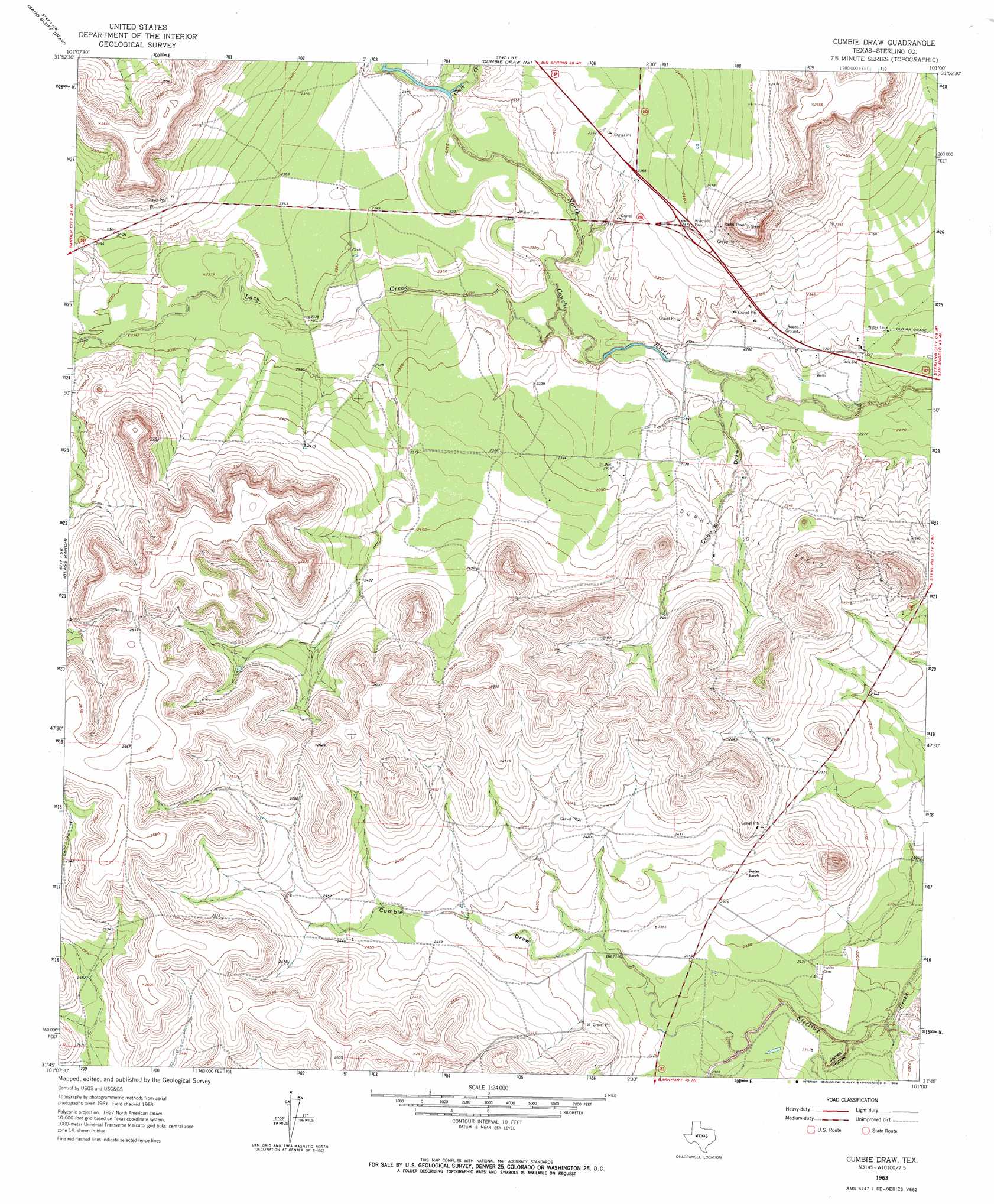
USGS Topo Quad 31101g1 - 1:24,000 scale
| Topo Map Name: | Cumbie Draw |
| USGS Topo Quad ID: | 31101g1 |
| Print Size: | ca. 21 1/4" wide x 27" high |
| Southeast Coordinates: | 31.75° N latitude / 101° W longitude |
| Map Center Coordinates: | 31.8125° N latitude / 101.0625° W longitude |
| U.S. State: | TX |
| Filename: | o31101g1.jpg |
| Download Map JPG Image: | Cumbie Draw topo map 1:24,000 scale |
| Map Type: | Topographic |
| Topo Series: | 7.5´ |
| Map Scale: | 1:24,000 |
| Source of Map Images: | United States Geological Survey (USGS) |
| Alternate Map Versions: |
Cumbie Draw TX 1963, updated 1964 Download PDF Buy paper map Cumbie Draw TX 2010 Download PDF Buy paper map Cumbie Draw TX 2013 Download PDF Buy paper map Cumbie Draw TX 2016 Download PDF Buy paper map |
1:24,000 Topo Quads surrounding Cumbie Draw
Forsan |
Hayrick Mountain |
Buffalo Draw |
Mcwhorter Mountain |
Dead Indian Mountain |
Garden City Ne |
Sand Bluff Draw |
Cumbie Draw Ne |
Sterling City Nw |
Crawford Slide |
Currie Reservoir |
Glass Ranch |
Cumbie Draw |
Sterling City |
Broome |
Three Bluff Draw Ne |
Coon Dive Draw Nw |
Dripping Springs Draw |
Dog Creek Nw |
Dog Creek Ne |
Three Bluff Draw |
Hay Hollow |
Coon Dive Draw |
Dog Creek Sw |
Dog Creek |
> Back to 31101e1 at 1:100,000 scale
> Back to 31100a1 at 1:250,000 scale
> Back to U.S. Topo Maps home
Cumbie Draw topo map: Gazetteer
Cumbie Draw: Airports
McEntires Lazy V Ranch Airport elevation 715m 2345′Cumbie Draw: Dams
W H Reed Dam elevation 711m 2332′Cumbie Draw: Oilfields
Durham Oil Field elevation 726m 2381′Cumbie Draw: Reservoirs
W H Reed Reservoir elevation 711m 2332′Cumbie Draw: Streams
Chalk Creek elevation 708m 2322′Lacy Creek elevation 696m 2283′
Cumbie Draw: Valleys
Cobb Draw elevation 692m 2270′Cumble Draw elevation 709m 2326′
James Hollow elevation 697m 2286′
Cumbie Draw digital topo map on disk
Buy this Cumbie Draw topo map showing relief, roads, GPS coordinates and other geographical features, as a high-resolution digital map file on DVD: