Salt Lake Topo Map Texas
To zoom in, hover over the map of Salt Lake
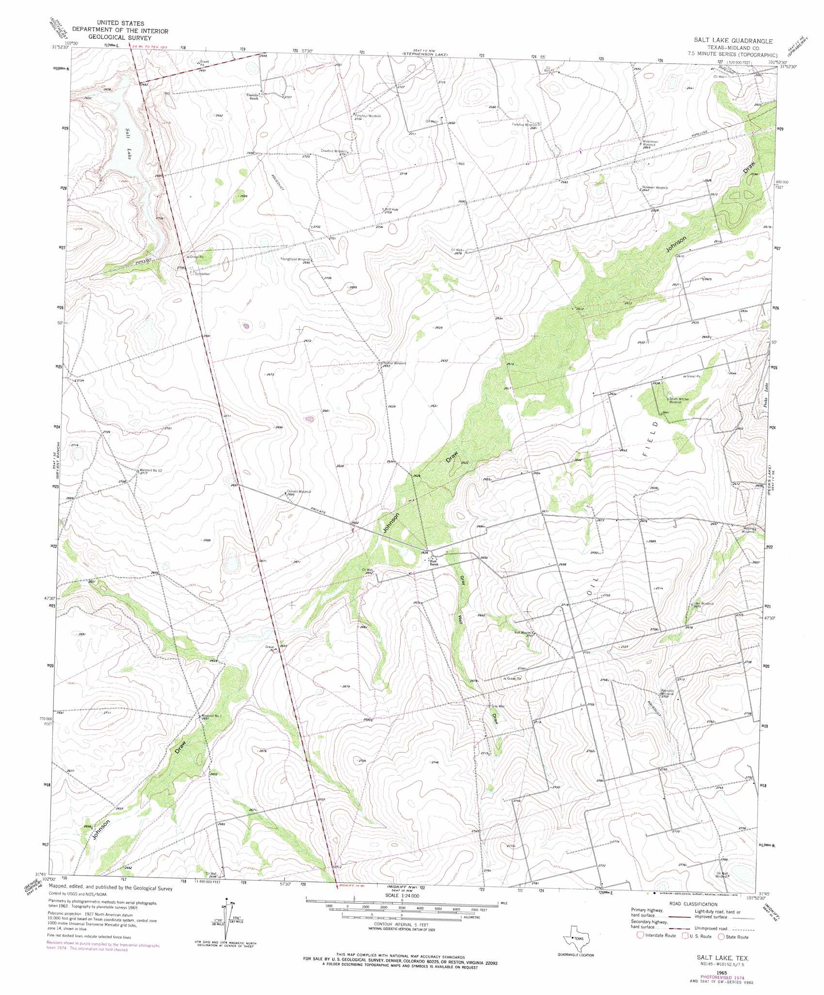
USGS Topo Quad 31101g8 - 1:24,000 scale
| Topo Map Name: | Salt Lake |
| USGS Topo Quad ID: | 31101g8 |
| Print Size: | ca. 21 1/4" wide x 27" high |
| Southeast Coordinates: | 31.75° N latitude / 101.875° W longitude |
| Map Center Coordinates: | 31.8125° N latitude / 101.9375° W longitude |
| U.S. State: | TX |
| Filename: | o31101g8.jpg |
| Download Map JPG Image: | Salt Lake topo map 1:24,000 scale |
| Map Type: | Topographic |
| Topo Series: | 7.5´ |
| Map Scale: | 1:24,000 |
| Source of Map Images: | United States Geological Survey (USGS) |
| Alternate Map Versions: |
Salt Lake TX 1965, updated 1966 Download PDF Buy paper map Salt Lake TX 2010 Download PDF Buy paper map Salt Lake TX 2012 Download PDF Buy paper map Salt Lake TX 2016 Download PDF Buy paper map |
1:24,000 Topo Quads surrounding Salt Lake
Northwest Midland |
Northeast Midland |
Germania |
Stanton Se |
Houston Ranch |
Southwest Midland |
Southeast Midland |
Stephenson Lake |
Spraberry |
Dewey Lake |
Parks |
Bryant Ranch |
Salt Lake |
Pecks Lake |
Patterson Lake |
Benge Corner Nw |
Benge Corner |
Midkiff Nw |
Midkiff |
Bigby Corner |
Benge Corner Sw |
Benge Corner Se |
Midkiff Sw |
Midkiff Se |
Slager Lake |
> Back to 31101e1 at 1:100,000 scale
> Back to 31100a1 at 1:250,000 scale
> Back to U.S. Topo Maps home
Salt Lake topo map: Gazetteer
Salt Lake: Lakes
Salt Lake elevation 810m 2657′Salt Lake: Valleys
Gray Well Draw elevation 802m 2631′Salt Lake: Wells
Gray Well elevation 818m 2683′Salt Lake digital topo map on disk
Buy this Salt Lake topo map showing relief, roads, GPS coordinates and other geographical features, as a high-resolution digital map file on DVD: