Ballinger Ranch Topo Map Texas
To zoom in, hover over the map of Ballinger Ranch
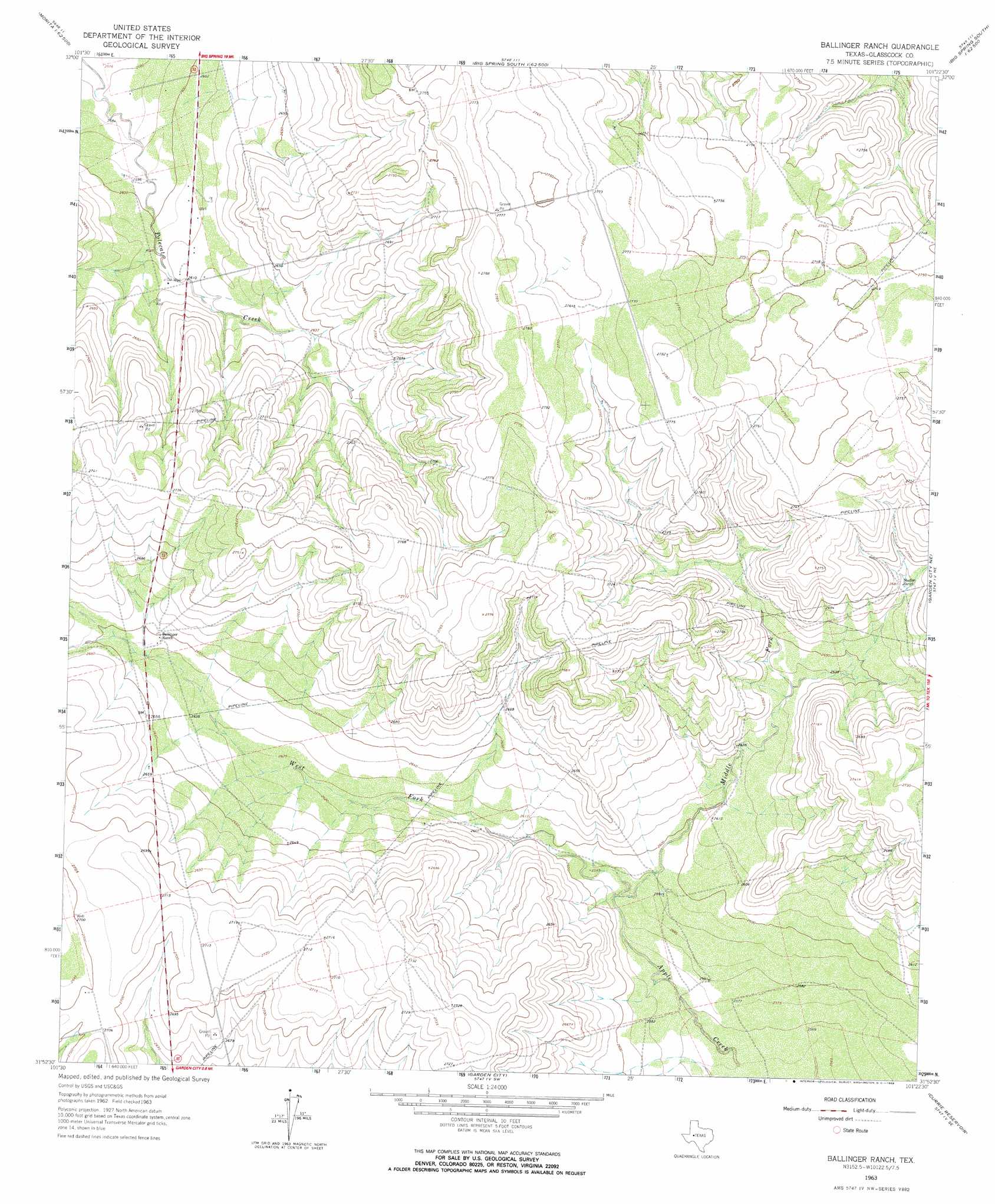
USGS Topo Quad 31101h4 - 1:24,000 scale
| Topo Map Name: | Ballinger Ranch |
| USGS Topo Quad ID: | 31101h4 |
| Print Size: | ca. 21 1/4" wide x 27" high |
| Southeast Coordinates: | 31.875° N latitude / 101.375° W longitude |
| Map Center Coordinates: | 31.9375° N latitude / 101.4375° W longitude |
| U.S. State: | TX |
| Filename: | o31101h4.jpg |
| Download Map JPG Image: | Ballinger Ranch topo map 1:24,000 scale |
| Map Type: | Topographic |
| Topo Series: | 7.5´ |
| Map Scale: | 1:24,000 |
| Source of Map Images: | United States Geological Survey (USGS) |
| Alternate Map Versions: |
Ballinger Ranch TX 1963, updated 1964 Download PDF Buy paper map Ballinger Ranch TX 1963, updated 1964 Download PDF Buy paper map Ballinger Ranch TX 2010 Download PDF Buy paper map Ballinger Ranch TX 2012 Download PDF Buy paper map Ballinger Ranch TX 2016 Download PDF Buy paper map |
1:24,000 Topo Quads surrounding Ballinger Ranch
Natural Dam Lake |
Elbow |
Big Spring South |
Moss Creek Lake |
Hyman |
Houston Ranch |
Lucian Wells Ranch |
Lees |
Forsan |
Hayrick Mountain |
Dewey Lake |
Dewey Lake Ne |
Ballinger Ranch |
Garden City Ne |
Sand Bluff Draw |
Patterson Lake |
Dewey Lake Se |
Garden City |
Currie Reservoir |
Glass Ranch |
Bigby Corner |
Saint Lawrence |
Three Bluff Draw Nw |
Three Bluff Draw Ne |
Coon Dive Draw Nw |
> Back to 31101e1 at 1:100,000 scale
> Back to 31100a1 at 1:250,000 scale
> Back to U.S. Topo Maps home
Ballinger Ranch topo map: Gazetteer
Ballinger Ranch: Streams
Middle Fork Apple Creek elevation 787m 2582′West Fork Apple Creek elevation 787m 2582′
Ballinger Ranch digital topo map on disk
Buy this Ballinger Ranch topo map showing relief, roads, GPS coordinates and other geographical features, as a high-resolution digital map file on DVD: