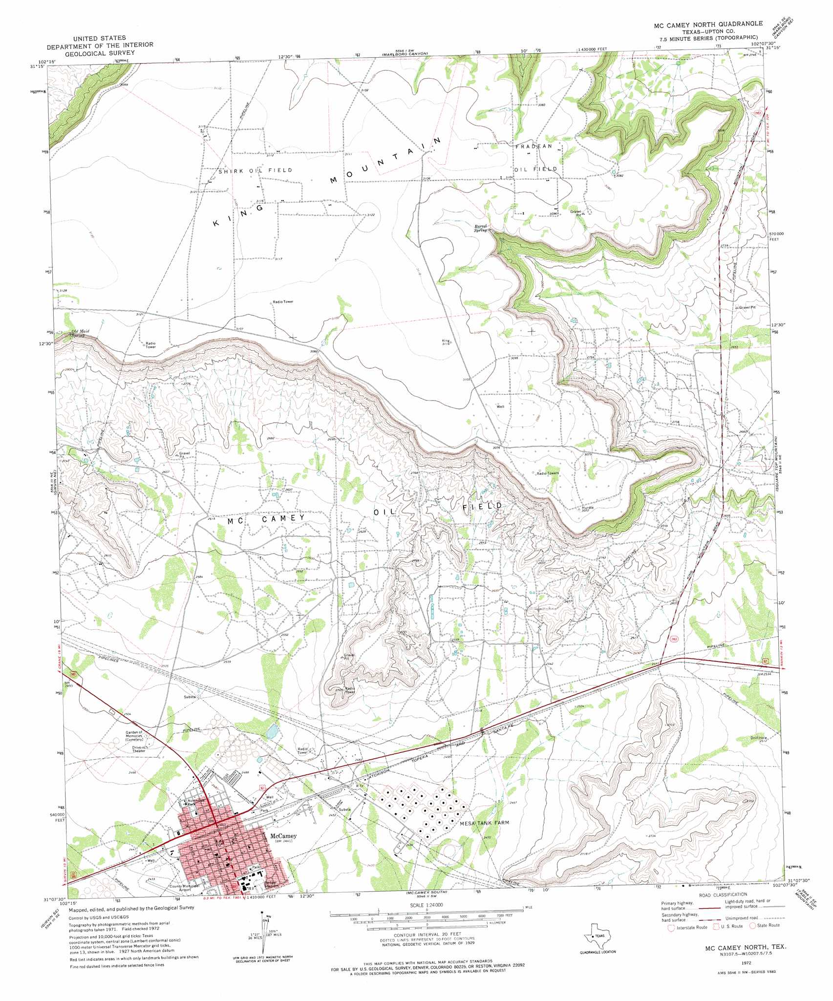
Mccamey North Topo Map Texas
To zoom in, hover over the map of Mccamey North
USGS Topo Quad 31102b2 - 1:24,000 scale
| Topo Map Name: | Mccamey North |
| USGS Topo Quad ID: | 31102b2 |
| Print Size: | ca. 21 1/4" wide x 27" high |
| Southeast Coordinates: | 31.125° N latitude / 102.125° W longitude |
| Map Center Coordinates: | 31.1875° N latitude / 102.1875° W longitude |
| U.S. State: | TX |
| Filename: | o31102b2.jpg |
| Download Map JPG Image: | Mccamey North topo map 1:24,000 scale |
| Map Type: | Topographic |
| Topo Series: | 7.5´ |
| Map Scale: | 1:24,000 |
| Source of Map Images: | United States Geological Survey (USGS) |
| Alternate Map Versions: |
McCamey North TX 1972, updated 1974 Download PDF Buy paper map McCamey North TX 2010 Download PDF Buy paper map McCamey North TX 2012 Download PDF Buy paper map McCamey North TX 2016 Download PDF Buy paper map |
1:24,000 Topo Quads surrounding Mccamey North
Crane Nw |
Crane |
Mcelroy Ranch |
Hanks Ranch |
Lindsey Ranch |
Crane Sw |
Castle Gap |
Marlboro Canyon |
Marlboro Canyon Se |
Sevenmile Corner |
Girvin Nw |
Girvin Ne |
Mccamey North |
Square Top Mountain |
Rankin |
Girvin |
Girvin Se |
Mccamey South |
Table Top Mountain |
Cedar Canyon |
Bootleg Canyon |
Bakersfield |
Indian Mesa |
Indian Mesa Ne |
Iraan |
> Back to 31102a1 at 1:100,000 scale
> Back to 31102a1 at 1:250,000 scale
> Back to U.S. Topo Maps home
Mccamey North topo map: Gazetteer
Mccamey North: Airports
Upton County Airport elevation 741m 2431′Mccamey North: Oilfields
Fradean Oil Field elevation 946m 3103′McCamey Oil Field elevation 835m 2739′
Shirk Oil Field elevation 950m 3116′
Mccamey North: Parks
Badger Stadium elevation 743m 2437′Badger Stadium elevation 741m 2431′
Northside Park elevation 752m 2467′
Mccamey North: Populated Places
McCamey elevation 752m 2467′Mccamey North: Springs
Barrel Spring elevation 930m 3051′Old Maid Spring elevation 924m 3031′
Mccamey North digital topo map on disk
Buy this Mccamey North topo map showing relief, roads, GPS coordinates and other geographical features, as a high-resolution digital map file on DVD: