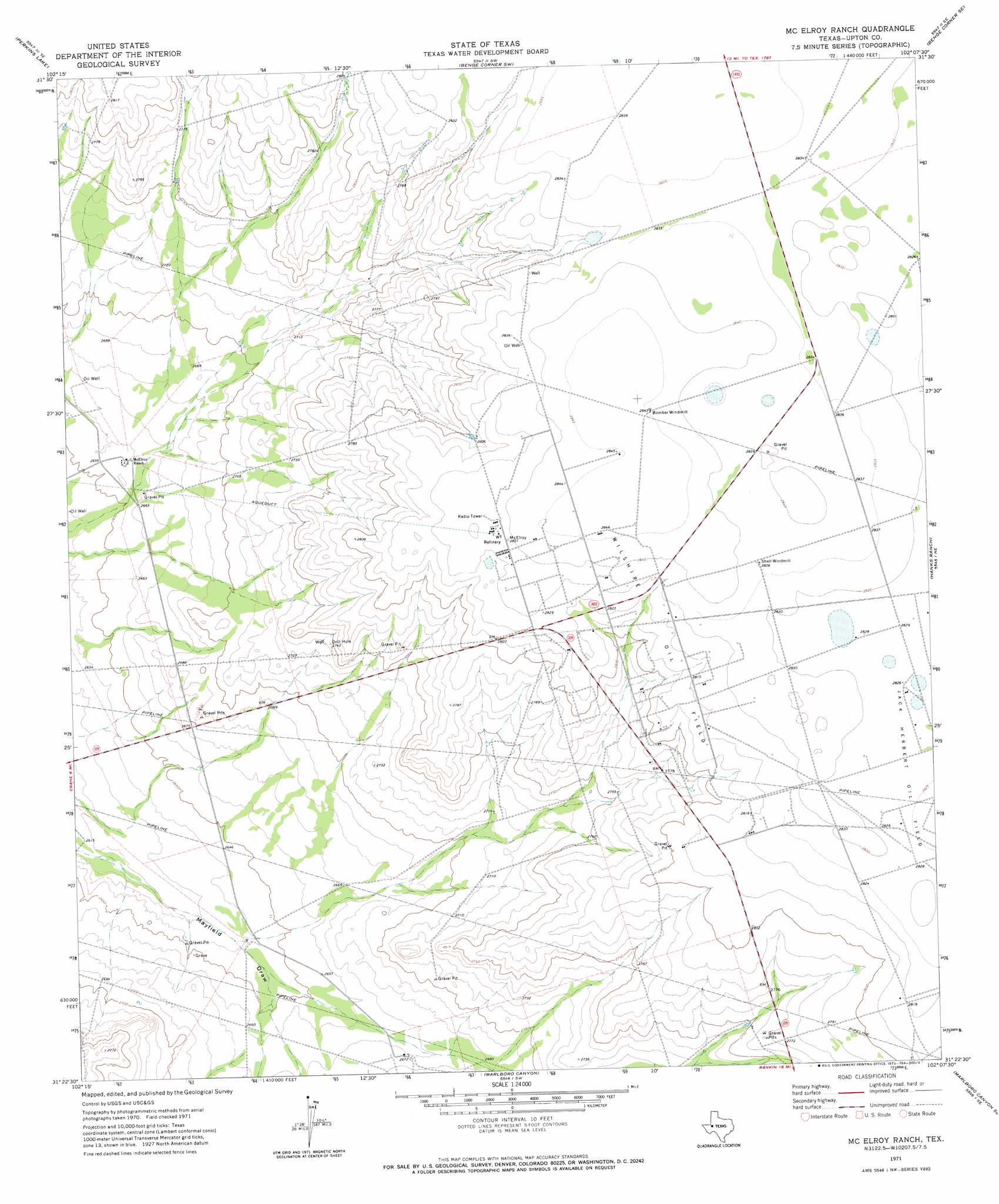
Mcelroy Ranch Topo Map Texas
To zoom in, hover over the map of Mcelroy Ranch
USGS Topo Quad 31102d2 - 1:24,000 scale
| Topo Map Name: | Mcelroy Ranch |
| USGS Topo Quad ID: | 31102d2 |
| Print Size: | ca. 21 1/4" wide x 27" high |
| Southeast Coordinates: | 31.375° N latitude / 102.125° W longitude |
| Map Center Coordinates: | 31.4375° N latitude / 102.1875° W longitude |
| U.S. State: | TX |
| Filename: | o31102d2.jpg |
| Download Map JPG Image: | Mcelroy Ranch topo map 1:24,000 scale |
| Map Type: | Topographic |
| Topo Series: | 7.5´ |
| Map Scale: | 1:24,000 |
| Source of Map Images: | United States Geological Survey (USGS) |
| Alternate Map Versions: |
McElroy Ranch TX 1971, updated 1973 Download PDF Buy paper map McElroy Ranch TX 2010 Download PDF Buy paper map McElroy Ranch TX 2012 Download PDF Buy paper map McElroy Ranch TX 2016 Download PDF Buy paper map |
1:24,000 Topo Quads surrounding Mcelroy Ranch
Clark Brothers Ranch |
South Cowden Ranch |
Benge Corner Nw |
Benge Corner |
Midkiff Nw |
Doodle Bug Well |
Perkins Lake |
Benge Corner Sw |
Benge Corner Se |
Midkiff Sw |
Crane Nw |
Crane |
Mcelroy Ranch |
Hanks Ranch |
Lindsey Ranch |
Crane Sw |
Castle Gap |
Marlboro Canyon |
Marlboro Canyon Se |
Sevenmile Corner |
Girvin Nw |
Girvin Ne |
Mccamey North |
Square Top Mountain |
Rankin |
> Back to 31102a1 at 1:100,000 scale
> Back to 31102a1 at 1:250,000 scale
> Back to U.S. Topo Maps home
Mcelroy Ranch digital topo map on disk
Buy this Mcelroy Ranch topo map showing relief, roads, GPS coordinates and other geographical features, as a high-resolution digital map file on DVD: