7 L Ranch Topo Map Texas
To zoom in, hover over the map of 7 L Ranch
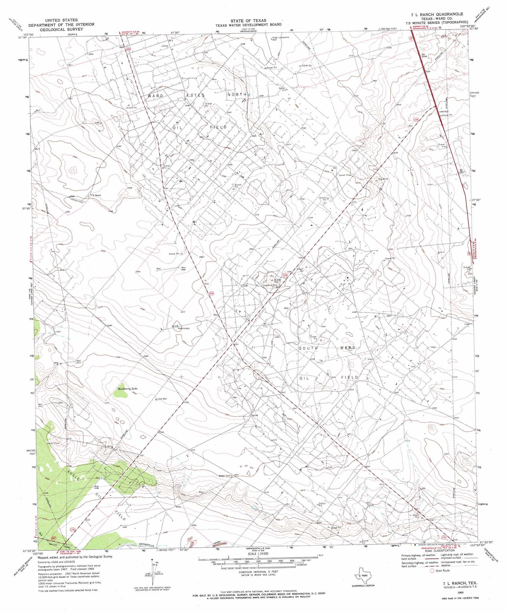
USGS Topo Quad 31102d8 - 1:24,000 scale
| Topo Map Name: | 7 L Ranch |
| USGS Topo Quad ID: | 31102d8 |
| Print Size: | ca. 21 1/4" wide x 27" high |
| Southeast Coordinates: | 31.375° N latitude / 102.875° W longitude |
| Map Center Coordinates: | 31.4375° N latitude / 102.9375° W longitude |
| U.S. State: | TX |
| Filename: | o31102d8.jpg |
| Download Map JPG Image: | 7 L Ranch topo map 1:24,000 scale |
| Map Type: | Topographic |
| Topo Series: | 7.5´ |
| Map Scale: | 1:24,000 |
| Source of Map Images: | United States Geological Survey (USGS) |
| Alternate Map Versions: |
7 L Ranch TX 1969, updated 1971 Download PDF Buy paper map 7 L Ranch TX 2010 Download PDF Buy paper map 7 L Ranch TX 2012 Download PDF Buy paper map 7 L Ranch TX 2016 Download PDF Buy paper map |
1:24,000 Topo Quads surrounding 7 L Ranch
Wink South |
Pyote Ne |
China Ranch |
Cowden Place |
Metz |
Pyote West |
Pyote East |
Monahans |
Monahans Se |
Penwell Sw |
China Lake |
China Lake Ne |
7 L Ranch |
Ozark Lake |
Imperial Nw |
Ligon Ranch |
Rio Pecos Ranch |
Grandfalls Sw |
Grandfalls |
Imperial |
Coyanosa Nw |
Coyanosa |
Diamond Y Spring Nw |
Diamond Y Spring Ne |
Buena Vista |
> Back to 31102a1 at 1:100,000 scale
> Back to 31102a1 at 1:250,000 scale
> Back to U.S. Topo Maps home
7 L Ranch topo map: Gazetteer
7 L Ranch: Lakes
Hackberry Lake elevation 772m 2532′7 L Ranch: Oilfields
South Ward Oil Field elevation 759m 2490′7 L Ranch: Wells
High Lonesome Well elevation 794m 2604′Little Well elevation 773m 2536′
Middle Well elevation 785m 2575′
Shetland Well elevation 774m 2539′
7 L Ranch digital topo map on disk
Buy this 7 L Ranch topo map showing relief, roads, GPS coordinates and other geographical features, as a high-resolution digital map file on DVD: