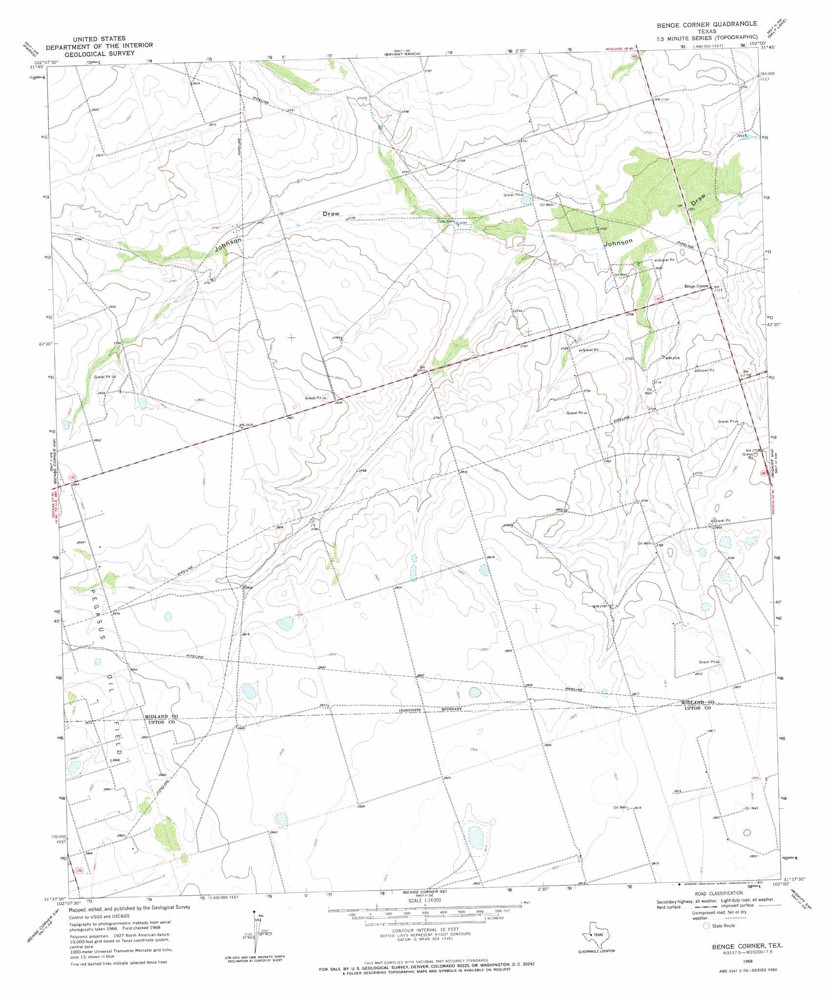
Benge Corner Topo Map Texas
To zoom in, hover over the map of Benge Corner
USGS Topo Quad 31102f1 - 1:24,000 scale
| Topo Map Name: | Benge Corner |
| USGS Topo Quad ID: | 31102f1 |
| Print Size: | ca. 21 1/4" wide x 27" high |
| Southeast Coordinates: | 31.625° N latitude / 102° W longitude |
| Map Center Coordinates: | 31.6875° N latitude / 102.0625° W longitude |
| U.S. State: | TX |
| Filename: | o31102f1.jpg |
| Download Map JPG Image: | Benge Corner topo map 1:24,000 scale |
| Map Type: | Topographic |
| Topo Series: | 7.5´ |
| Map Scale: | 1:24,000 |
| Source of Map Images: | United States Geological Survey (USGS) |
| Alternate Map Versions: |
Benge Corner TX 1968, updated 1970 Download PDF Buy paper map Benge Corner TX 2010 Download PDF Buy paper map Benge Corner TX 2012 Download PDF Buy paper map Benge Corner TX 2016 Download PDF Buy paper map |
1:24,000 Topo Quads surrounding Benge Corner
Odessa Ne |
Southwest Midland |
Southeast Midland |
Stephenson Lake |
Spraberry |
Odessa Se |
Parks |
Bryant Ranch |
Salt Lake |
Pecks Lake |
South Cowden Ranch |
Benge Corner Nw |
Benge Corner |
Midkiff Nw |
Midkiff |
Perkins Lake |
Benge Corner Sw |
Benge Corner Se |
Midkiff Sw |
Midkiff Se |
Crane |
Mcelroy Ranch |
Hanks Ranch |
Lindsey Ranch |
Sevenmile Corner Ne |
> Back to 31102e1 at 1:100,000 scale
> Back to 31102a1 at 1:250,000 scale
> Back to U.S. Topo Maps home
Benge Corner topo map: Gazetteer
Benge Corner: Populated Places
Benge Corner elevation 831m 2726′Benge Corner: Wells
Tubb Wells elevation 824m 2703′Benge Corner digital topo map on disk
Buy this Benge Corner topo map showing relief, roads, GPS coordinates and other geographical features, as a high-resolution digital map file on DVD: