China Ranch Topo Map Texas
To zoom in, hover over the map of China Ranch
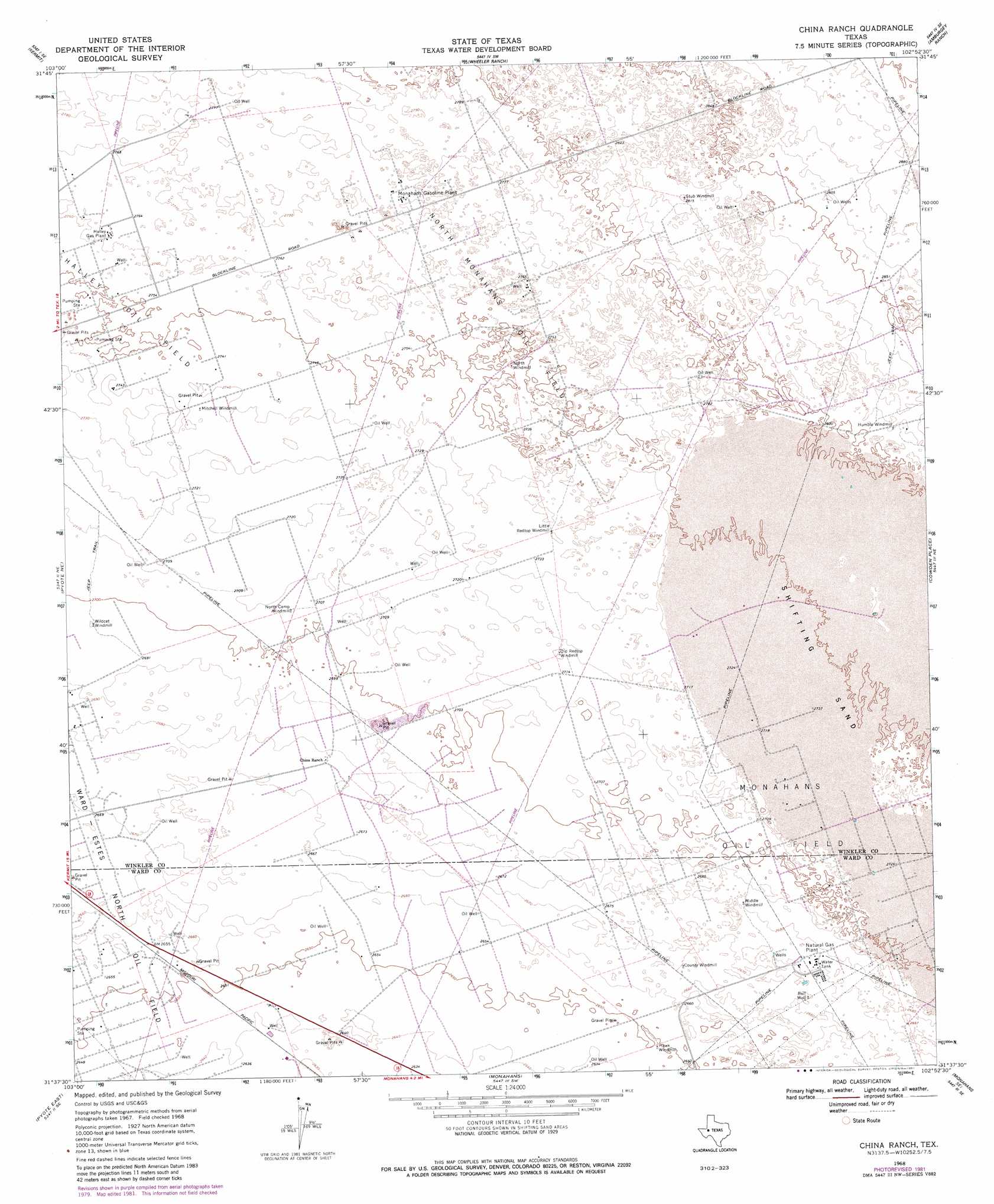
USGS Topo Quad 31102f8 - 1:24,000 scale
| Topo Map Name: | China Ranch |
| USGS Topo Quad ID: | 31102f8 |
| Print Size: | ca. 21 1/4" wide x 27" high |
| Southeast Coordinates: | 31.625° N latitude / 102.875° W longitude |
| Map Center Coordinates: | 31.6875° N latitude / 102.9375° W longitude |
| U.S. State: | TX |
| Filename: | o31102f8.jpg |
| Download Map JPG Image: | China Ranch topo map 1:24,000 scale |
| Map Type: | Topographic |
| Topo Series: | 7.5´ |
| Map Scale: | 1:24,000 |
| Source of Map Images: | United States Geological Survey (USGS) |
| Alternate Map Versions: |
China Ranch TX 1968, updated 1971 Download PDF Buy paper map China Ranch TX 1968, updated 1981 Download PDF Buy paper map China Ranch TX 2010 Download PDF Buy paper map China Ranch TX 2012 Download PDF Buy paper map China Ranch TX 2016 Download PDF Buy paper map |
1:24,000 Topo Quads surrounding China Ranch
Kermit Nw |
Vesrue |
Notrees Nw |
Notrees |
Turnbaugh Corner |
Wink North |
Kermit |
Wheeler Ranch |
Amburgey Ranch |
Red Lakes |
Wink South |
Pyote Ne |
China Ranch |
Cowden Place |
Metz |
Pyote West |
Pyote East |
Monahans |
Monahans Se |
Penwell Sw |
China Lake |
China Lake Ne |
7 L Ranch |
Ozark Lake |
Imperial Nw |
> Back to 31102e1 at 1:100,000 scale
> Back to 31102a1 at 1:250,000 scale
> Back to U.S. Topo Maps home
China Ranch topo map: Gazetteer
China Ranch: Oilfields
Halley Gas Plant elevation 842m 2762′Halley Oil Field elevation 838m 2749′
Monahans Gasoline Plant elevation 845m 2772′
Monahans Oil Field elevation 834m 2736′
North Monahans Oil Field elevation 842m 2762′
China Ranch: Springs
Buzzard Roost Springs elevation 832m 2729′Willow Springs (historical) elevation 835m 2739′
China Ranch: Wells
Bull Well elevation 811m 2660′China Ranch digital topo map on disk
Buy this China Ranch topo map showing relief, roads, GPS coordinates and other geographical features, as a high-resolution digital map file on DVD: