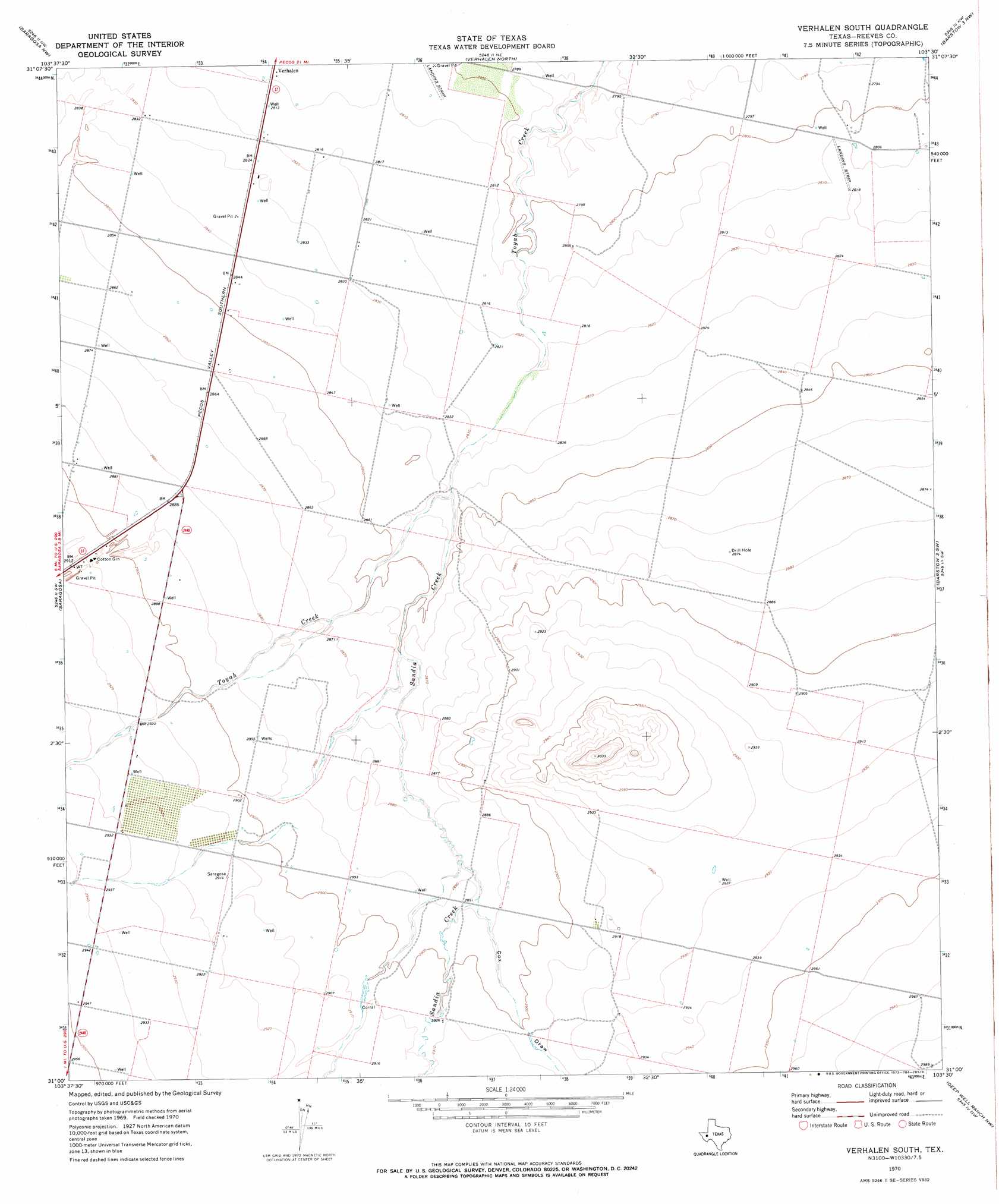
Verhalen South Topo Map Texas
To zoom in, hover over the map of Verhalen South
USGS Topo Quad 31103a5 - 1:24,000 scale
| Topo Map Name: | Verhalen South |
| USGS Topo Quad ID: | 31103a5 |
| Print Size: | ca. 21 1/4" wide x 27" high |
| Southeast Coordinates: | 31° N latitude / 103.5° W longitude |
| Map Center Coordinates: | 31.0625° N latitude / 103.5625° W longitude |
| U.S. State: | TX |
| Filename: | o31103a5.jpg |
| Download Map JPG Image: | Verhalen South topo map 1:24,000 scale |
| Map Type: | Topographic |
| Topo Series: | 7.5´ |
| Map Scale: | 1:24,000 |
| Source of Map Images: | United States Geological Survey (USGS) |
| Alternate Map Versions: |
Verhalen South TX 1970, updated 1973 Download PDF Buy paper map Verhalen South TX 2010 Download PDF Buy paper map Verhalen South TX 2012 Download PDF Buy paper map Verhalen South TX 2016 Download PDF Buy paper map |
1:24,000 Topo Quads surrounding Verhalen South
Toyah |
Hermosa Sw |
Worsham |
Toyah Lake |
Old X Ranch |
Florenzo Hill |
Saragosa Nw |
Verhalen North |
Barstow 3 Nw |
Barstow 3 Ne |
Meier Hills |
Saragosa |
Verhalen South |
Barstow 3 Sw |
Barstow 3 Se |
Toyahvale |
Balmorhea |
Cox Draw |
Deep Well Ranch Nw |
Tucker Hill |
Big Aguja Mountain |
Barrilla Mountains West |
Barrilla Mountains East |
Deep Well Ranch |
Deep Well Ranch Se |
> Back to 31103a1 at 1:100,000 scale
> Back to 31102a1 at 1:250,000 scale
> Back to U.S. Topo Maps home
Verhalen South topo map: Gazetteer
Verhalen South: Streams
Sandia Creek elevation 863m 2831′Verhalen South: Valleys
Cox Draw elevation 881m 2890′Verhalen South digital topo map on disk
Buy this Verhalen South topo map showing relief, roads, GPS coordinates and other geographical features, as a high-resolution digital map file on DVD: