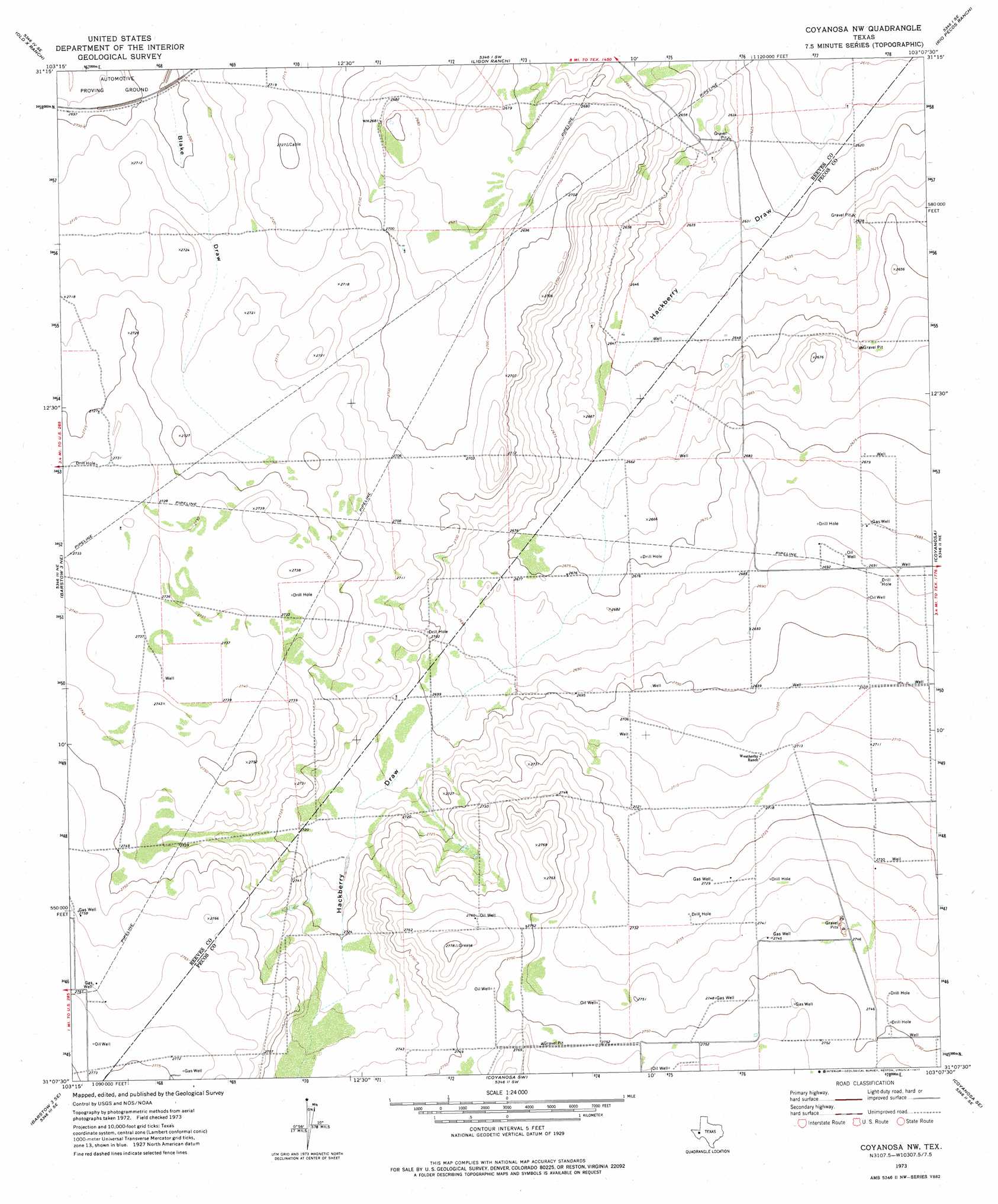
Coyanosa Nw Topo Map Texas
To zoom in, hover over the map of Coyanosa Nw
USGS Topo Quad 31103b2 - 1:24,000 scale
| Topo Map Name: | Coyanosa Nw |
| USGS Topo Quad ID: | 31103b2 |
| Print Size: | ca. 21 1/4" wide x 27" high |
| Southeast Coordinates: | 31.125° N latitude / 103.125° W longitude |
| Map Center Coordinates: | 31.1875° N latitude / 103.1875° W longitude |
| U.S. State: | TX |
| Filename: | o31103b2.jpg |
| Download Map JPG Image: | Coyanosa Nw topo map 1:24,000 scale |
| Map Type: | Topographic |
| Topo Series: | 7.5´ |
| Map Scale: | 1:24,000 |
| Source of Map Images: | United States Geological Survey (USGS) |
| Alternate Map Versions: |
Coyanosa NW TX 1973, updated 1977 Download PDF Buy paper map Coyanosa NW TX 2010 Download PDF Buy paper map Coyanosa NW TX 2013 Download PDF Buy paper map Coyanosa NW TX 2016 Download PDF Buy paper map |
1:24,000 Topo Quads surrounding Coyanosa Nw
Pecos East |
Quito Draw |
China Lake |
China Lake Ne |
7 L Ranch |
Toyah Lake |
Old X Ranch |
Ligon Ranch |
Rio Pecos Ranch |
Grandfalls Sw |
Barstow 3 Nw |
Barstow 3 Ne |
Coyanosa Nw |
Coyanosa |
Diamond Y Spring Nw |
Barstow 3 Sw |
Barstow 3 Se |
Coyanosa Sw |
Coyanosa Se |
Diamond Y Spring |
Deep Well Ranch Nw |
Tucker Hill |
Belding Nw |
Belding Ne |
Fort Stockton West |
> Back to 31103a1 at 1:100,000 scale
> Back to 31102a1 at 1:250,000 scale
> Back to U.S. Topo Maps home
No gazetteer data is available for the Coyanosa Nw topo map sheet.
Coyanosa Nw digital topo map on disk
Buy this Coyanosa Nw topo map showing relief, roads, GPS coordinates and other geographical features, as a high-resolution digital map file on DVD: