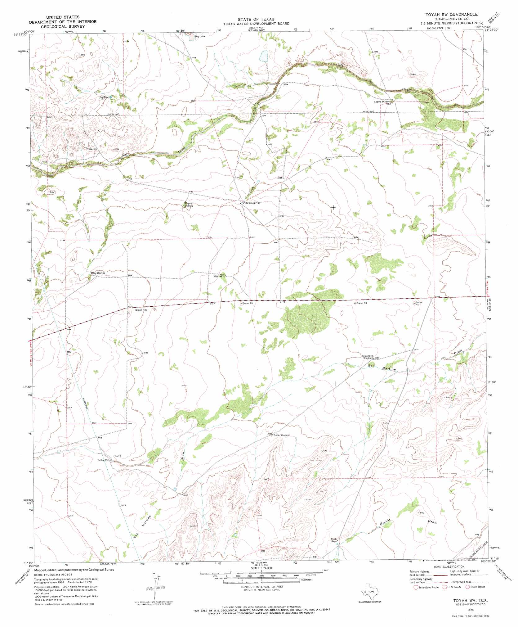
Toyah Sw Topo Map Texas
To zoom in, hover over the map of Toyah Sw
USGS Topo Quad 31103c8 - 1:24,000 scale
| Topo Map Name: | Toyah Sw |
| USGS Topo Quad ID: | 31103c8 |
| Print Size: | ca. 21 1/4" wide x 27" high |
| Southeast Coordinates: | 31.25° N latitude / 103.875° W longitude |
| Map Center Coordinates: | 31.3125° N latitude / 103.9375° W longitude |
| U.S. State: | TX |
| Filename: | o31103c8.jpg |
| Download Map JPG Image: | Toyah Sw topo map 1:24,000 scale |
| Map Type: | Topographic |
| Topo Series: | 7.5´ |
| Map Scale: | 1:24,000 |
| Source of Map Images: | United States Geological Survey (USGS) |
| Alternate Map Versions: |
Toyah SW TX 1970, updated 1973 Download PDF Buy paper map Toyah SW TX 2010 Download PDF Buy paper map Toyah SW TX 2013 Download PDF Buy paper map Toyah SW TX 2016 Download PDF Buy paper map |
1:24,000 Topo Quads surrounding Toyah Sw
Two Mill Draw East |
Dry Lake |
W T Ranch |
Halamicek Ranch |
Mentone Sw |
Dellahunt Draw East |
Burnt Spring Hills |
Toyah Nw |
Big Hill |
Hermosa |
Hopper Draw East |
Burnt Spring Hills Se |
Toyah Sw |
Toyah |
Hermosa Sw |
Iron Mountain |
San Martine |
Gozar |
Florenzo Hill |
Saragosa Nw |
Kent |
Gomez Peak |
Sotol Hill |
Meier Hills |
Saragosa |
> Back to 31103a1 at 1:100,000 scale
> Back to 31102a1 at 1:250,000 scale
> Back to U.S. Topo Maps home
Toyah Sw topo map: Gazetteer
Toyah Sw: Reservoirs
Jog Tank elevation 957m 3139′Toyah Sw: Springs
Bone Spring elevation 975m 3198′Coyote Spring elevation 959m 3146′
Pelican Spring elevation 955m 3133′
Petican Spring elevation 949m 3113′
Toyah Sw: Valleys
Harwell Draw elevation 968m 3175′Toyah Sw: Wells
Kelley Well elevation 979m 3211′Toyah Sw digital topo map on disk
Buy this Toyah Sw topo map showing relief, roads, GPS coordinates and other geographical features, as a high-resolution digital map file on DVD: