China Lake Ne Topo Map Texas
To zoom in, hover over the map of China Lake Ne
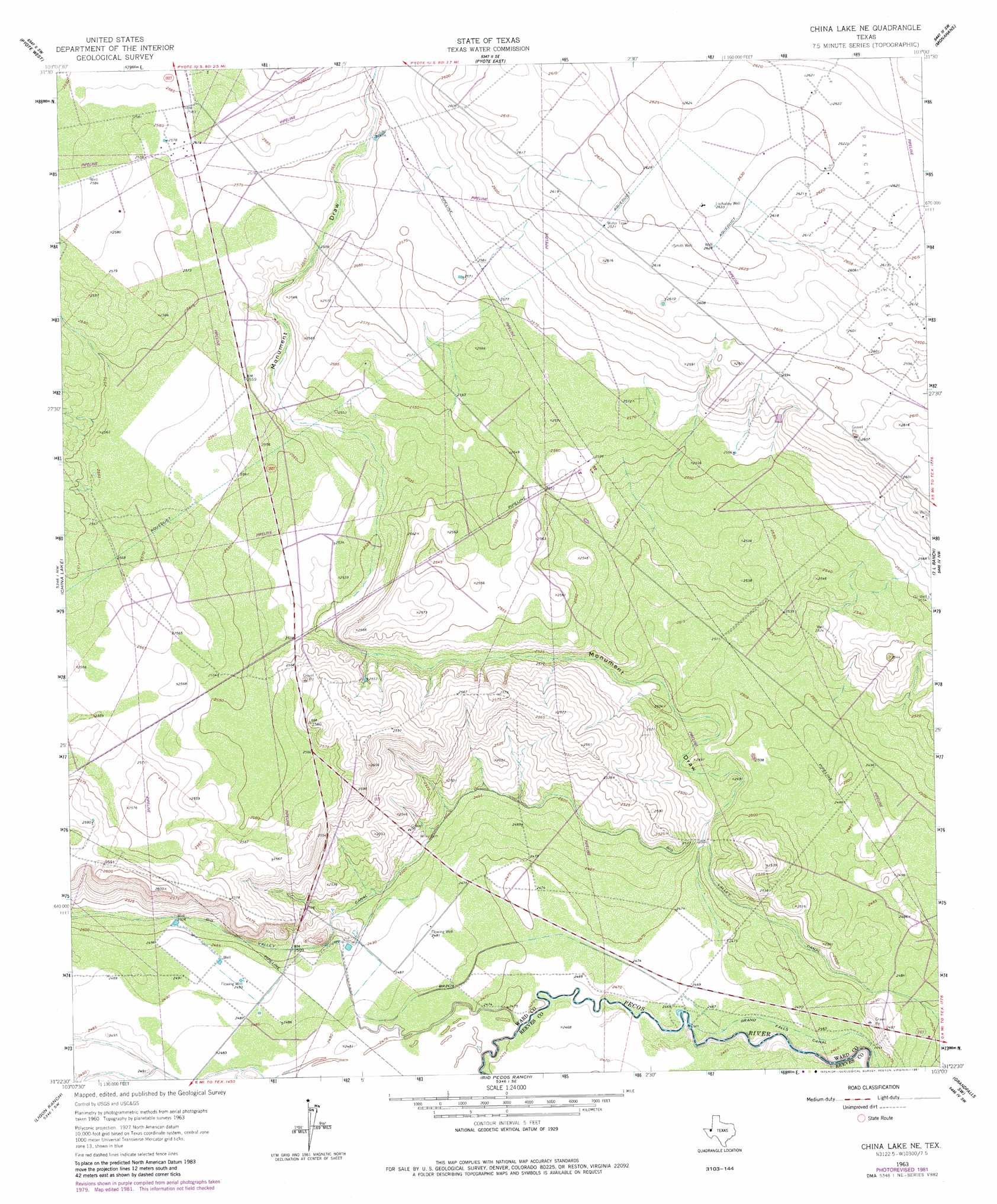
USGS Topo Quad 31103d1 - 1:24,000 scale
| Topo Map Name: | China Lake Ne |
| USGS Topo Quad ID: | 31103d1 |
| Print Size: | ca. 21 1/4" wide x 27" high |
| Southeast Coordinates: | 31.375° N latitude / 103° W longitude |
| Map Center Coordinates: | 31.4375° N latitude / 103.0625° W longitude |
| U.S. State: | TX |
| Filename: | o31103d1.jpg |
| Download Map JPG Image: | China Lake Ne topo map 1:24,000 scale |
| Map Type: | Topographic |
| Topo Series: | 7.5´ |
| Map Scale: | 1:24,000 |
| Source of Map Images: | United States Geological Survey (USGS) |
| Alternate Map Versions: |
China Lake NE TX 1963, updated 1965 Download PDF Buy paper map China Lake NE TX 1963, updated 1965 Download PDF Buy paper map China Lake NE TX 1963, updated 1981 Download PDF Buy paper map China Lake NE TX 2010 Download PDF Buy paper map China Lake NE TX 2012 Download PDF Buy paper map China Lake NE TX 2016 Download PDF Buy paper map |
1:24,000 Topo Quads surrounding China Lake Ne
Soda Lake Ne |
Wink South |
Pyote Ne |
China Ranch |
Cowden Place |
Soda Lake Se |
Pyote West |
Pyote East |
Monahans |
Monahans Se |
Quito Draw |
China Lake |
China Lake Ne |
7 L Ranch |
Ozark Lake |
Old X Ranch |
Ligon Ranch |
Rio Pecos Ranch |
Grandfalls Sw |
Grandfalls |
Barstow 3 Ne |
Coyanosa Nw |
Coyanosa |
Diamond Y Spring Nw |
Diamond Y Spring Ne |
> Back to 31103a1 at 1:100,000 scale
> Back to 31102a1 at 1:250,000 scale
> Back to U.S. Topo Maps home
China Lake Ne topo map: Gazetteer
China Lake Ne: Oilfields
Spencer Oil Field elevation 798m 2618′China Lake Ne: Valleys
Monument Draw elevation 753m 2470′Monument Draw elevation 751m 2463′
China Lake Ne: Wells
Lochaboy Well elevation 802m 2631′China Lake Ne digital topo map on disk
Buy this China Lake Ne topo map showing relief, roads, GPS coordinates and other geographical features, as a high-resolution digital map file on DVD: