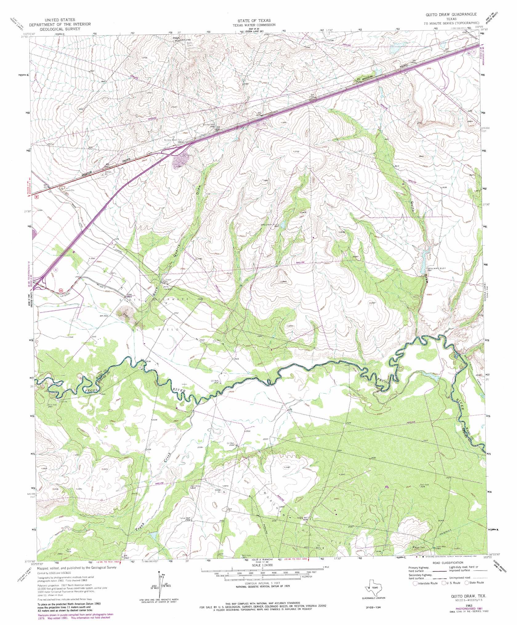
Quito Draw Topo Map Texas
To zoom in, hover over the map of Quito Draw
USGS Topo Quad 31103d3 - 1:24,000 scale
| Topo Map Name: | Quito Draw |
| USGS Topo Quad ID: | 31103d3 |
| Print Size: | ca. 21 1/4" wide x 27" high |
| Southeast Coordinates: | 31.375° N latitude / 103.25° W longitude |
| Map Center Coordinates: | 31.4375° N latitude / 103.3125° W longitude |
| U.S. State: | TX |
| Filename: | o31103d3.jpg |
| Download Map JPG Image: | Quito Draw topo map 1:24,000 scale |
| Map Type: | Topographic |
| Topo Series: | 7.5´ |
| Map Scale: | 1:24,000 |
| Source of Map Images: | United States Geological Survey (USGS) |
| Alternate Map Versions: |
Quito Draw TX 1963, updated 1965 Download PDF Buy paper map Quito Draw TX 1963, updated 1981 Download PDF Buy paper map Quito Draw TX 2010 Download PDF Buy paper map Quito Draw TX 2012 Download PDF Buy paper map Quito Draw TX 2016 Download PDF Buy paper map |
1:24,000 Topo Quads surrounding Quito Draw
Mentone |
Soda Lake Nw |
Soda Lake Ne |
Wink South |
Pyote Ne |
Sand Lake |
Soda Lake |
Soda Lake Se |
Pyote West |
Pyote East |
Pecos West |
Pecos East |
Quito Draw |
China Lake |
China Lake Ne |
Worsham |
Toyah Lake |
Old X Ranch |
Ligon Ranch |
Rio Pecos Ranch |
Verhalen North |
Barstow 3 Nw |
Barstow 3 Ne |
Coyanosa Nw |
Coyanosa |
> Back to 31103a1 at 1:100,000 scale
> Back to 31102a1 at 1:250,000 scale
> Back to U.S. Topo Maps home
Quito Draw topo map: Gazetteer
Quito Draw: Oilfields
Scott Delaware Oil Field elevation 780m 2559′Quito Draw: Reservoirs
Barstow Water Tank elevation 817m 2680′Quito Draw: Streams
Toyah Creek elevation 773m 2536′Quito Draw: Summits
Hays Hill elevation 850m 2788′Quito Draw: Valleys
Quito Draw elevation 770m 2526′Rock Quarry Draw elevation 774m 2539′
Quito Draw: Wells
Barstow Well elevation 810m 2657′Jones Well elevation 776m 2545′
Teague Well elevation 780m 2559′
Turner Well elevation 783m 2568′
Quito Draw digital topo map on disk
Buy this Quito Draw topo map showing relief, roads, GPS coordinates and other geographical features, as a high-resolution digital map file on DVD: