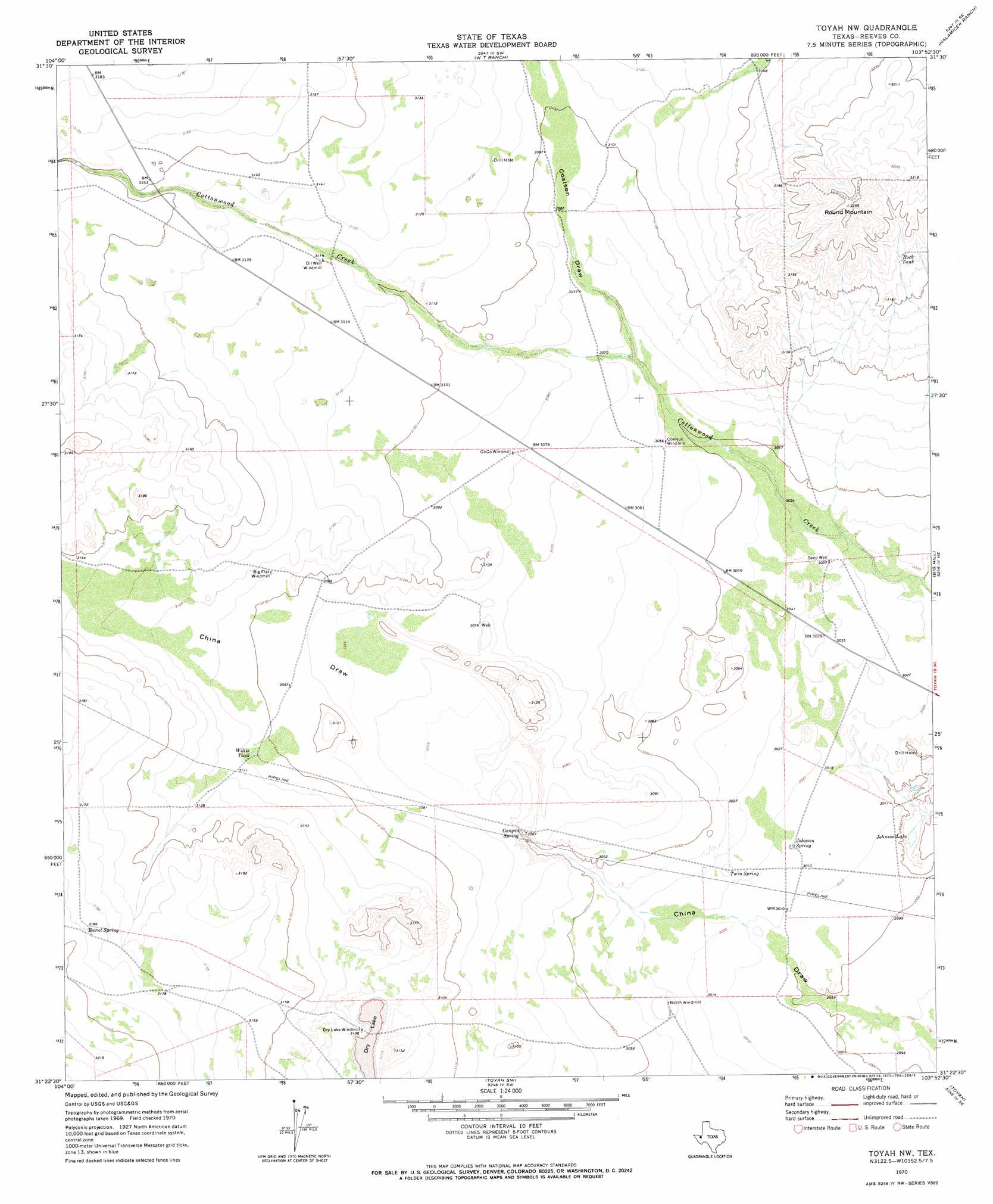
Toyah Nw Topo Map Texas
To zoom in, hover over the map of Toyah Nw
USGS Topo Quad 31103d8 - 1:24,000 scale
| Topo Map Name: | Toyah Nw |
| USGS Topo Quad ID: | 31103d8 |
| Print Size: | ca. 21 1/4" wide x 27" high |
| Southeast Coordinates: | 31.375° N latitude / 103.875° W longitude |
| Map Center Coordinates: | 31.4375° N latitude / 103.9375° W longitude |
| U.S. State: | TX |
| Filename: | o31103d8.jpg |
| Download Map JPG Image: | Toyah Nw topo map 1:24,000 scale |
| Map Type: | Topographic |
| Topo Series: | 7.5´ |
| Map Scale: | 1:24,000 |
| Source of Map Images: | United States Geological Survey (USGS) |
| Alternate Map Versions: |
Toyah NW TX 1970, updated 1973 Download PDF Buy paper map Toyah NW TX 2010 Download PDF Buy paper map Toyah NW TX 2013 Download PDF Buy paper map Toyah NW TX 2016 Download PDF Buy paper map |
1:24,000 Topo Quads surrounding Toyah Nw
Rustler Hills |
Derrick Draw |
Threemile Draw |
Narrow Bow Draw |
Anderson Ranch |
Two Mill Draw East |
Dry Lake |
W T Ranch |
Halamicek Ranch |
Mentone Sw |
Dellahunt Draw East |
Burnt Spring Hills |
Toyah Nw |
Big Hill |
Hermosa |
Hopper Draw East |
Burnt Spring Hills Se |
Toyah Sw |
Toyah |
Hermosa Sw |
Iron Mountain |
San Martine |
Gozar |
Florenzo Hill |
Saragosa Nw |
> Back to 31103a1 at 1:100,000 scale
> Back to 31102a1 at 1:250,000 scale
> Back to U.S. Topo Maps home
Toyah Nw topo map: Gazetteer
Toyah Nw: Lakes
Johnson Lake elevation 910m 2985′Toyah Nw: Reservoirs
Rock Tank elevation 967m 3172′Willis Tank elevation 947m 3106′
Toyah Nw: Springs
Burnt Spring elevation 972m 3188′Canyon Spring elevation 938m 3077′
Canyon Spring elevation 930m 3051′
Johnson Spring elevation 921m 3021′
Twin Spring elevation 924m 3031′
Toyah Nw: Summits
Round Mountain elevation 992m 3254′Toyah Nw: Valleys
Coalson Draw elevation 933m 3061′Toyah Nw: Wells
Seep Well elevation 927m 3041′Toyah Nw digital topo map on disk
Buy this Toyah Nw topo map showing relief, roads, GPS coordinates and other geographical features, as a high-resolution digital map file on DVD: